|
We had this trip to cross the Simpson Desert planned for almost a year but in March 2025 almost record rains in far western Queensland and the eastern Northern Territory area meant our plans had to change considerably. The water from the rain flooded the area from Mount Isa to Boulia to Birdsville and into South Australia around Innamincka. In addition, the area towards Windorah, Thargomindah and Charleville and up to Longreach and even to the coast flooded with the towns either just staying above water or even getting partially inundated.
This water flowed into the Cooper Creek, Diamantina River and the Georgina River. The Georgina flowed into Eyre Creek which then flowed into the Diamantina which then flowed into Warburton Creek. This then flowed into Lake Eyre. Meanwhile, the Cooper Creek flowed very slowly and did not reach Lake Eyre till late July.
These waters flooded all the roads and even in July 2025 significant roads such as the Birdsville Track, Strezlecki Track and others were closed and not expected to open till late 2025 at the earliest. In addition, tracks in the Simpson Desert were also flooded causing a number of detours (detailed in the diary later).
Our original plan was to head from Sydney to Bourke and then to Tibooburra, Cameron Corner and down the Strezlecki Track to Lyndhurst. From there the plan was to go to Maree, Oodnadatta, Mount Dare and then across the Simpson to Birdsville. From here the plan was to go to Innamincka via Cordello Downs. From here to Noccundra and into southern Queensland. However, as mentioned above, the Strezlecki Track was flooded so we had to go a different way and there was no direct or even indirect way to get from Birdsville to Innamincka.
On this trip with me in my Toyota Land Cruiser 200 series was Ron and Donna in their 200 series and Ian and Sharon Gowan in their Land Cruiser 79 series ute. Ron and Donna and I had rooftop tents and Ian and Sharon slept in the canopy on the back.
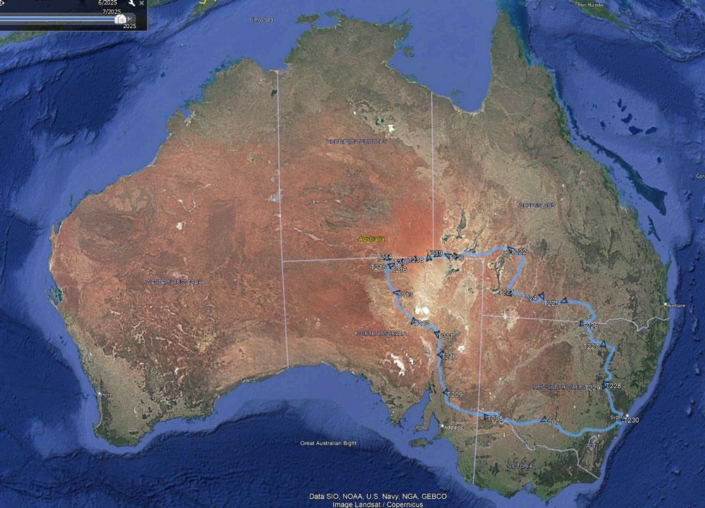
MAPS OF TRIP
 |
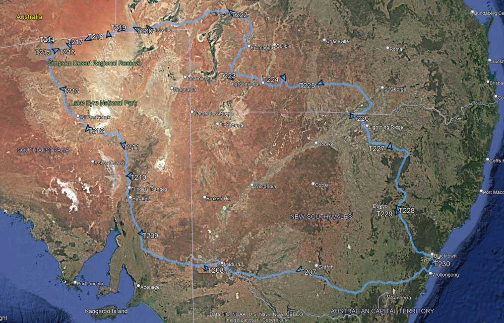 |
My route as recorded by my GPS uploaded to Google Earth
Left home in Sydney bottom right then west to South Australia, north up the Oodnadatta Track to Mount Dare.
Then across the Simpson and east into southern Queensland and back to Sydney. The triangles are overnight stops. |
Day 1 â Saturday 28 June 2025 â Sydney to Carrathool
I headed off at 6:05 am and travelled via the Princes Highway to Stanwell Tops, then Picton Road to the Hume Freeway for the trip south. It is very cold and foggy. At 7:37 am I arrive at the Suttons Forest Service Centre and go to McDonalds for breakfast. The others are already there. It is -1.0°C!
After some breakfast, I have to fix a problem with my 12 volt outlet in the rear that powers my fridge. I fix it but the problem reoccurs many times later in the trip requiring me to continually fix it. However, these fixes only work for a few hours or a couple of days and are undone by rough tracks which, of course, we have many.
We head off at 8:05 am. It is foggy and only 1°C for the next 100 kilometres before finally warming a bit. There are a lot of cars on the road, but not many trucks. We arrive at Jugiong at 10:05 am where we stop for morning tea and a toilet break. It is now a warmer 7°C and sunny.
We leave at 10:28 am. We are sitting on just over 100 km/h and we turn onto the Sturt Highway south of Gundagai at 11:45 am we arrive at Wagga Wagga. This is 448.1 km from home. It is warmer at 12°C. We refuel at a cheap fuel station. I take 59.8 litres at $1.599 (cheaper than Sydney!) for $95.73. This is an average of 13.0 litres/100 kilometres (l/100).
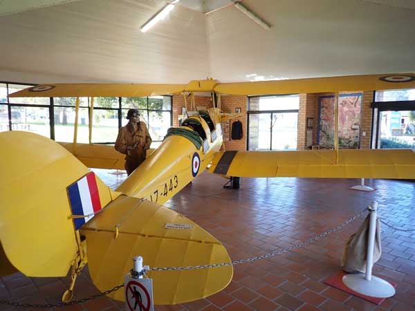 | 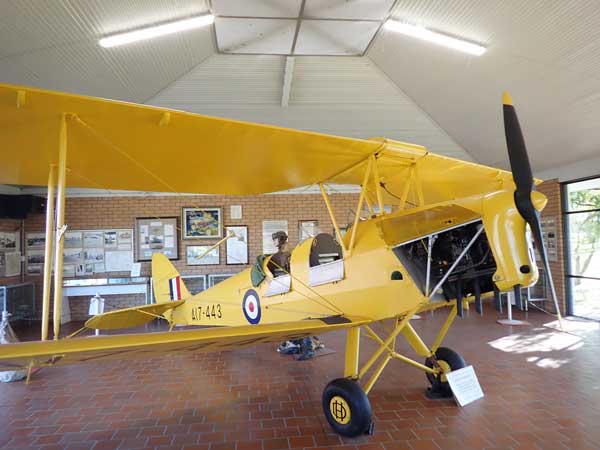 |
| The Tiger Moth on display in the Narrendera flight training museum | Another shot of the Tiger Moth |
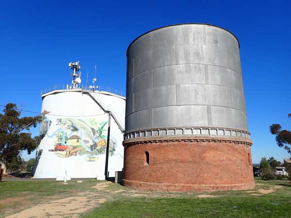 | 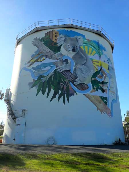 |
| The old Narrendera water tank with part of the mural on the new tank | The mural on the other side of the Narrendera water tank |
We leave at noon and stop seven minutes just on the western side of the town at a small park to have lunch. We leave at 12:45 pm. At 1:47 pm we arrive in Narrandera (548.3 km) and stop at the visitor centre to use the toilets. Next door is a display about the WWII flight training centre in the town. This has a Tiger Moth aircraft on show. We then go to look at the water tower art before visiting the Sturt Memorial back next to the Murrumbidgee River.
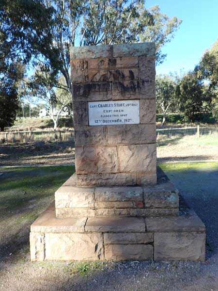 | 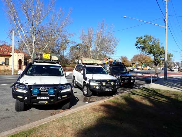 | |
| Marking Sturt's route past here on his exploration trip | All our vehicles outside the Narrendera Visitor Centre |
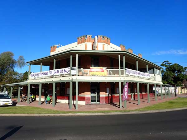 | 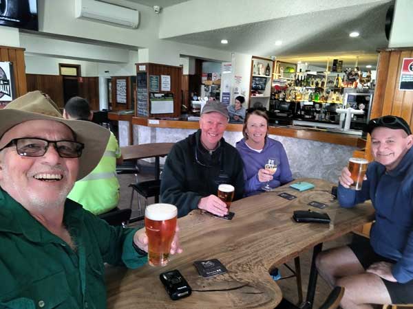 |
| The Punt Hotel at Darlington Point | Having a beer inside the Punt Hotel |
We leave at 2:28 pm and arrive at Darlington Point at 3:10 pm. This is 614.0 km from home. Here we go to the Punt Hotel where Ian, Ron and I have a beer. After the beer we continue on the Sturt Highway and stop at 3:57 pm to collect some firewood. We leave at 4:06 pm and at 4:36 pm we arrive at the Carrathool Bridge Camping Area next to the Murrumbidgee River. Back in 2021 Ron, Donna and I planned to stop here on our trip to Birdsville but it was pouring rain so we need up at the hotel in the town which is to the north.
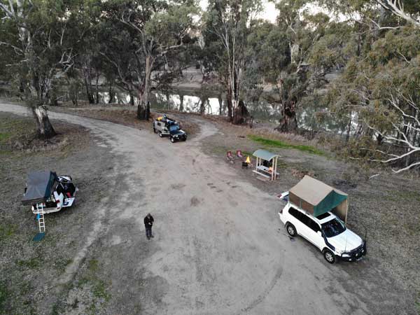 | 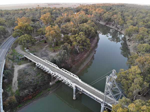 |
| Our campsite at Carrathool Bridge from my drone | The historic Carrathool Bridge from my drone |
The camping area is large and quite nice. We stop next to the only table and chair and near the toilet. Sharon starts a fire (like she does most nights) and we then have drinks. I also fly my drone to take some photos of the historic timber lift bridge. I have brought some leftover spaghetti and meatballs and I later reheat this for dinner. Ian and I watch Souths play the Dolphins on his tablet.
Ian has a Starlink setup on his roof so we have excellent internet, phone etc for the whole trip. We stop watching at half time as Souths are getting smashed (ended up 50-28). I go to bed at 9:30 pm.
Weather: Fine, max 16ÂșC Arrived: Carrathool Bridge Time: 4:35 pm Distance: 677.7 kilometres
Day 2 - Sunday 29 June 2025 â Carrathool Bridge to Werrimulla
Weather: Foggy, 0.5ÂșC minimum
I have the best sleep since I came home from Bali just under three weeks ago. I only wake twice during the night and am awake at 7:10 am. I get up at 7:30 am and it is still only 1.1°C and foggy. I have breakfast and use my new Jetboil copy to boil water. It takes only a few minutes to boil a large cup, much quicker than using the kettle on the propane stove. The weather is strange, it warms to 2.8°C before dropping to 0.8°C and getting foggy again.
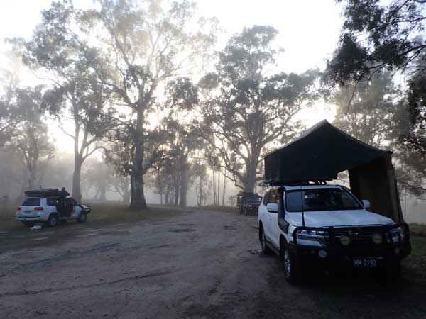 | 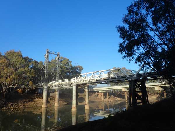 |
| A foggy morning at Carrathool Bridge | The historic Carrathool Bridge |
I pack up and then walk to the bridge to take some photographs of the old truss bridge. We leave at 8:55 am and drive to Carrathool to use the proper toilets there opposite the hotel. On the way back to the Sturt Highway we use the old timber bridge to cross the Murrumbidgee.
We arrive in Hay at 9:38 am (58.6 km). It is now 8°C and sunny. We go to water tank art and then to a coffee cart in the main street. I go to the IGA in between to get some things. While the others get a coffee I have the tea I made earlier.
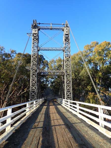 | 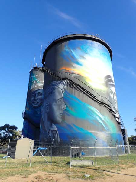 |
| The historic Carrathool Bridge | The murals on the water tanks at Hay |
We leave at 10:20 am. When I go to pass a road train I throw the codes that stop me using 5th and 6th gear. I have to stop, turn off the engine and restart to fix this problem. It is somehow related to the DPF and only occurs under very heavy acceleration or going up steep hills with my camper. We arrive in Balranald at 11:40 am (190.9 km). It is now overcast and 13°C.
We find that there is a free hot shower at the information centre so we all have a shower. We leave at 12:13 pm and stop at a rest area at 12:24 pm. We have lunch here. It is overcast, then sunny and then overcast again. We leave at 12: 55 pm and at 2:35 pm we arrive in Mildura in Victoria. Here we refuel, 71.29 litres at $1.789 for $127.54. This is an average of 12.2 l/100 km since Wagga.
After this we go to Annaconda as Donna wants some things. We leave at 3:02 pm. We continue on the Sturt Highway and we have a short stop at a weighbridge where you can weigh your vehicle for free. We turn off the highway at Cullulleraine and head south to Werrimull.
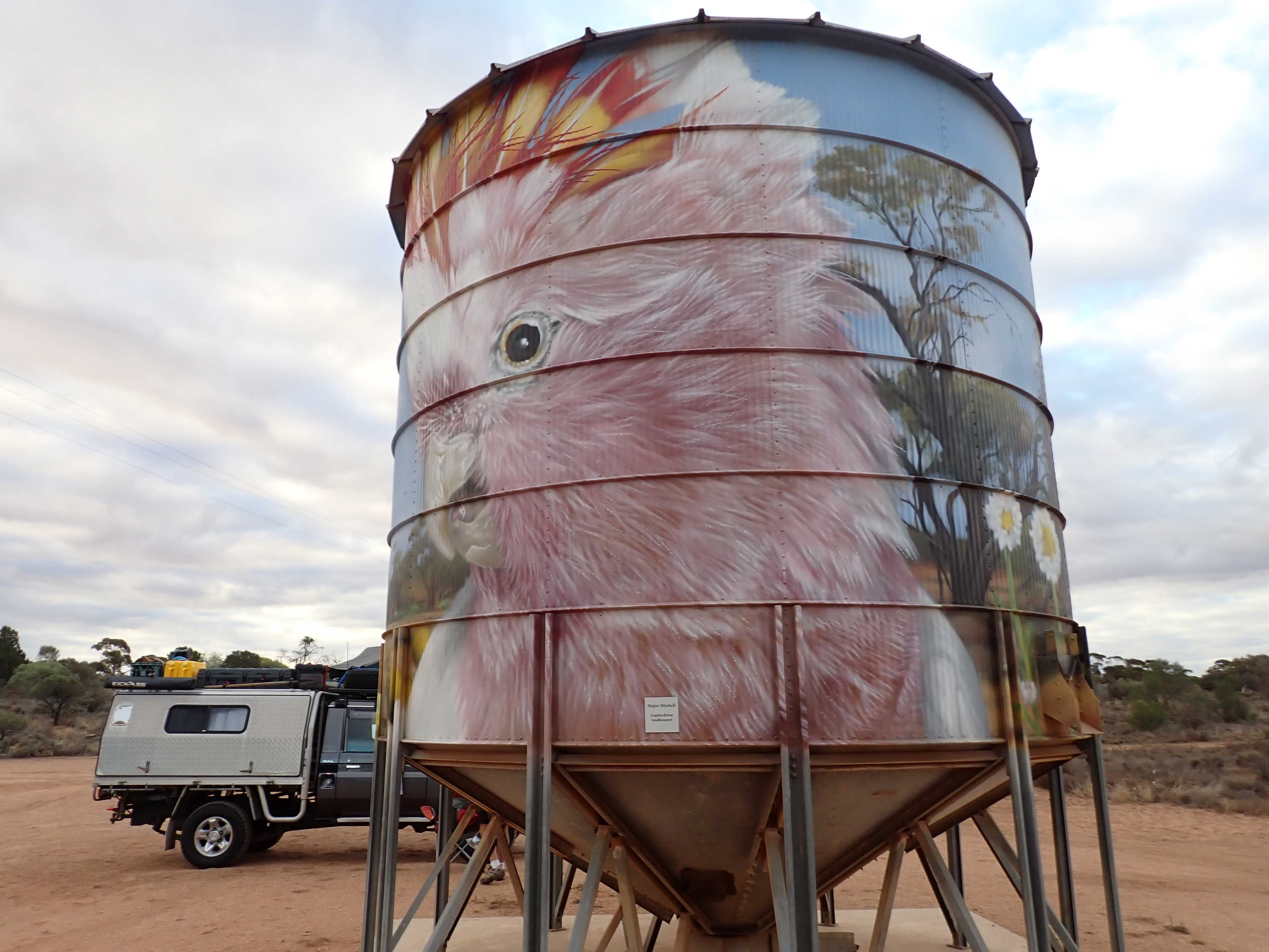 | 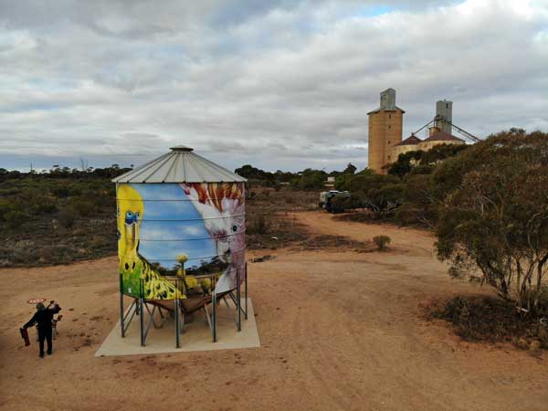 |
| A Major Mitchell cockatoo on a mobile silo in the Werrimull Camping Area | Drone shots of mobile silo |
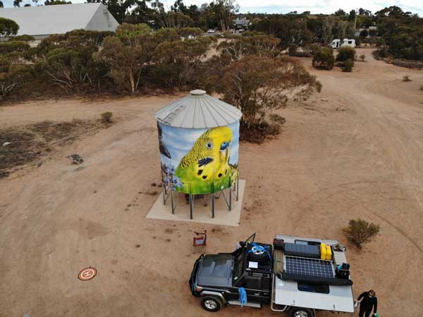 | 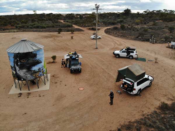 |
| A drone shot of a mobile silo with a budgie and Ian's car | Drone shots of our campsite |
We arrive there at 3:31 pm and go to the free camping area opposite the hotel and setup near the artwork portable silos. These have budgies and Major Mitchell cockatoos on them.
I also fly my drone and after this Ron, Ian and I go to the pub for a beer (Carlton Draught at $9). We are back at 5:15 pm. We have drinks and nibblies around the fire. For dinner I cook some lamb koftas and potato on my skillet over the fire. Later we have port and chocolate.
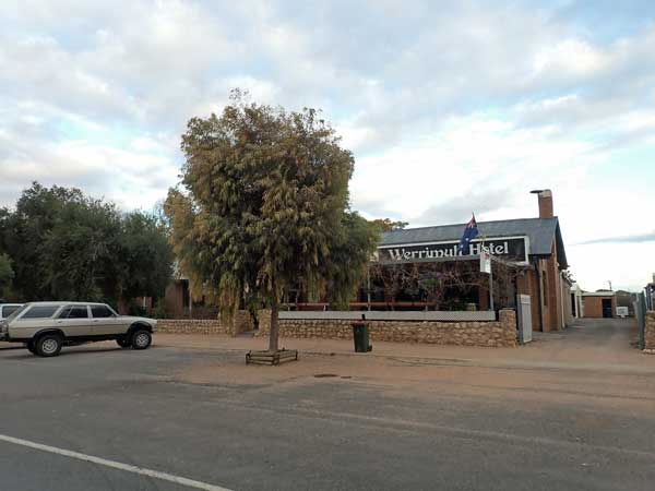 | 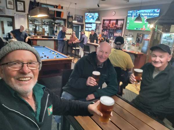 |
| The Werrimull Hotel | Me, Ron and Ian inside the pub |
There are lots of vehicles here, including five cans with many children. Despite this, there is plenty of room. Later the sky clears and we see some shooting stars. I go to bed at 9:30 pm.
Weather: Overcast, max 16°C Arrived: Werrimull Time: 3:51 pm Distance: 422.3 kilometres
Day 3 - Monday 30 June 2025 â Werrimull to Terowrie
Weather: Overcast, 5.5ÂșC minimum
Another great sleep, I want at 7:30 am. I get up at 7:40 am. It is overcast but later there is some fine rain. I have breakfast and when packing up it rains a bit heavier. We leave at 8:50 am and it is 8ÂșC and still drizzling.
We have to stop at the Quarantine checkpoint just inside South Australia. They check inside my glovebox, fridge and drawers. The only fruit or vegetable I have is a lettuce which is permitted. We arrive at Calperum Rest Area at 9:30 am (all times now SA). We have travelled 103.1 km this morning. It is now sunny and 10 ÂșC.
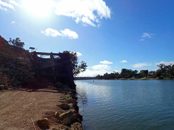 | 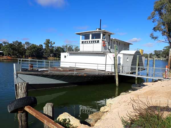 |
| The historic Morgan Wharf | The rebuilt paddlewheeler |
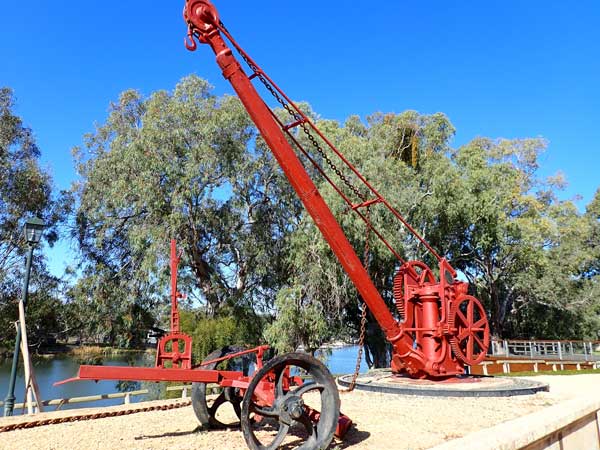 | 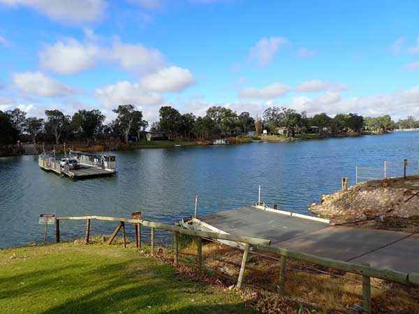 |
| An old crane at Morgan Wharf railway station | The ferry crossing the Murray River |
We leave at 9:48 am and travel via the Goyder Highway to Morgan where we stop at 10:26 am (210.0 km). I buy lemon and raspberry tarts from the bakery. I have one for morning tea and keep the other for this afternoon. We go to the historic wharf area which also has a railway terminus. There is a paddle steamer here as well. We then go to the historic morgue which is next to the car ferry crossing of the Murray River. There are two great looking pubs just above the river.
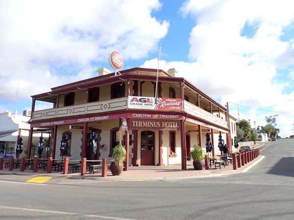 | 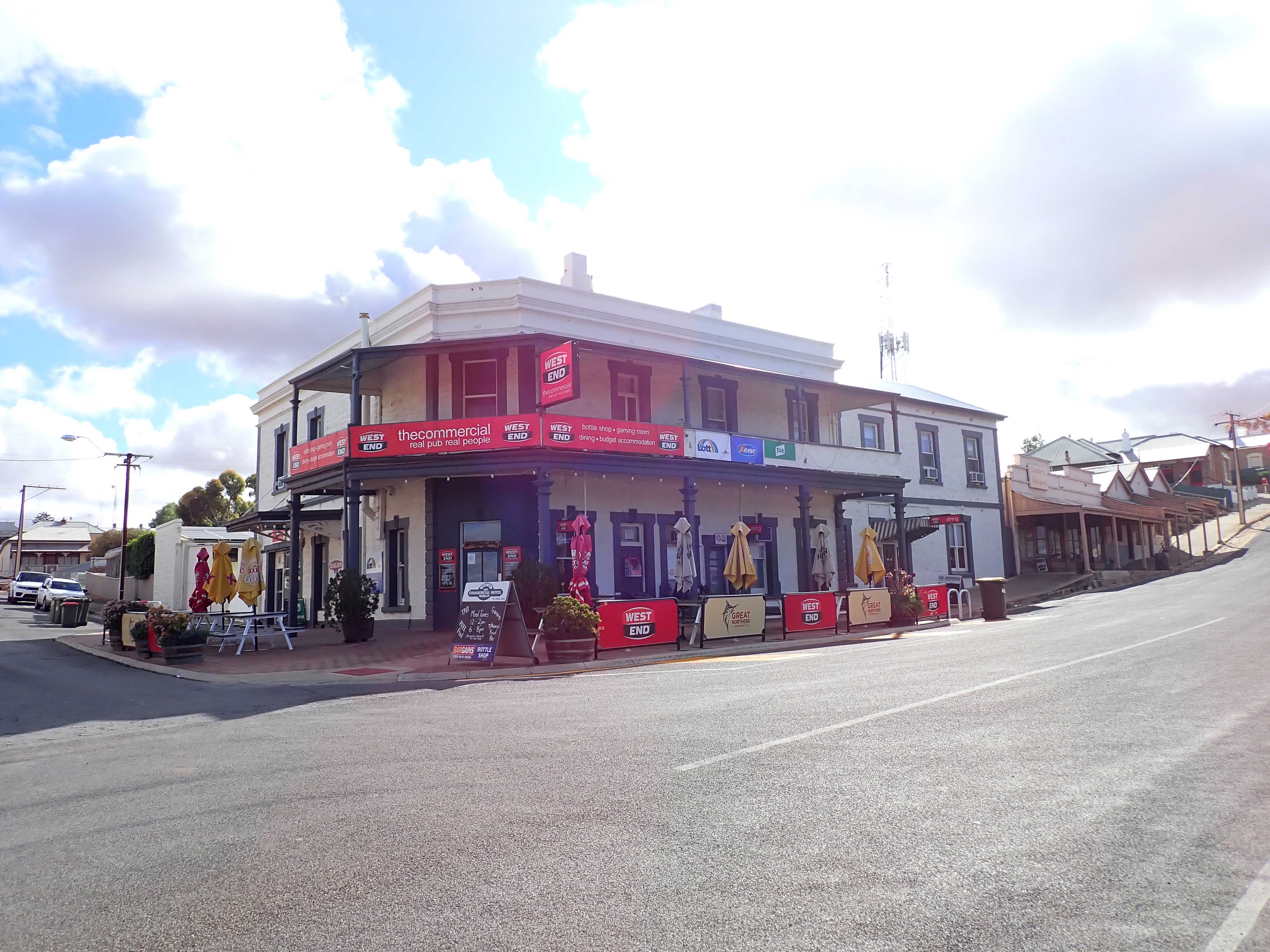 |
| The Morgan Terminus Hotel | The Commercial Hotel |
From the water front we go back up past the two hotels and then to a lookout. This has nice views over the wharf/railway station area and of course, the Murray River.
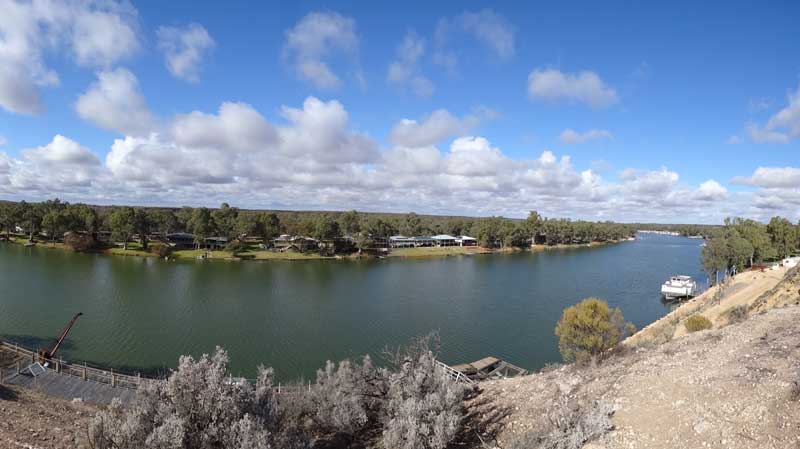 |
| A panoramic photograph of the Murray River and the wharf from the lookout at Morgan |
We leave at 12:10 pm and at 1:06 pm we arrive in Burra, a very historic town. We have travelled at 296.5 km. Burra is at 471 metres and it is a cool 11ÂșC and overcast again. We have lunch in the park and then I go to the IGA to get fruit and vegetables. After this we go via one of the open cut mines and head out north. We stop for a short time at the âMidnight Oil houseâ which is on the cover of Diesel and Dust. We leave here at 2:20 pm.
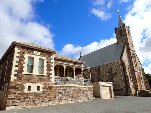 | 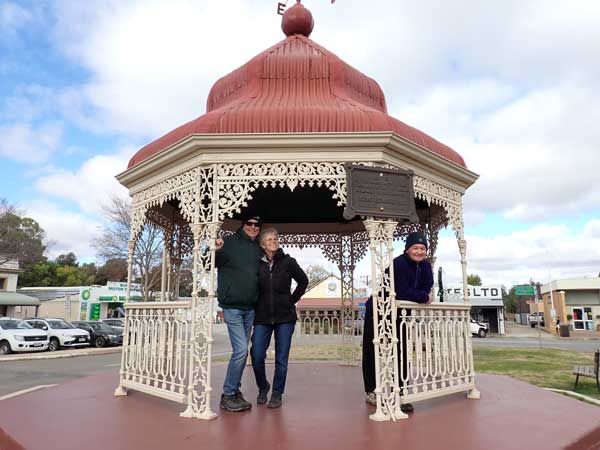 |
| The Burra Catholic Church | Ron, Donna and Ian in the rotunda in the centre of Burra |
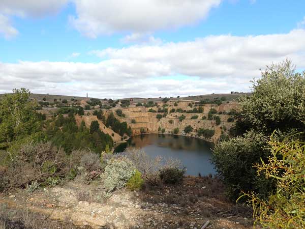 |  |
| The Burra mine | The "Midnight Oil" house |
We arrive in Hallett at 2:40 pm. Our intention was to stay here in the recreation reserve. I stayed here in 2019 on the way home from the Big Red Bash. Even though Wikicamps has comments that indicate people were staying here as recently as a week or so ago, it now shows it is closed. Ron ends up ringing the number on the notice which is the council. They have no idea and give him the number of the âshower key holderâ. He rings this number and gets a message that says it is now closed.
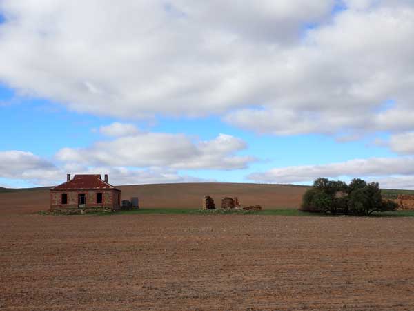
We have a backup plan. We leave at 2:51 pm and at 3:14 pm we arrive at the free camping area at the Terowrie Railway Station. This is quite nice, grassed and with nearby toilets. We set up. It is pretty windy and cold at 12ÂșC but now sunny (it is 508 metres high). I walk to the main street where there is a closed hotel and some nice old buildings. This is where the toilets are located.
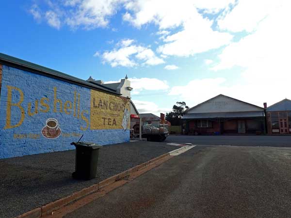 | 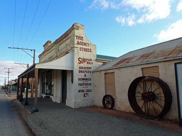 |
| An "old" Bushells Tea sign on the side of a shop in Terowrie | More old shops in the main street of Terowrie |
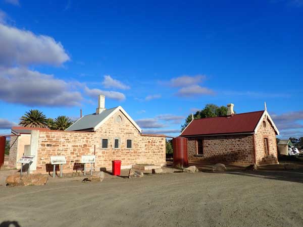 | 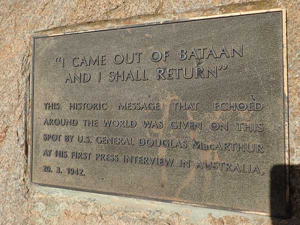 |
| Terowrie Railway Station | A plaque commemorating General Douglas MacArthur's visit in 1942 |
I go back to the railway station and discover that on 20 March 1942 General Douglas MacArthur and his wife Jean stopped here to swap trains when escaping from Manila in the Philippines and heading to Melbourne. He uttered his most famous statement âI shall returnâ to two Adelaide journalists on the station platform. This is commemorated by a plaque at the station.
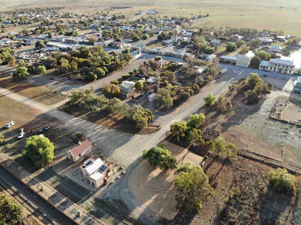 | 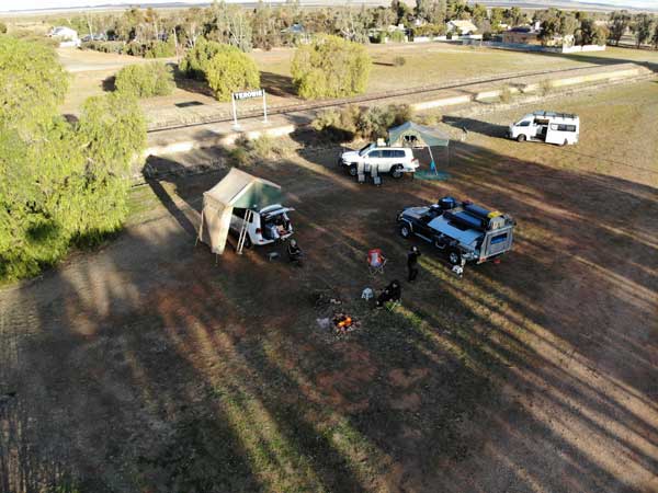 |
| A photo from my drone showing the railway station and the town (old hotel top right) | Our campsite at the Terowrie Railway Station |
We start the fire at 4:05 pm and I fly my drone as the wind has now dropped a fair bit. We have early drinks at 4:35 pm. Sharon cooks sausages and onions and we have on rolls. It is a very cold 4ÂșC when I go to bed at 9:00 pm.
Weather: Overcast, max 12ÂșC Arrived: Terowrie Time: 5:14 pm Distance: 331.9 kilometres
Day 4 - Sunday 1 July 2025 â Terowrie to Parachilna Gorge
Weather: Fine, -0.9ÂșC minimum
I woke at 5:00 am and finally go back to sleep about 6:00 am. I wake again at 7:10 am. It is very cold and there is ice on the inside of the rooftop tent. When I get up at 7:30 am it is only 1.4 ÂșC but at least it is sunny. There is frost all over the grass and on my windscreen. I have breakfast, gloves on to keep warm.
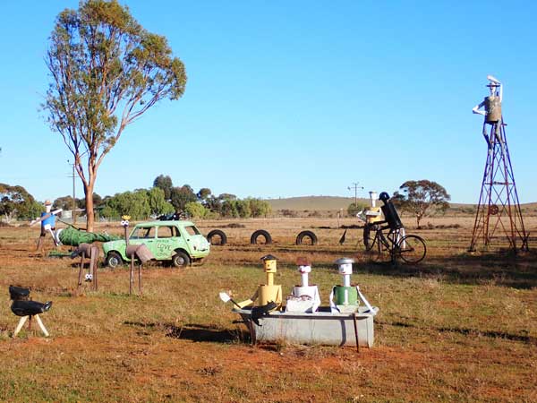 | 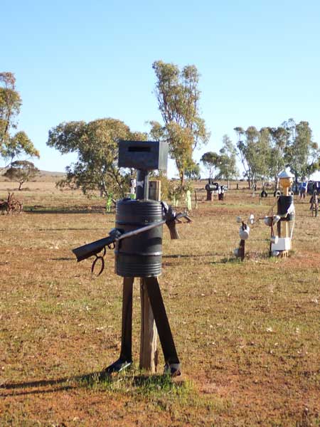 |
| Emus and shop owners in a bathtub, one not very politically correct | Ned Kelly |
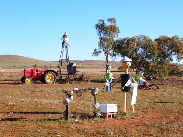 | 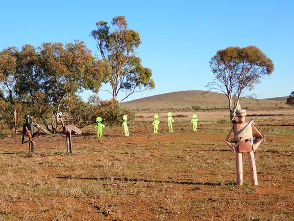 |
| Rock and roller and a Chinese restaurant owner | Aborigine, emu, aliens and a red Indian |
When I am packing up my hands are freezing cold as there is still ice on the canvas and the metal bits are very cold. We leave at 9:02 am and it has warmed to 4ÂșC. We stop at the âTin Menâ on the way out of town. These are some sculptures made out of metal and on a private property. There are so many things to see, all quite ingenious. See some in the photographs above.
We are back underway at 9:18 am and arrive in Peterborough at 9:36 am. Here we refuel, I take 60.34 litres at $1.814 for a total of $109.76. This was an average of 13.2 l/100 km since Mildura. This fuel is at one of those self serve stations, no people there at all. There are lots of them in country and the fuel is considerably cheaper.
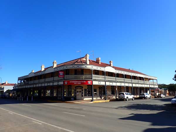 | 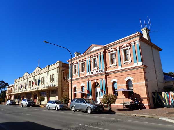 |
| Peterborough Hotel | Old shops in the main street of Peterborough |
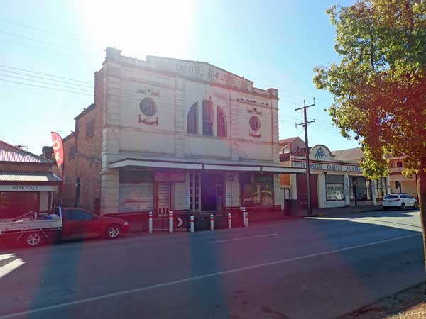 | 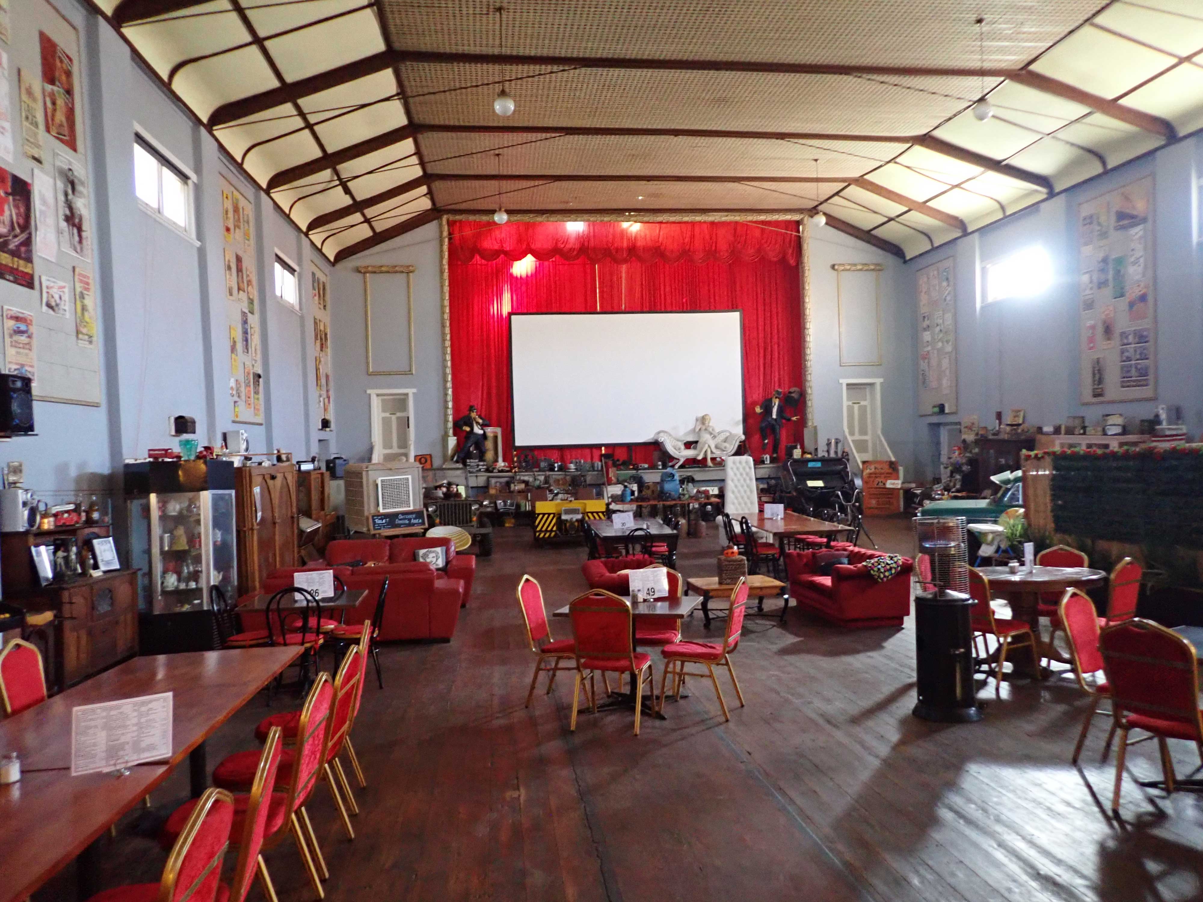 |
| The Peterborough Capitol Theatre | Inside the Capitol Theatre |
We head into town and stop outside the Foodworks and toilet. A buy a few more things and I get a vanilla slice for $6. We then go to the dump point where there is a water tap. We top up our drinking water. This is opposite the old Capitol Theatre. We then go over to the theatre where the others have a coffee. It is inside the main part of the theatre. It is quite a beautiful building.
We leave at 11:20 am and travel via Orroroo and Cradock (a nice looking pub). We arrive at Hawker at 12:55 pm, the gateway to the Flinders Ranges. I have been here twice before. It is sunny and 14°C and we have travelled 168.0 km. We have lunch in the large park just off the main road. This is quite nice and has tables and toilets. The park also has some emus wandering around. We have lunch here.
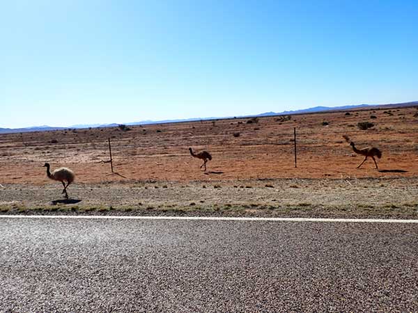 | 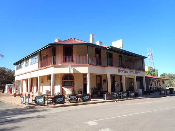 |
| Three emus on the side of the road just outside Hawker | The Hawker Hotel |
We leave at 1:30 pm and head north on The Outback Highway. We stop at 1:55 pm at Moralana Creek where we cut some timber for firewood. We are cooking camp ovens tonight so need a fair bit. We leave after 18 minutes. At 2:43 pm we arrive at Parachilna, 256.7 km and 17°C. There is a toilet block here which also has showers. The cost is $2.
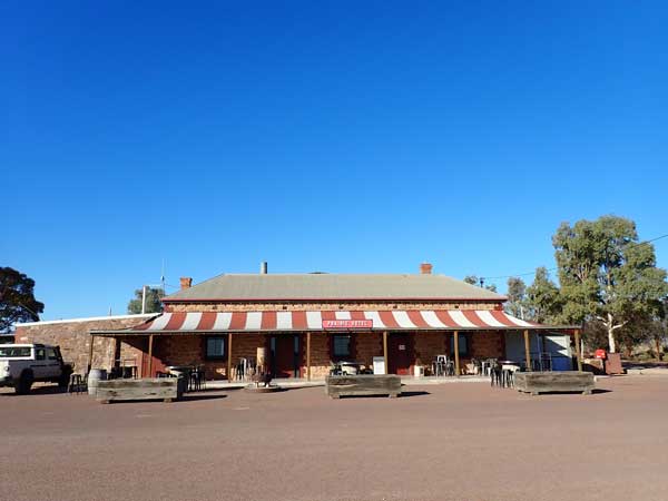 | 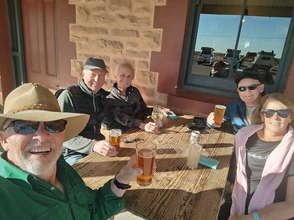 |
| The Prairie Hotel | Having a drink outside the Prairie Hotel |
We all have showers. I got over four minutes and it was still going when I stopped. Some of the others do not even have to put in money to get their shower! We then go to the Prairie Hotel for a beer. I cannot remember the cost (one of the others shouted) but it was a local craft beer and quite nice.
We head off at 3:46 pm and arrive in Parachilna Gorge. This is a huge gorge that has hundreds of campsites. In 2021 I camped a fair bit up the gorge, but this time we stop at a camping spot that is one of the first as you come in. It takes 18 minutes from the hotel. We set up camp and one of the first things Sharon does is start the fire. We need a bit of a roaring fire so we can get coals.
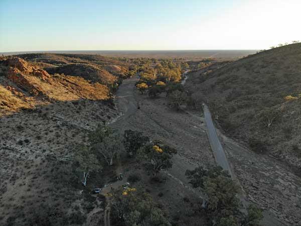 | 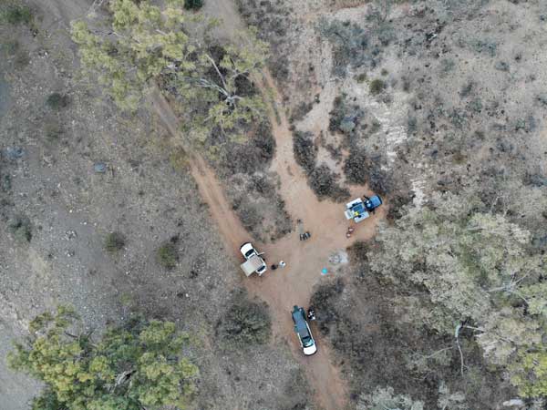 |
| A drone shot looking west out of Parachilna Gorge towards the Prairie Hotel | Looking straight down at our campsite |
I setup camp and then have a cuppa and then fly my drone. Later I prepare my pork and at 5:20 pm I put mine on. The chickens are on earlier. All are cooked by 6:30 pm. We have chicken and pork with vegies (sweet potato, potato and carrot).
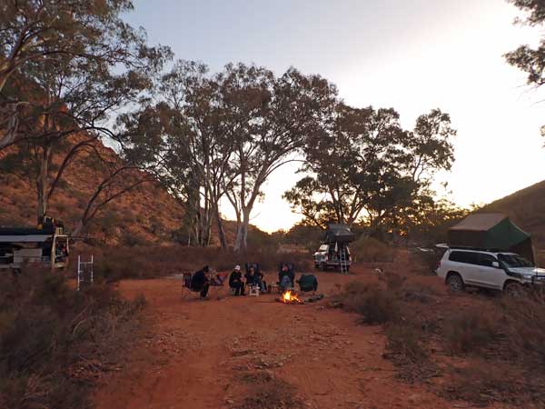 | 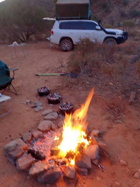 |
| Our campsite in Parachilna Gorge at sunset | The fire and the three camp ovens |
Later we have port and chocolate. We see a few satellites and one shooting star. It is warmer tonight at 6.3°C when I go to bed at 9:30 pm.
Weather: Fine, max 16ÂșC Arrived: Parachilna Gorge Time: 4:04 pm Distance: 269.9 kilometres
Day 5 - Wednesday 2 July 2025 â Parachilna Gorge to Farina
Weather: Fine, 2.1ÂșC minimum
I have a good sleep again but woke at 4:00 am for about 30 minutes. I then wake at 6:50 am. I listen to the ABC Sydney news via Ianâs Starlink and download the SMH. I read a bit and get up at 7:45 pm. I cook a bacon sandwich for breakfast. We are leaving late as we do not have far to travel today.
We pack up and leave at 9:28 am (8ÂșC). We stop at the toilets near the pub and then leave at 9:52 am. We stop at Breakfast Time Creek at 10:08 am and cut some more timber for firewood. We leave 14 minutes later.
We arrive in Leigh Creek (77.3 km) at 10:51 am and go to the shopping centre. This has a good supermarket, Ian even gets a chair to replace his which broke last night. As it turns out, he never uses it as he successfully repairs his chair over the coming days.
The others get a coffee from a cafĂ© and I have my tea and the other half of the vanilla slice I bought yesterday. We leave at 11:40 am and at 12:03 pm we arrive in Lyndhurst. We go to the service station but the pumps appear to be out of order. We then go to the hotel which has fuel opposite. However, the publican tells us that power is out to the whole town, so we cannot refuel. We donât really need to, but it is heaps cheaper here compared to Maree where we will now have to refuel tomorrow.
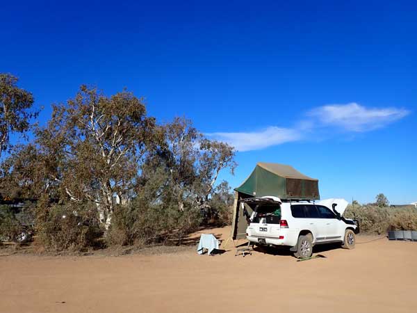 | 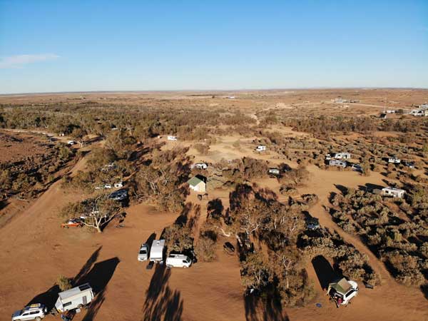 |
| My campsite at Farina | A drone shot of the camping area, I am bottom right |
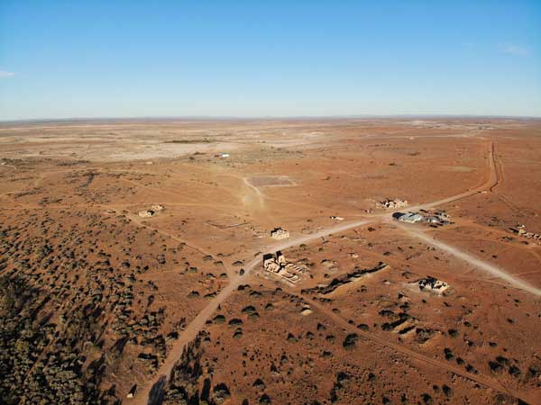 | 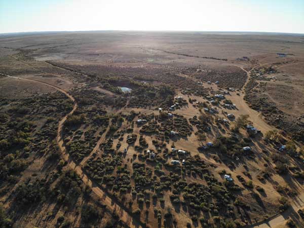 |
| The Farina township | Looking to the north-west from the camping area |
We continue on and arrive at Farina at 12:33 pm. We go straight to the camp ground and find a spot. This has changed heaps since I first came here in 2003 (this is my fourth time here). Back then, and even in 2010, it had lots of grass. However, there are so many people coming here now it is all dead. I have lunch and then set up and walk back to the gate to pay my $10 (per person per night).
At 2:00 pm we go for a walk to the old deserted township. We walk around looking at the buildings, especially the ones that are getting some minor restoration work done. This is funded by profits from the bakery, more about this later. We walk to the old Ghan railway line. Here the very old line and the most recent one came together as they were on different alignments from Lyndhurst.
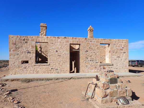 | 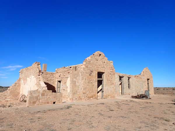 |
| This old building was having restoration work done on the walls | I think this was a hotel and then used for many other purposes |
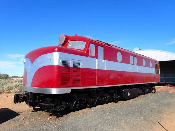 | 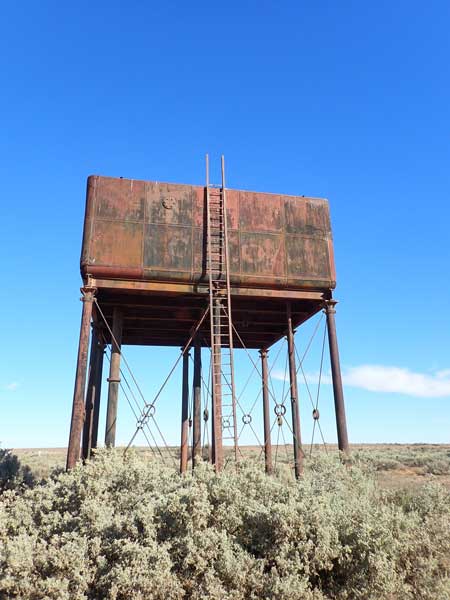 |
| A restored Ghan diesel train | The old water tank for the Ghan steam engines |
Here there is an old diesel train being painted. It appears to be finished and a few days later they move it into the new shed they have built for it. We then walk back to the main part of the township and look at the underground bakery and oven. This is being used to bake bread and rolls. We then go to the new(ish) above ground bakery. This building was here in 2019. In this they bake things like cakes, tarts etc and sell all their items.
The baker is run totally by volunteers and all the profits are used to fund the restoration works. We have a look but do not buy anything, we plan to get some stuff tomorrow as we leave. We walk back to the camp ground. I then have a cuppa and after this I walk the short distance to the war memorial. I then read and later have a shower (water is heated by a donkey boiler). It is only warm, I should have looked at the fire!
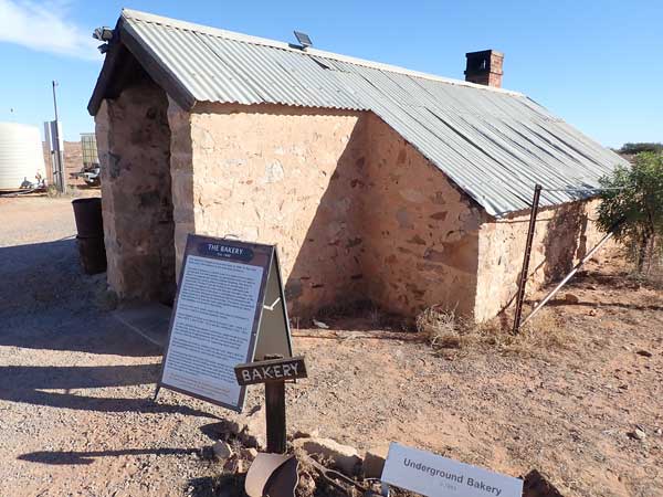 | 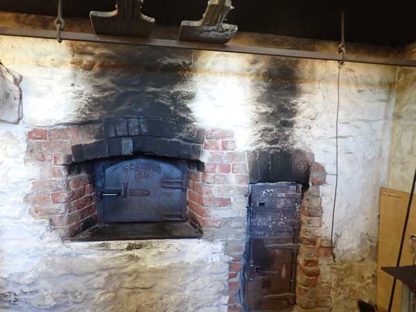 |
| The Farina underground bakery | The oven inside the underground bakery |
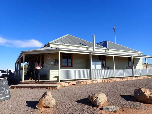 | 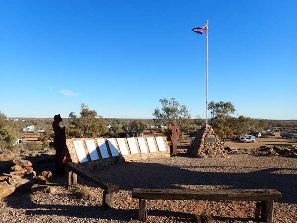 |
| The new bakery where all the bread is sold and other things are baked | The Farina War Memorial |
We put a fire on and have drinks. I later cook three rissoles and a cheesy rice dish. I keep one rissole for another day. I go to bed at 9:15 pm, it is a cold 3.9ÂșC.
Weather: Fine, max 17ÂșC Arrived: Farina Time: 12:33 pm Distance: 143.6 kilometres
Day 6 - Thursday 3 July 2025 â Farina to Coward Springs
Weather: Mostly fine, -0.2ÂșC minimum
Another very cold night, but no ice on the inside of the rooftop. I slept very well and wake at 6:00 am. I read the SMH and then listen to the ABC news. I get up at 7:30 am. I have breakfast and then pack up. We move to the bakery once it opens at 9:00 am we go in. I buy a finger bun and a vanilla slice ($10.50). We leave five minutes later and continue north on The Outback Highway.
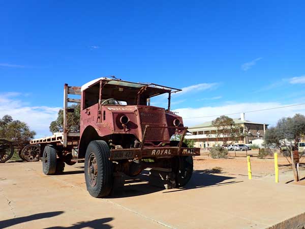 | 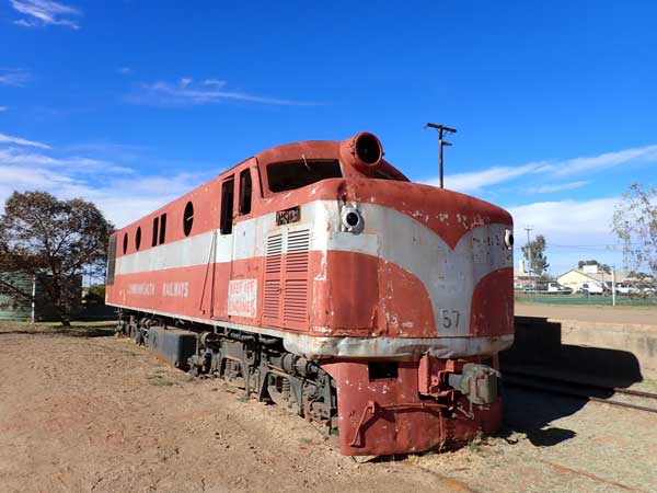 |
| One of Tom Kruse's old trucks, the museum about him is in the hotel | One of the diesel Ghan Railway engines |
There are lots of wedgetail eagles along this section of road and we arrive in Marree at 9:43 am (58.4 km). It has warmed up a bit to 11ÂșC and is now sunny. We go to the general store/fuel station. There are only a few pumps and some of them appear to be out of order. We get it a queue from the north so we can use the pump that is no accessible to people with caravans as the roof appears to be very low. We finally get fuel, I take 60.71 litres at $2.90 for a total of $176.06, an average of 13.6 l/100 km since Peterborough.
I then go for a walk to the trains and Tom Krusesâs old truck. I bought the book about him last year (second hand), poorly written but still very interesting. Once back, I have morning tea and half the vanilla slice, it is very good. Then we all drop our tyre pressures. I drop to 32 psi in front and 34 psi rear. I also change into shorts, it is much better now.
We leave at 10:43 am and head up the Oodnadatta Track. After 35 km we pass two graders and a water truck working on the track. At 11:27 am we arrive at the outback art site which is on a private property, 49 kilometres from Marree. It is 17ÂșC and sunny.
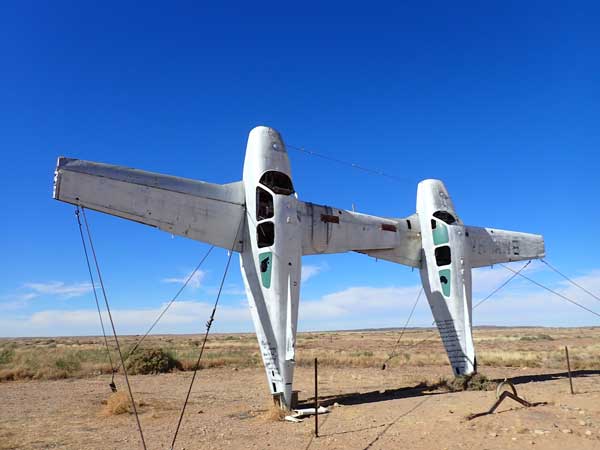 | 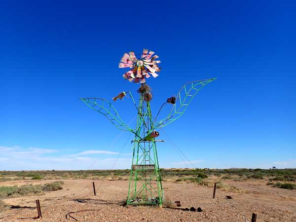 |
| The two planes | Windmill turned into a flower |
I have stopped here three times before, but there are some new works since 2019. There are the old planes joined together, the windmill made to look like a flower and the hover bus. This used to be visible from the track in 2003 (and maybe later) but now there are bushes blocking it. There is a new lizard car eating yellow cake uranium. There is a cool breeze as we leave, but not too bad yet.
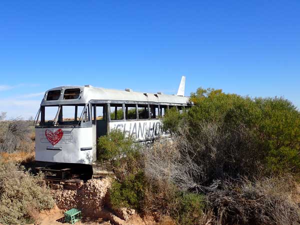 | 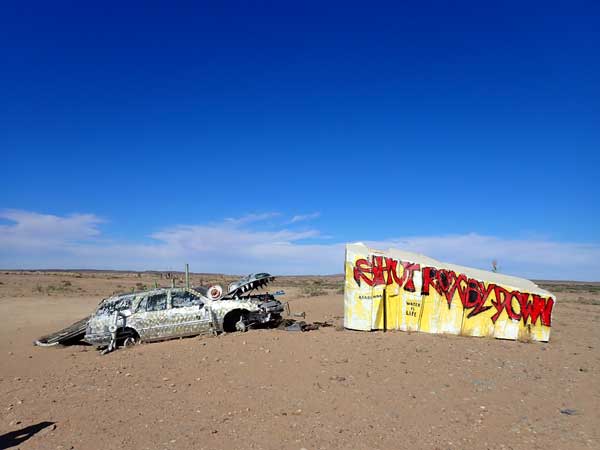 |
| The Ghan Hovertrain, not almost invisible from the track | This is a new one, a lizard car eating yellow cake uranium and
advocating shutting down the nearby Roxby Downs Uranium Mine |
We leave at 11:53 am and at 12:29 pm we arrive at the Lake Eyre South Lookout (148.9 km). A dozen caravans leave as we pull in, we will encounter them a few more times over the coming days. We decide to have lunch here, there are only a few flies, not as many as there has been the past few days. I also fly my drone to get some photographs of the filling lake.
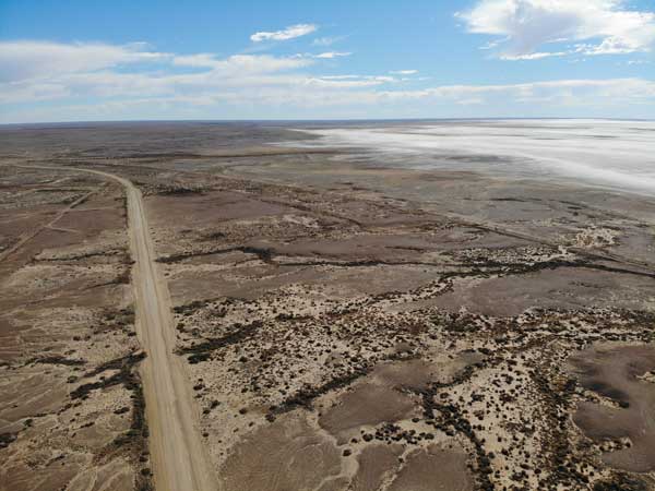 | 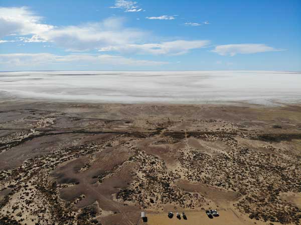 |
| Looking along the Oodnadatta Track towards William Creek with Lake Eyre South on the right | Looking north over Lake Eyre South |
We leave at 1:05 pm and 12 minutes later we arrive at Curdimurka Siding. I spent the night here in 2019, it has deteriorated a fair bit since then and heaps since my first visit in 2003. There used to be an annual ball here but it has not been held since the insurance company HIH failed in 2001 as third party insurance became extremely expensive or even not available after that for a long time. The ball raised money to maintain the structures. The water tank on the large tower for the steam engines has totally collapsed. It was fully intact in 2010 and partly fallen apart in 2019.
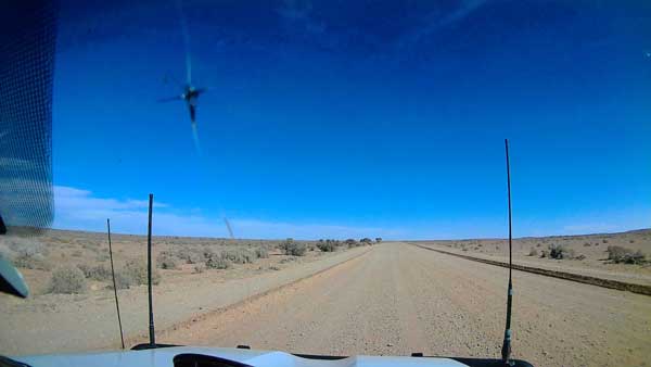 | 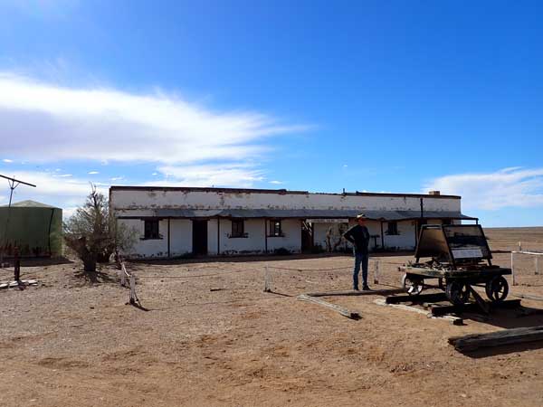 |
| View of the Oodnadatta Track from my dashcam | The fettler cottages at Curdimurka Siding |
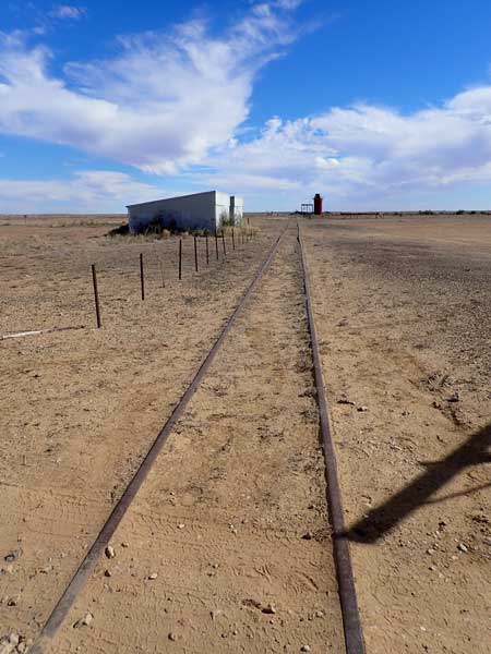 | 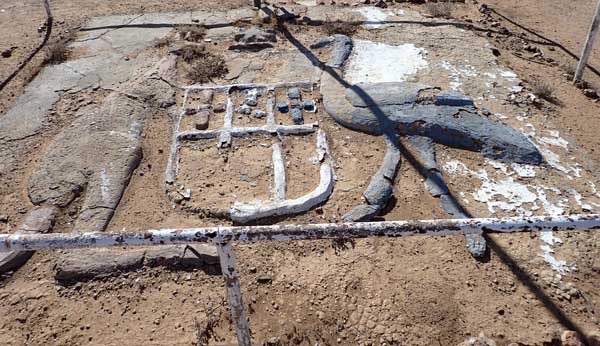 |
| Looking along the old railway line at Curdimurka Siding | Australian Coat of Arms at Curdimurka |
We leave at 1:33 pm and a bit further on we start going down the track to The Bubbler. However, it is so corrugated, we turn around and continue on. I doubt NPWS has graded it since 2003! We arrive at Coward Springs at 2:05 pm. New people have taken over the camping area and now you get allocated a spot. We check in ($18 pp) and go to the spot we have been given. It is quite a nice spot and close to the showers and toilets. We set up and then I have a cuppa and half the finger sponge. It is now overcast.
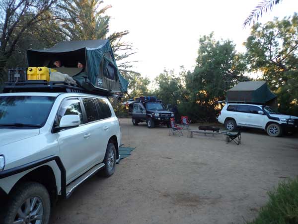 | 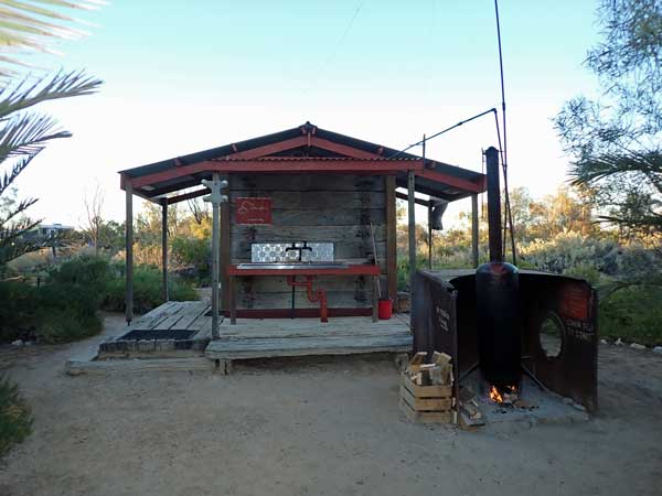 |
| Our campsite at Coward Springs | The showers and toilets made from sleepers, donkey boiler at right |
It is now overcast. We all go to the artesian bath. This is made from old Ghan railway sleepers. The water is about 30ÂșC. After this I have a shower, again the water is heated by a donkey boiler. This time I check to make sure it will be hot. It is!
We have a fire in the provided fire pit and drinks while sitting around it. Later I cook some Aldi chicken tenderloins on my skillet over the gas stove and heat up some of the rice as well. I go to bed at 9:30 pm, it is 8.3ÂșC and fine again.
Weather: Fine, max 19ÂșC Arrived: Coward Springs Time: 2:05pm Distance: 193.1 kilometres
Day 7 - Friday 4 July 2025 â Coward Springs to Algebuckina Bridge
Weather: Overcast, 2.5ÂșC minimum
Another cold night but I sleep well. I wake at 6:35 am and later read the SMH and listen to the ABC Sydney news at 7:00 am via my phone. I get up at 7:30 am. It is still only 4.0°C. I have breakfast and then take some photographs. We pack up and leave at 9:10 am.
The road is quite smooth at first but then there are some corrugations but the last 10 kilometres are smooth. I drive a lot of the way in the gutter drain as it is smoother there a lot of the time. We arrive in William Creek at 10:18 am, (73.0 km). There is a lot of wind and it has been from ahead of us so fuel economy is worse at 14.7 1/100 km. Itâs now 15°C but the strong wind makes it seem much cooler.
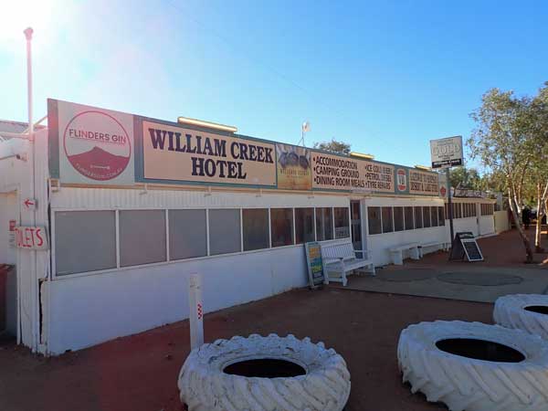 | 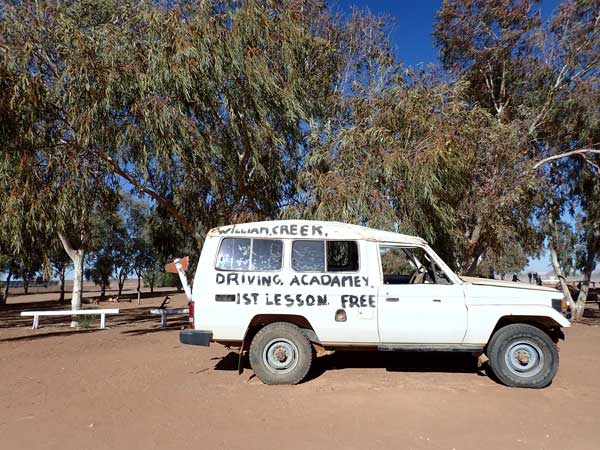 |
| The William Creek Hotel | A rolled Land Cruiser at William Creek |
The tiny town has changed a bit since my last visit in 2019. There is a new Royal Flying Doctor Service clinic building near the pub and a new cross runway at the airstrip. The Wrightsair office is now in a new building next to the pub as well. Other than that, nothing too much has changed. We have morning tea here and watch the many planes take off for tours over Lake Eyre. I did this in 2010 when it was 75% full, so no need to do it again.
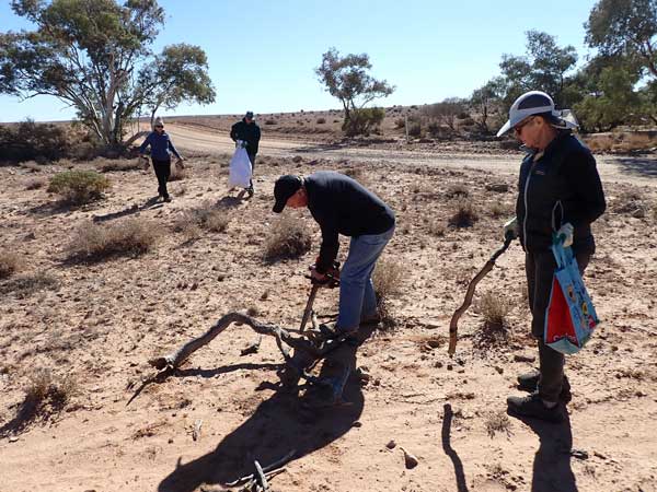 | 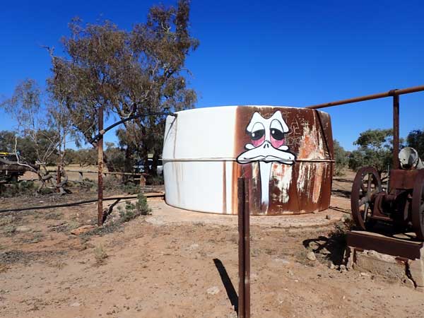 |
| Cutting firewood at a creek | The water tank at Edward Creek where we had lunch |
We leave at 10:52 am and the road is much better, we sit on 75 to 80 kmh mostly. At 11:28 am we stop at a creek (117.4 km) to collect firewood. We get a fair bit of good stuff. After 20 minutes we head on and at 12:28 pm we stop at Edward Creek (164.4 km) for lunch. There is a water tank here with a pained emu on it. There are lots of flies, more than previous days. It is still very windy but a sunny 23°C feels like 15°C.
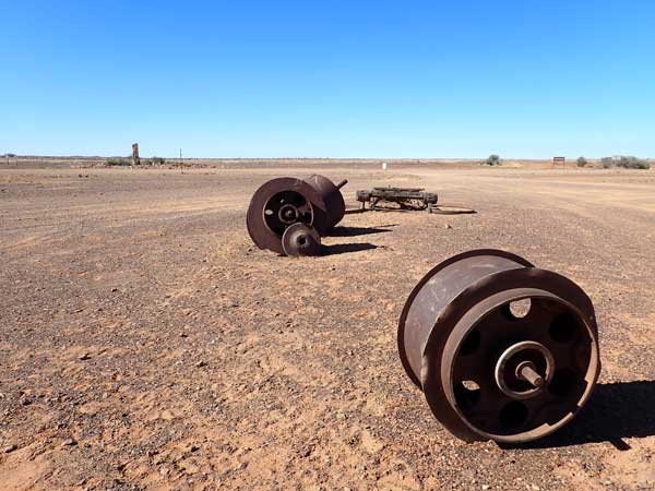 | 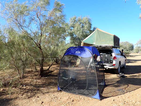 |
| The artefacts at Warrina Siding | My campsite at Algebuckina Bridge |
We leave at 12:58 pm and at 1:15 pm we stop at Warrina Siding (179.8 km). The Elder Scientific Expedition left here in 1891 (having come this far on the Ghan Railway) and headed across to Western Australia. There is a monument to this here. We leave at 1:20 pm and decide against going to Peake Telegraph Station which was also an old mining location.
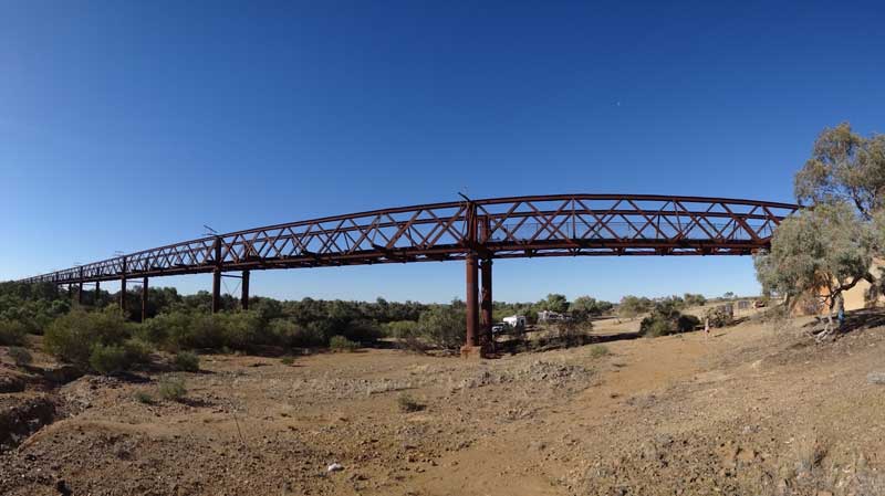 |
| A panoramic photograph of the Algebuckina Bridge from the western side |
We arrive at Algebuckina Bridge at 2:08 pm. This is the longest bridge in South Australia and was built for the Ghan Railway. We first look on the eastern of the Oodnadatta Track but find no available spots adjacent to the Algebuckina Lagoon. We later learn that you can go through a closed gate and there are more. However, we head back to the track and I look on the opposite side of the lagoon but there are only small sites.
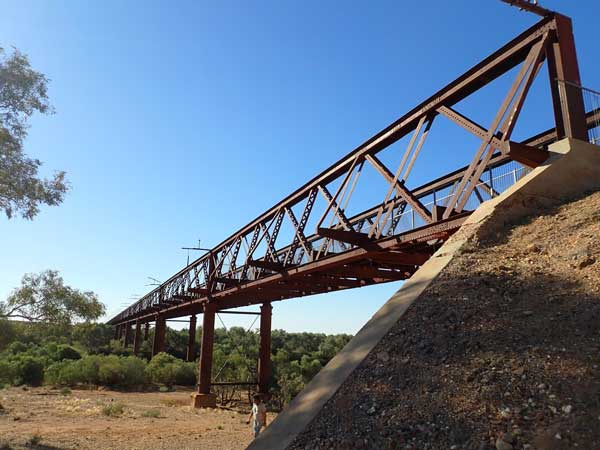 | 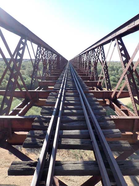 |
| The Algebuckina Bridge from the western side | Looking across Algebuckina Bridge from the south |
We then look between the bridge and the track on the southern side of the creek and find a good spot. We set up camp here. It is 27°C and windy but not as bad as earlier. I put up my fly tent as there are lots around. I then walk to the bridge with the others and take some photographs. I come back and make a cuppa and have with half of the finger bun from Farina. I sit in the tent and read the SMH and then a book, unaffected by the flies.
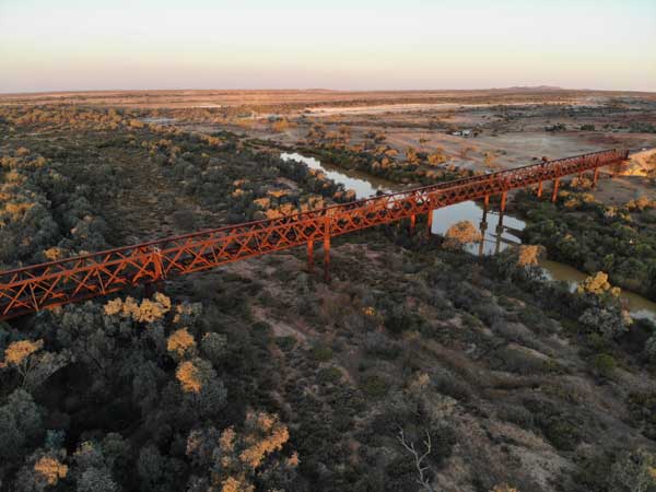 | 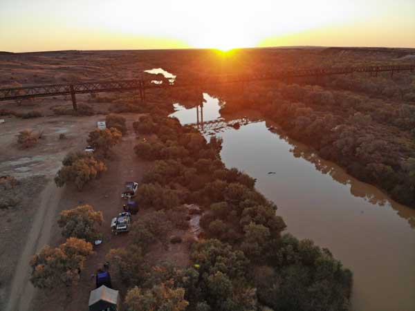 |
| The Algebuckina Bridge from the western side | Looking towards Algebuckina Bridge showing our campsite on left |
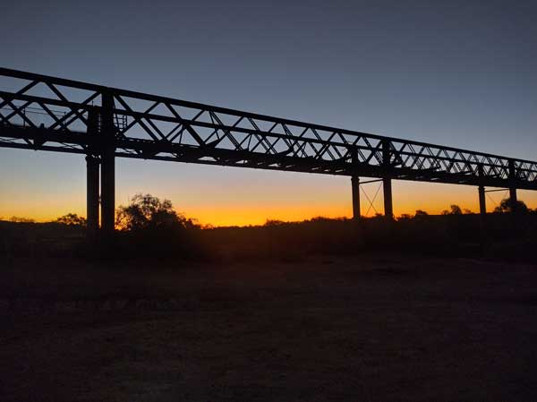 | 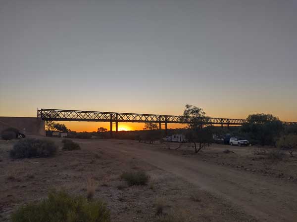 |
| The Algebuckina Bridge sunset | Another sunset shot of the Algebuckina Bridge |
There are not many camped here at all. At 5:00 pm the wind drops and we put the fire on and the flies have abated a bit. We have drinks and watch a great sunset. I later cook sausages and potato on my skillet over hot coals. We watch the NRL on Ianâs tablet. It remains fairly warm at 15°C at 9:25 pm when I go to bed.
Weather: Fine, max 27ÂșC Arrived: Algebuckina Bridge Time: 2:08 pm Distance: 220.5 kilometres
Day 8 - Saturday 5 July 2025 â Algebuckina Bridge to Mount Dare
Weather: Fine, 10.4ÂșC minimum
A warm night, I have to strip clothes off during the night as I am too hot. I wake at 6:00 am and later listen to the ABC News from Sydney via the app. I get up at 7:30 am and notice that at 8:00 am the temperature has now dropped to 8.6°C. Weird! I have a rissole and cheese toasted jaffle for breakfast. I also walk to the bridge to take a photo of it with the sun now on the eastern side. We leave at 8:35 am as we have a long way to travel on what are probably going to be poor quality roads.
We arrive at Oodnadatta at 9:27 am. Once again we have head winds. We refuel, I take 57.02 litres at $2.999 a litre totalling $171.00. I have averaged 13.7 l/100 km since Marree, quite high. Just before I pull in I notice that my snorkel is bouncing around. I have been checking this regularly as even since it was installed it has been coming loose. The screws holding it in place on the pillar long ago worked free and I have to keep replacing them with bigger ones. I find some rubber which I use to fill in the worse hole and tighten it all up. This repair ends up lasting till the second last day of the trip. Back home I do a more permanent repair that I hope will last forever!
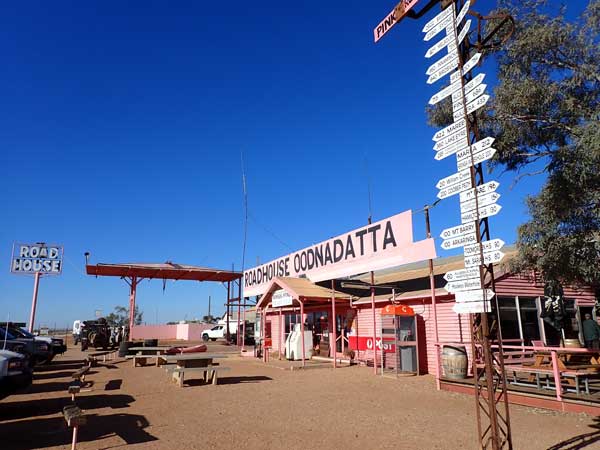 | 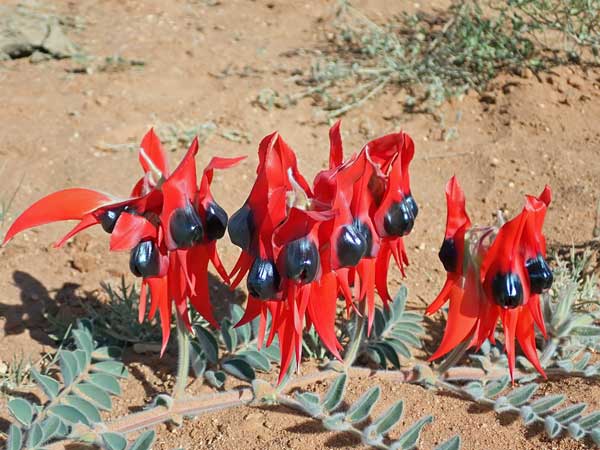 |
| The Pink Roadhouse at Oodnadatta | Sturts Desert Peas north of Oodnadatta |
I buy some bread in the Pink Roadhouse for $8.50. It was frozen of course. There is a HiLux up on a jack getting repaired, its bearing has gone. There is a free water machine that filters the bore water. It is very slow filling my container (which I have previously emptied into my main water tank). We leave at 10:25 am.
We continue on the Oodnadatta Track but 17 km north we turn onto the Mount Dare Road. The road is good at first and at 10:55 am we stop as we have seen some Sturtâs Desert Peas. This beautiful flower cannot be passed by without stopping for photographs. It turns out that this is the only spot we see them on the whole trip. I change into shorts as it has warmed up to 18°C. There are only a few vehicles that pass us on this road.
About 30 kilometres on I hear a noise like a stick hitting the bottom of the car. I see nothing in my revision mirrors nor does Ian who is behind me. We continue on and at 12:13 pm we arrive at Hamilton Homestead (167.4 km) where we will turn towards Dalhousie Springs. There are two ways to Mount Dare, this way and straight ahead. Back at the Pink Roadhouse they told us this is the better track. Mount Dare, of course, tells us it is the other way!
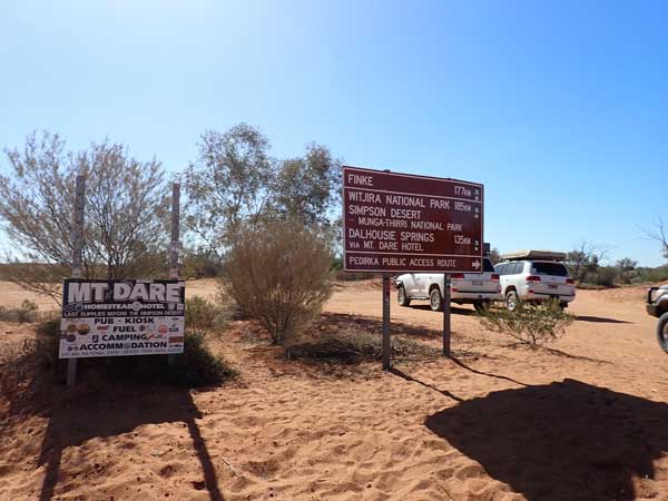 | 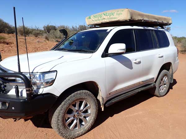 |
| The turnoff at Hamilton Homestead for the Perdirka Track | My Land Cruiser and the missing strip on passenger door |
Anyway, while we stop here I notice that the fake chrome strip on the bottom of the passenger door is missing. This part is only on the Sahara version. It looks like three of the plugs holding it in place have come free and the remainder have broken. That is obviously the noise I heard. Bugger! We leave at 12:20 pm and continue on the Public Access Route (PAR) which goes through the property. It is a rough rocky track.
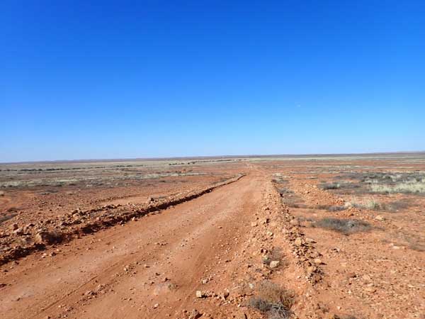 | 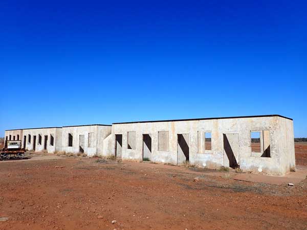 |
| The Perdicka Track | Fettler cottages at Perdirka Siding |
At 12:35 pm we stop in a creek bed for lunch (178.8 km). There are lots of flies as we have become accustomed to on this trip. We leave at 12:57 pm and eight minutes later arrive at Perdirka Siding. This is where there are the remains of more old Ghan Railway buildings. We have a look around and leave at 1:17 pm. It is windy again, but at least now the wind is behind us so we get much better fuel economy.
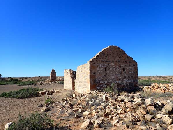 | 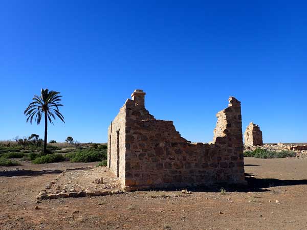 |
| One of the ruins at Dalhousie Springs Homestead | Another of the old ruins |
At 1:55 pm we enter the national park and briefly stop at an information bay. We have only had one vehicle pass us the past few hours. The track is rough and we can only do 40 to 60 km/h. At 2:21 pm we arrive at the ruins of the Dalhousie Homestead (226.6 km), averaging under 11 l/100 km since lunch. There are the remains of the old buildings and we have a walk around. It is now 21°C.
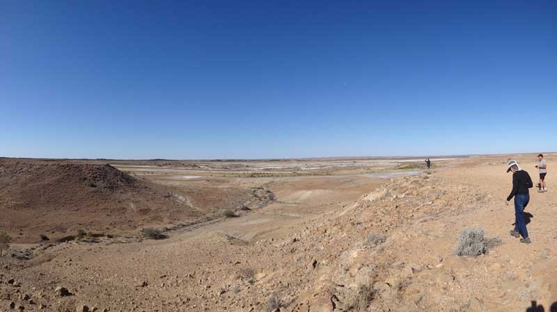 |
| A panoramic photograph from the lookout near the old Dalhousie Springs Homestead |
We leave at 2:35 pm and two kilometres on we stop at a lookout for a few minutes. There are nice views to the east. We continue on a turn onto the Dalhousie Springs/Mount Dare Road via the newish (well new since 2003!) track that has been put in to bypass a section of road. Note that many maps still show the old road as existing.
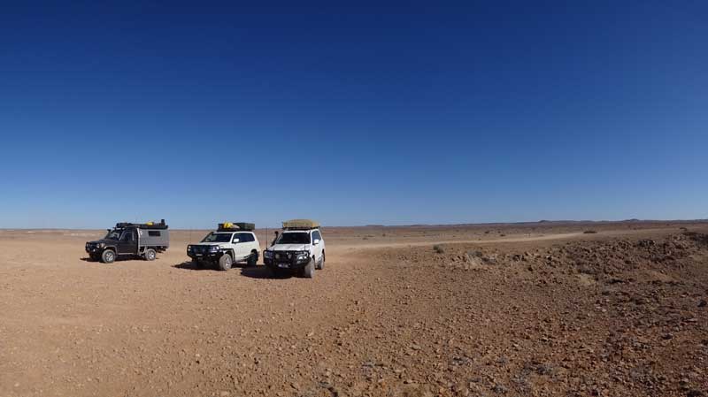 |
| A panoramic photograph of our vehicles at the lookout |
The track from here to Mount Dare is atrocious, does not look like it has been graded in 20 years. A 70 kilometre distance that should be able to be covered in a little over an hour takes about 100 minutes. For the last section we actually drive on a track that has been made by vehicles above the proper track, it is much smoother. The track has either corrugations or rocks, all making it a very slow and uncomfortable trip.
We arrive at Mount Dare (298.9 km) at 4:19 pm and go straight to the fuel bowser. I take 30.65 litres at $2.90 a litre for $88.89. I have averaged 12.4 litres per 100 kilometres since Oodnadatta. We then go into the hotel to pay for our camping and get our South Australian Desert Parks Pass. I pay for the camping ($25 per car) but not the pass as so many people come in the woman says to come back later.
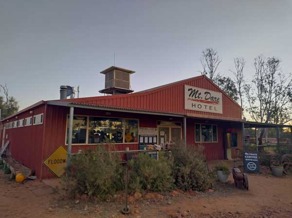 |  |
| Mount Dare Hotel in 2025 | Mount Dare Bar (not a hotel then) in 2003 |
We move to the camping area and find a nice spot and set up. I then go and have a shower, so good. We have a beer and then at 5:55 pm we walk back to the hotel for dinner. I have lemon pepper chicken ($26) which was nice, but my meal was about 60% the size of Sharonâs same meal. Beers are $8.50 a can and wine $9.
We are watching Australia play Fiji in the rugby union, Australia just wins. I notice in the merchandise area that they have nice fleeces at $60. I decide to buy one and tell the others. We all end up getting one! Finally I also buy my parks pass, $204, a bit of a rip off considering the condition of the roads in the national park. We head back to camp at 8:00 pm and I go to bed at 8:45 pm. A few minutes after, a few fireworks go off. No idea why.
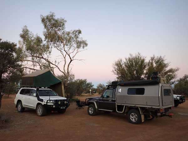 | 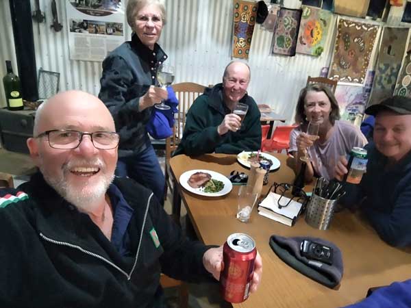 |
| Our campsite at Mount Dare Hotel | Having dinner and drinks inside the Mount Dare Hotel |
Back in 2003, Mount Dare was a working cattle property with fuel, a small bar and a small camping area. Now it is part of the national park, with a proper pub, accommodation and a much larger camping area. Not sure if this is better or not.
Weather: Fine, max 22°C Arrived: Mount Dare Time: 4:19 pm Distance: 298.9 kilometres
Click here for the next part of this article.
| 
 v6.00.307 © 2003-2005