|
Saturday 2 October 2005
We meet up at the car park at Hartley Historic Site, west of Blackheath. It takes about two hours to get here from Sydney. There are three other cars in our group (from the Jeep Club of NSW).
We head off on the road to Jenolan Caves, stopping to look at the huge wind generators just before you start the drop down into the caves precinct.
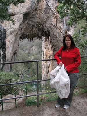 | 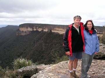 |
| Kelly in front of one of the Arches at Jenolan Caves | Here we are at Kanangra Walls |
It was a cool and damp drive and arriving at the top car park (best place to meet and stop as you do not need to pay) it is still a bit threatening. We go for a couple of short walks and then have morning tea.
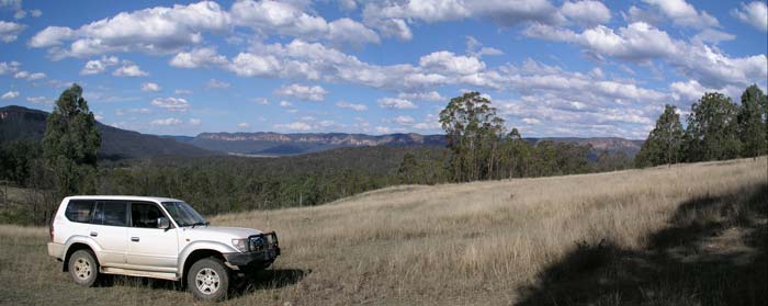
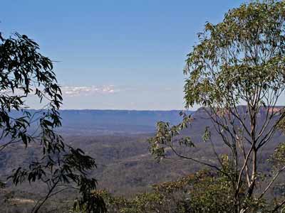
From here we head off towards the Kanangra Walls in Kanangra-Boyd National Park. This is along the Kanangra Road, a good dirt road suitable for two wheel drives. These spectacular cliffs are well worth visiting. There are some short walks to lookouts and also to waterfalls. There are lots of other longer walks in the area as well. Along the way you pass Boyd River Camping Area which looks pretty nice.
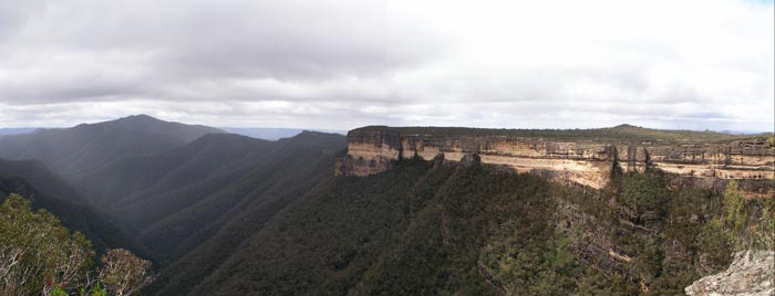 |
| Kanangra Walls |
After leaving Kanangra Walls, we head back along the Kanangra Road till we reach one of two access roads. The first one is either Uni Rover Trail or Boyd Ridge Trail (not sure as some maps are not clear) and it joins up with the second which is the Kowmung River Fire Trail. This trail leads down to the Kowmung River. The track is quite steep and is certainly only for four wheel drives.
At the bottom you come to the Kowmung River. This can have lots of water in it at times. There is a small causeway that helps crossing. On one trip here we had water to the top of the front of the bonnet, but other times it can be only up to your bumper. Be careful. The Kowmung runs into Lake Burragorang which is better known as Warragamba Dam, Sydney's major water supply reservoir (so don't pee in it!).
From here it is another steep climb up and out of the valley. A bit along here you come to Dingo Dell Camping Area. This is not the greatest camping area I have seen but I suppose it would not be too bad. We have lunch here and it is drizzling.
After lunch we head south and a few hundred metres along there is a Y intersection. The right hand track is Bouchers Fire Trail and the left one is Banshea Trail. This is the best one to take as there are some excellent views across to the cliffs above the Kowmung River.
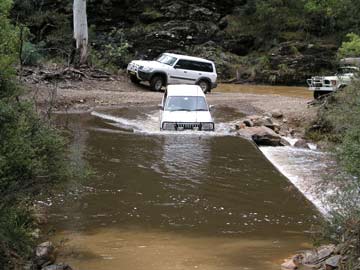 |  |
| Crossing the Kowmung River | Our camp site near Yerranderie |
We turn left at the Uni Rover Trail (again) and follow this to the south-east. We pass Limeburners Creek Trail which we will use in two days to leave this area and travel the 31 kilometres to the access track to Bat Shit Camp. This is a small camping area that would be suitable for up to about 5 vehicles.
We continuie along the Uni Rover Trail (no idea how it keeps this name as the one we came down earlier has intersected with us a few kilometres back). It is another 26 kilometres to the turn-off to Yerranderie. It takes us almost an hour to get here. We have a look as some spots near this intersection as there is an old ruined homestead here and there are some nice grassed areas.
It is decided to look at another spot which is down the old road that leads to Picton. There area where we are now is right near the exclusion zone around Lake Burragorang (Warragamba Dam). You can only drive a short way down the Yerranderie to Piction road before your come to a locked gate and warning signs. You can walk along the road to a point where you can cross over to the Nattai River, but you cannot drive it. I have done the drive a couple of times as part of my work (fighting bushfires). It is a spectacular drive and should be open to the public, albeit under some sort of permit system.
 |
| Burragorang Walls from near our camp site |
We go a little way down the road towards Picton and go down a track to the left (north side of the road) where we find a great spot. We camp among the ruins of an old homestead that overlooks Burragorang Walls and the lake. It has lots of green grass and is a very nice place to camp. The GPS Reading is 34º 01' 13.4"S 150º 16' 30.8"E using WGS84 as datum.
Sunday 3 October 2005
We wake up and find dozens of kangaroos all over the old property. We go for a walk and see many have joeys. This is a really nice place, the old grassed paddocks are kept clear by the roos.
After breakfast, we drive the few kilometres to Yerranderie. This is an old mining town which is privately owned. The owner has restored the buildings over the past 30 years. It is a real credit to her that they have been kept in as original condition as possible. We spend the day exploring the village and the mines.
 |  |
| The bank bulding at Yerranderie | One of the pieces of machinery at Yerranderie |
There is a lot to see, the ruins of the old school, the Court House, the old bank, the post office and more. There is a camping area and there are various other accommodation options in the old buildings. There is a nice little museum in one of the buildings with lots of things that have been found here over the years.
We visit the mining area and the ore processing area.
In the afternoon we head back to the camp site. We first go to the closed gate and then off a bit to the north to see where it goes. We return to the camp and watch a spectacular sunset which lights up the cliffs over the eastern side of Lake Burragorang.
Monday 4 October 2005
We head off back along the Uni Rover Trail and turn left at Limeburners Creek Trail. This leads to Limeburners Creek which has a huge open area where you can camp. We have stayed here a couple of times over the years and there are some nice spots on the western side.
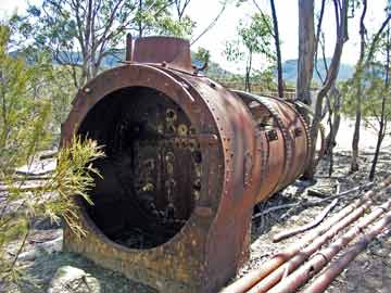 | 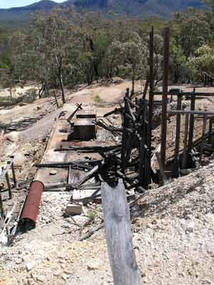 |
| A boiler at Yerranderie | A section of the Yerranderie Mine |
We continue towards Wombeyan Caves along the various fire trails. We stop at the caves for lunch and do a couple of short walks. We have been here before so we do not explore any of the caves apart from the large open cave that has a track to it.
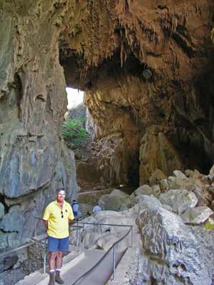 |  |
| Me in front of the main arch at Wombeyan Caves | Near Wombeyan Caves |
From here we head back along the narrow and winding Wombeyan Caves Road to Mittagong and then back up the Hume Highway to Sydney.
A really nice trip.
Distance:
676 kilometres
Cost:
101.1 litres of fuel costing $100 at an average of 15 litres per 100 kilometres (18.9 mpg). No camping costs and only other costs were food and drinks.
|  v6.00.307 © 2003-2005

