|
Day 3 - 28 December 2007 - Bindaree Hut to Wonnangatta Camping Area, Wonnangatta River
For the previous part of this trip, click here.
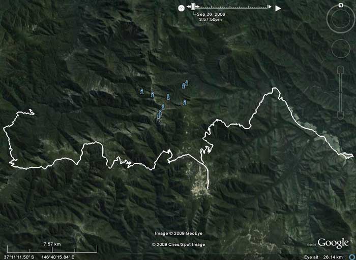 |
Day Three - Bindaree Hut is at the start of track at left. Wonnagatta Valley is at right.
Howitt Hut is at the bottom of the off-shoot in middle |
Last night was cool and this morning it is only about 8ÂșC at 7 am. We have a leisurely start and leave Bindaree Hut at 8:50 am.
The road basically follows the Howqua River and after about 10 kilometres we come to the Pikes Flat Camping Area. This also has a hut called Pikes Flat Hut (probably the worst one we see - made from corrugated iron). This is a very nice camping area and there are a few people camped here with families. It has a toilet and across the river there are more sites, a toilet and a shed. While we were here, Kelly decided she was hungry and she ate a fly!
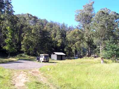 | 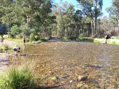 |
| Pikes Flat Camping Area and Hut | Howqua River at Pikes Flat |
We keep going and we planned to look at Ritchies Hut which is about three kilometres further on, just off the main road. Although this is not a Camping Area, you can apparently camp here. However, we missed the track that leads to it as it does not appear to be signposted. I suspect that the track comes off immediately after you cross a creek that feeds into the river and as you make a sharp left turn.
We continue along the road we were on yesterday and soon come to the Bluff Link Road again. At this intersection we turn right and just over 500 metres along we turn left onto a track that is signposted "Bluff Hut 4x4 Only". This is Bluff Track and Bluff Hut is only 2.2 kilometres along this track and it has a very good camping area. However, Bluff Hut when we visit is being totally rebuilt as it burnt down in the 2006-7 bushfires. You cannot camp here at the moment, although about 200 metres further up there is a grassy spot that you could try.
 |  |
| Bluff Hut being rebuilt | A tree near Bluff Hut |
While at Bluff Hut, we walk to a spot just above the road (or you could drive up about 200 metres and walk across the grassy area that I mentioned above). This has great views out to Mount Stirling and Mount Buller.
 |
The view out west above Bluff Hut
Mt Buller Resort is one third from left and Mt Stirling one third from right |
After Bluff Hut we start climbing up towards Lovick Hut. It does not take long to get to the top of the ridge but as the road is pretty rough, the 6.6 kilometres takes 30 minutes. There are very nice snow gums along this section of the track. The height here is over 1600 metres. The track drops a little before climbing again.
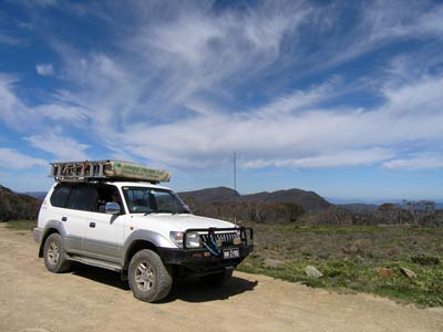 | 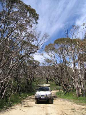 |
| The view from Bluff Road | The track on Bluff Road |
After 6.3 kilometres we come to an intersection with Cairn Creek Track. Lovick Hut is actually about 300 metres past the intersection and on the track we are proposing to keep using.
 | 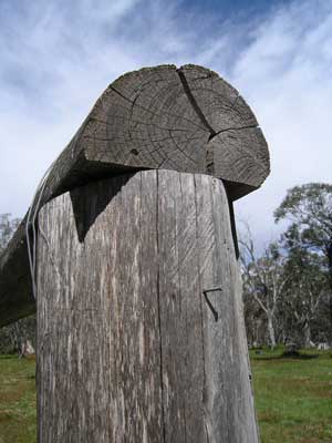 |
| The partially rebuilt Lovick Hut | One of the posts from the hut |
We decide to have morning tea here as we look around. At the time I thought that the hut had obviously burnt down, perhaps as long ago as the January 2003 fires as there was some rebuilding done (limited to poles and some beams) and they look old. There is also some corrugated iron over to the side of the "hut". Howeverm in 2015 I discovered when visiting again that the hut had been pulled down by the owner (not sure how there is an owner on something on public land) as it was falling apart. The scones I baked last night are consumed with strawberry jam as we walk around.
On the other side of the track from the hut there is a nice camping area with pit toilets. The sites have a great grass cover and are under lots of snow gums.
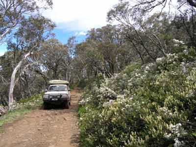 |  |
| The road just past Lovick Hut | Lovick Hut Camping Area |
After Lovicks we continue on the track we are on (still called Bluff Track I think). We continue climbing till we are on the top of the ridge. We see some bushwalkers here as well as some people camped nearby.
After about 5.3 kilometres we come to Brocks Road. This is closed somewhere down to the right due to a bridge being burnt out in the 2006-7 bushfires. Near this intersection there is supposed to be King Billy No 1 Hut but I discover when I return home that if it is still there, it is up the walking track that crosses the road here. We turn left into King Billy Track and start a steep descent into the valley. We end up following and crossing the Macalister River for about 2.5 kilometres before climbing back up again. It takes an hour to travel the 13 kilometres from Brocks Road to the top of the valley.
A further two kilometres on we come to a parking area with a lot of cars. This is the start of a walking track to Mt Howitt and Gartner Hut. We do not have time to do the six kilometres round walk so we continue on.
Only 1.5 kilometres along we come to an intersection. Off to the left is Zeka Spur Track. Just before this we passed Butcher Country Track to the right. We are actually heading off down Zeka Spur Track but first we want to go to Howitt Hut. This is about 2.5 kilometres down the Howitt Road.
 | 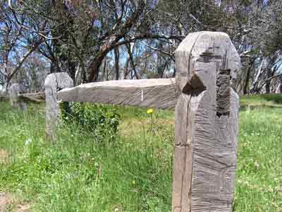 |
| Howitt Hut | The fence at Howitt Hut |
We stop for lunch at Howitts Hut (it is 12:55 pm). This is really worth visiting as it is a very beautiful spot. As well as the hut, there is a well and nearby a camping area with toilet. The whole area has lots of snow gums and they provide a lot of shade. There are lots of flies around so we eat in the hut which has less flies. While we are here, a ranger arrives and we chat to him about the hut.
 |  |
| Howitt Plain | Howitt Plain |
We leave at 1:30 pm and backtrack to Zeka Spur Track. Before we get there, we stop at Howitt Plain. This large open area has a lot of wildflowers and the clouds are making a very attractive view. Kelly takes some photographs.
The Zeka Spur Track is very steep and leads down to the Wonnangatta Valley which follows the Wonnangatta River. It is first and second gear high range all the way down and it takes 80 minutes to drive the 20 kilometres to the start of the valley. We stop at one spot and cut up a log for firewood as we are having a roast tonight and need lots of coals.
This long valley was a farming property from the late 1860s till 1988 and has a long history, including the unsolved double murder of Jim Barclay and John Bamford in 1917.
Less than three kilometres further on we come to the start of the Wonnangatta Station. This is at an intersection with Rileys Track. There are three bushwalkers resting here. We go down Rileys for a short distance till I decide that we need to continue on the main track. As we approach the bushwalkers they motion us to stop (two chaps and a girl, all in their early 20s). We get out and chat to them. We find that they have walked the 23 kilometres from Howitts Road (we had seen their old LandCruiser parked there) since 8 am. Not bad going.
However, they are totally lost as they think that they have come down a certain track to the south rather than Zeka Spur Track. We show them where they really are located. We offer them a cool drink but they decline as they have just got water out of the river. They say that they are trying to get to the old cemetery for the Wonnangatta Homestead. I would have offered to give them a lift but we could only fit one person in given the gear we have in the back. It is too far to shuttle them, so they have to walk. I doubt that they will make it the 6.8 kilometres they still have to go.
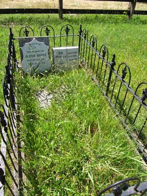 | 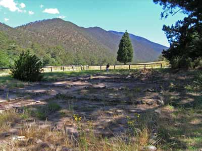 |
| Two of the graves at Wonnangatta Cemetery | Wonnangatta homstead remains |
We first go to the cemetery which is on the side of the valley. There are a couple of graves, including three of the Bryce family who owned the station. We move about 400 metres to the site of the homestead. This was the homestead for the station till it was burnt down in 1957, apparently by some careless bushwalkers. All that remains are some paving stones, the falling remains of two chimneys and some hedges. Just below the site there is a hut. This is called Guys Hut in at least one guidebook but this is not its name (Guys Hut is at the top of the escarpment). There is also a camping area. This hut was built in 1957 from the remains of the homestead.
There are many places to camp, both formal and informal here. I had originally planned to get to Eaglevale Camping Area but as this is over 32 kilometres away, and it is already 4:10 pm, we have no chance of doing this in comfort. This was a wise decision.
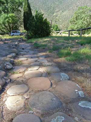 |  |
| The stone pathway at Wonnangatta Homestead | Unknown name Hut |
We cross Conglomerate Creek (which flows into the Wonnangatta River here) to Duffys Camping Area but find that it is very dusty and already has some people there. We recross the creek and drive along the main river. There are a lot of people camped here, including what appears to be about 20 vehicles from one 4WD club. There are many toilets and BBQs. We find a spot near a toilet and park. It is very hot, at least 30ÂșC. The flies are extremely bad, the worst I have ever encountered. We put on our fly caps (fly screens that go on your head) and walk to the river to cool down.
We have not yet put up the tent as it is too hot. On our walk we find a better spot with easy access to the river. I rush back to the car to move and while I am away, two vehicles ask Kelly if the spot is taken. We set up camp and then take a beer to the river and sit with our feet cooling.
 | 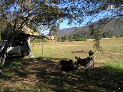 |
| Kelly cooling down in the Wonnangatta River | Our campsite at Wonnangatta next to the river |
As the flies are so bad, we decide to delay dinner and do not put the roast on till 7:30 pm. At 8:15 pm we have roast pork with potatoes and carrots washed down with the savignon blanc we purchased in Jugiong. After dinner I make some muffins (albeit in a small loaf tin) for morning tea.
We watch the stars and see four satellites and one shooting star. It is relatively late as I go to bed at 11:10 pm.
Kilometres: 82 kilometres
Weather: Fine, very hot, over 30ÂșC
For the next part of this trip, click here.
| 
 v6.00.307 © 2003-2005