|
After last year's epic journey to the Victorian High Country, this year we decided to stick closer to home and also to limit our kilometres. The plan was for a much more relaxed time away than our normal camping trips.
The plan was to head off Christmas Day after lunch and go down the South Coast and head inland from Ulladulla to Yadboro Flat. This is a site we went to in May 2013 for our wedding anniversary.
On this trip there will be Kelly's Dad, Tomas in his newly purchased Toyota LandCruiser 80 series, our normal 4WD (and dive) buddies Ron and Donna in their Toyota LandCruiser Prado 120 series and of course, us in our Prado 90 series. Joining us later are our dive buddies Gary and Nancy in their brand new Prado 150 series. This will be their first proper camping trip, although they headed off from Sydney on 15 December 2013 and have travelled to Mount Gambier in South Australia to have Christmas with Gary's parents. They will meet up with us a few days after Boxing Day.
 |
Our route as recorded by our GPS using OziExplorer and uploaded to Google Earth
1 is Yadboro Flat, 2 is Araluen, 3 is Lowden Park and 4 is Corang River - home is top |
You can download the Google Earth track of this trip by clicking here and looking at it in Google Earth.
Day 1 - Wednesday 25 December 2013 - Kareela to Yadboro Flat
Kelly and I go to my mother's place for lunch and after that we head back home to pick up the Prado. We get on the road at 3:45 pm, even earlier than we thought we would. As normal we have the ShippShape roof-top tent on the car. We also have on board Veto, our dog (our daughter!). As on other occasions, she has been so excited the past few days as we loaded the car, somehow she sensed that she was coming along with us.
We head south on the Princess Highway. It is drizzling and only 21ÂșC. We meet Tomas at Waterfall and Kelly changes cars to go with him. She ends up driving as he wants Kelly to see what his car is like. At 5:20 pm we stop at the Berry Rest Area (just south of Berry) where there are toilets. We are back on the road within 10 minutes.
As Tomas has LPG fuel on the Cruiser, we decide that he should fill up before we leave the highway. This means we need to go to Ulladulla for fuel as there are no service stations in Milton that have LPG (in fact they are closed anyway). We stop at the Caltex at the top of the hill just after 6:30 pm and he refuels. It is still raining (drizzling really) and we leave at 6:40 pm.
We head south out of town and just past Burrill Lake we turn right into Wheelbarrow Road. It is six kilometres from the Princes Highway to Woodburn Road. Here we turn left (right goes back to Milton). Just over three kilometres from here we turn right onto Clyde Ridge Road. This is a dirt road and you are now in heavily timbered country. At this intersection there are signs to Yadboro Flat as well as Pigeon House. There is also a tea room about 100 metres down the road.
Once you are past this point, look for suitable timber on the side of the road to collect for your fire. Do not wait till you are close to Yadboro Flat as there is virtually none around there to find. We stop at a spot and I cut a lot of timber and we put it in both our and Tomas's cars. Another 7.8 kilometres on there is another intersection. This is where Yadboro Road starts. The Clyde Ridge Road actually turns left here and you continue straight ahead on the new road.
A further 4.3 kilometres along you will see the turnoff to the start of the walk to Pigeon House Mountain on the right and then another 6.8 kilometres sees the turnoff on the left to Blue Gum Flat Camping Area. Both these are in Morton National Park so we are not supposed to visit them (since we have Veto with us).
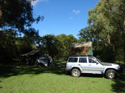 | 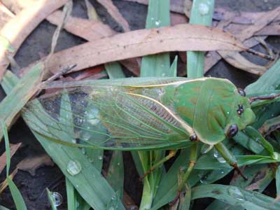 |
| Tomas's 80 series and our Prado, Yadboro Flat | A greengrocer cicada, Yadboro Flat |
We arrive at Yadboro at 7:45 pm. It is just under one hour's drive from Milton (38 kilometres). Yadboro Flat is in Yadboro State Forest and is located on the Clyde River. The whole road in is in very good condition and appears to be suitable for 2WD vehicles all the time.
The Yadboro Flat Camping Area has three sections. The first is on the left as you approach the river. This is very small and really would only be used if the other two parts are full. There is a timber bridge over the river.
On the left side after crossing the bridge there is a large flat section of the camping area which has a very nice grass base with plenty of trees for shade. There is a toilet as well as a number of fire-pit rings. There are two sets of people set up here. Most of the barbecues are broken as it seems the vertical support has rusted away where it enters the ground. The southern-most part of the spot looks like it floods a bit as there are channels dug in the ground to direct water away. Most of the spots are very good, some right next to the river.
We cross the road and look at the other side. This is a bit bigger and straddles a longer section of the river. There are also quite a few spots down close to the river that are very nice. In summer they would be the prime spots. I should also point out that the very bottom spots on the rocky beach will flood as when we were here last time there was evidence that the water was covering this section in the past few days. Beware!
There are two cars camped on the northern side of the road but the majority of the area is empty. As it is high summer, we look for a spot that where we can get shelter from the sun. The whole area has good grass cover. The northern side of the camping area is bounded by private property. This runs cattle and some horses.
Unfortunately, the cattle appear to be able to get through the fence (we see them do it) and roam around the camping area at will. This means that there is heaps of cow shit all over the place. Luckily it is not summer so it does not smell and there are no flies. A pity the farmer cannot/will not keep his cattle on his own property.
Anyway, we drive to a cleared area near the fence (it appears the private property may in fact not be just over this fence as a new fence has been erected since May about 100 metres to the north). There is still a light drizzle so we decide to set up here rather than closer to the river in case it rains more heavily overnight.
As it is raining on and off, we put out our ShippShape as an awning and also put up the rear door tent. This lets us access the back of the car without getting wet. We soon have our things set up (Tomas also has a ShippShape tent that we purchased a few weeks ago) and it is time to have a beer. I do not think I have waited this long on Christmas Day to have a drink since I was 18 years old!
We decide to not worry about a fire as although it is cool, it would be a pain to try to light it in this weather. As we had a huge Christmas lunch, we really do not need to eat much, so we have a small snack of half a small left over veal schnitzel from last night's Christmas Dinner and a small ice cream each.
We spend the rest of the evening talking and I start the first of the eight books I will read on Kelly's Kindle.
Meanwhile, Veto has been running around in the rain and barking at the cows. She does not like them and has done this before when we were camping on the Murray River in late 2010. We have to dry her a few times during the night.
About 10 pm millions of small bugs come in and hang around our lights. Getting a beer from the fridge is very annoying as they even fly into the fridge attracted by the internal light. Eventually we decide we have to go to bed to get away from them.
Once in the roof top tent, we have to use insect repellent to try to kill the bugs that got in while we had the access door open. The light drizzle continues throughout the night till the early hours when it stops.
Weather: Raining, max 21ÂșC Arrived: Yadboro Flat Time: 7:45 pm Distance: 239 kilometres
Day 2 - Thursday 26 December 2013 - Yadboro Flat to Yadboro Flat
Weather: Fine, 16.8ÂșC minimum
We laze in bed as we have no real plans today apart from perhaps going for a drive down south a bit to a lookout. In any case, we have to wait for Ron and Donna to arrive. We get up at 8:30 am, although I have been awake since much earlier and have listened to the 7:45 am ABC Radio News (as I nearly always do). The sun soon comes over the trees and it is 19ÂșC by this time. Also, Veto has been barking at the cows which have been right next to the car. Of course, Veto sleeps in the ShippShape, mostly down at our feet, but sometimes you wake up with her in between us and her head on the pillow. I am sure she thinks she is a human.
Last time we were here Veto rolled in cow shit a couple of times. We have tried to make sure she does not do it this trip by telling her she will be bad if she does. We hoped it would work but she rolls in some, at least it is dryish. She gets an early bath!
Kelly goes for a swim in the river (which is a nice 20ÂșC).
There are lots of flies and bugs, including quite a few Christmas beetles. There are also millions of cicadas and they start their chirping about 7 am and do not stop till sunset. They are so loud it is almost deafening. Kelly finds some ear plugs and at times we have these in to minimise the noise.
 |
| Our final campsite at Yadboro Flat |
We carry our chairs down to the river and sit around reading till 12:00 pm when Ron and Donna arrive. We decide to move camp down to the river's edge. We carry our table down and then partially close the roof top tents for the move. Kelly and I set up our car, but Tomas and Ron do not as we are going for a drive after lunch. We put out their chairs and tables to block off the spot for us when we return.
We have lunch and at 1 pm we head off. We are taking Tomas for a drive on some rougher roads to show him what the Cruiser is capable of. We head north out of the camping area along Yadboro Road. Just over 3.5 kilometres up the track is the turn off to Long Point Camping Area and the access to The Castle. This is in Morton National Park. We decide to go and have a look. It is not far down to the camping area. To say that I am disappointed with it would be an understatement. It is not a great spot, poorly located and set out. Forget it, Yadboro Flat is much better.
We head back to the main road and turn right. Past here the name of the track changes to the Western Distributor. Again, it is a very good road, suitable for cars. Along this section of track there are views of the spectacular sheer cliffs and The Castle, but no real spot where you can get a good photograph.
There are a number of good tracks that head off to the left along here, including Blue Gum Flat Road (which is not a through road with the other section!) and Mares Hill Road. The first leads to near the camping area at Blue Gum Flat (but not the right side of the river), the second goes to Clyde Ridge Road. We end up turning off at Cattlemans Fire Trail. This goes to the left and follows a ridge back to the east.
I am driving Tomas's 80 series as he wants to see how to drive it on the steeper sections. There are a couple of other tracks that come off this one, but the fire trail is pretty obvious. After 6.1 kilometres the track drops down to the Bimberamala River and we cross this. It is not very wide or deep normally. We climb back up the ridge to about 220 metres (maximum height has been only just over 300 metres along this whole route) and a bit further on to about 270 metres. There are some steep descents and ascents along here which require low range.
 |
| A panoramic photo looking north, Moogood Lookout |
Only 3.1 kilometres after crossing the river we come to an intersection where Cattlemans Fire Trail appears to go straight ahead up a steepish hill while the main (and what appears to be a newer) trail goes to the left. We go up the hill as we know that this leads to the Mogood Lookout. This is steep and rough and requires low range. Tomas is impressed with what the car will climb!
The lookout is about 390 metres above sea level and has a small loop track around a trig station. The remarkable thing is that it has 360Âș views, with the ocean visible to the east and the plateau towards Braidwood to the west. North you can see Pigeon House Mountain and The Castle. It is very hot by now, 30ÂșC.
It appears that this is used as a helicopter landing spot as all the trees are only a metre or two high, apart from one large one. For some reason, perhaps to help the pilots spot it from the air, there is one tree on the western side that is about 15 metres high. Anyway, this is a great spot and well worth visiting.
While I am here, I use the opportunity to phone Gary and Nancy to see if when they are leaving Mount Gambier. They are on their way from Adelaide to Mount Gambier when I call and still propose to leave there on Saturday 28 December. I tell them that we have decided to stay one more night at Yadboro (as the forecast for Saturday is for very hot conditions) and that we will contact them again from Braidwood to check on where we will be meeting. It is now 2:30 pm so we decide to head back.
 |  |
| Tomas and his 80 series at Moogood Lookout | Donna on top of their Prado, Moogood Lookout |
Last time we were here, we heard lyrebirds singing from the bush to the north-east of us. It was really a beautiful song. We do not hear any today.
We head down to Clyde Ridge Road and turn left (right would take us to Shallow Crossing). This will take us back to Yadboro Road. We pass by Mares Hill Road again and then come to the Clyde River. There is a possible small camping area before the bridge on the right. Further on is Flat Rock Road (which you can come back on from Shallow Crossing) and then on the left is Yadboro Road. We turn here and head back towards Yadboro.
On the way back we decide to go to Blue Gum Flat to have a look. As mentioned, the turn off is a few kilometres before Yadboro. Like all the roads we have been on today (apart from Cattlemans) it is a good 2WD dirt road. It is about 2.5 kilometres down to the camping area which is also on the Clyde River. Once more, this is a very poorly set out camping area, with bollards stopping cars from going onto the grassy area. It is useless for anyone with a roof-top tent or camper trailer.
We head back to Yadboro and arrive there at 4 pm. Tomas has driven since we turned onto Yadboro Road. He was driving a bit fast at first but then slowed down a lot.
As we approach our campsite we see that there is another car parked down here. "Bastards" I say! Ron even complains that one of them is sitting in his chair. We pull up and are surprised to see that it is one of our diving buddies, Ian, and his wife Sharon in their 70 series Land Cruiser ute. They live at Port Macquarie now but are on their annual holiday at Lake Tabourie. They knew we were coming here and have seen our Spot GPS on Facebook that recorded our location from last night.
 | 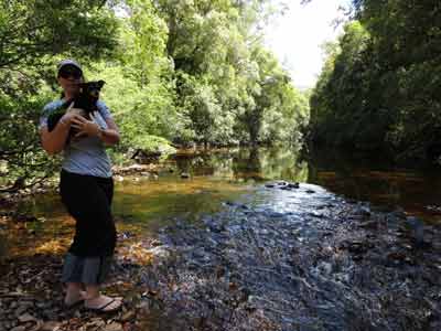 |
| Ian and Sharon visit us at Yadboro Flat | Kelly and Veto on a shallow section of the Clyde River |
Ian and Sharon stay for a while, so we get out the beers and have one with them. It starts to drizzle a bit so we need to set up our awnings again. After drinks and nibblies, Ian and Sharon head off back to their camping area. The rain has now set in a little, so we decide to have an early dinner. I cook rice and Kelly cooks creamy garlic prawns. Excellent. Later we have Ron's Christmas pudding with double cream.
As the rain looks like it is setting in, we are in bed by 9 pm. I read for a while before going to sleep.
Weather: Fine and then rain, max of 30ÂșC Arrived: Yadboro Flat Time: 4:30 pm Distance: 77 kilometres
Day 3 - Friday 27 December 2013 - Yadboro Flat
Weather: Fine, minimum of 15ÂșC
The rain stopped sometime during the night and it was a little cooler. Kelly gets up at 8:15 am and has a swim/bath in the river. I get up at 8:45 am. Today the plan was to walk to Pigeon House Mountain but we change our minds (we are feeling lazy).
We spent most of the day with our chairs on the side of the river, reading our books and going for an occasional swim. Kelly, Veto and I went for a couple of short walks up the road in either direction as well as along the road opposite our campsite (this leads to a private property). On the way back from one of these walks, we see a young guy standing in the river with his hand under the water. It looks like he has either burnt it or has been bitten by something. His hand is very red and swollen. We ask if he is okay but he does not answer. We think he is with a bunch of young'uns nearby, so figure they will take him to hospital if it is needed.
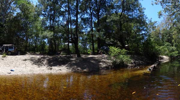 |
| Our camp site at Yadboro Flat |
All during the day a few cars and motorhomes arrive. The place is a lot fuller now, but there is still plenty of room.
At 5 pm we start our normal drinks and nibblies and then cook silverside steaks and sausages on the barbecue. We have these with a beetroot salad and then Tomas brings out some delicious tiramisu Swiss rolls. By this time Veto is so exhausted from running around the campsite and exploring that she can hardly walk. We put her to bed on the passenger seat and she crashes out straight away.
We end up going to bed at 10:15 pm after a very nice relaxing day.
Weather: Fine, maximum of 26ÂșC Arrived: Did not leave Time: N/A Distance: 0 kilometres
Day 4 - Saturday 28 December 2013 - Yadboro Flat
Weather: Fine, minimum of 11ÂșC
It was a lot cooler overnight, almost 5 degrees less than yesterday. We both get up between 8:30 and 9 am and have a swim in the river. Then we have breakfast.
Once again we spend most of the day with our chairs on the side of the river, reading our books and going for an occasional swim.
At 10:30 am Ron, Tomas and I go for a drive in Tomas's Cruiser to get some more timber. We drive up past the turnoff to Long Gully Camping Area and find some nice timber. Ron got a new Stihl chainsaw from Santa so he wants to try it out. He quickly cuts a lot of timber, probably more than we need, but what the hell.
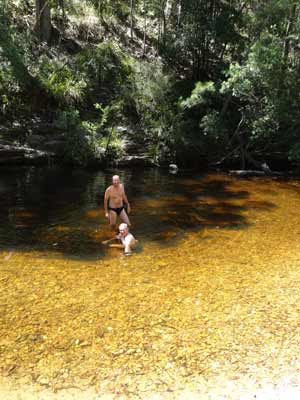 |  |
| Ron (standing) and Michael cool off in the Clyde River | Kelly in the river at Yadboro |
Today is a lot hotter than the previous days, it hits 30.9ÂșC, even in the shade on the river side. It was even hotter up on the grassed area in the shade. We spent a lot of time in the river, it was so refreshing. Kelly has finished reading her first book, "Dune is a Four Letter Word" by Griselda Sprigg. Griselda and her husband Reg were the first people to drive across the Simpson Desert in 1963. It is an excellent read, see the review .
Today Veto did not run around anywhere near as much as yesterday. We figured she is still tired.
Tonight we are having a baked dinner, so we start the fire early to get some good coals. Kelly is cooking roast chicken and Ron is doing roast pork. We have potatoes, carrots and pumpkin to go with this.
Drinks and nibblies were started as normal at 5 pm and about 6 pm we put on the roasts. We were cooking them slow, so it took about 75 minutes for them to be ready. As normal, the meats were perfect, perhaps some of the vegies could have done with a little more cooking.
After dinner it was still hot, so we went for another swim. It was still 24.6ÂșC at 8:30 pm. We went to bed at 9:30 pm after another very nice relaxing day. I read till about 10 pm.
Weather: Fine, maximum of 31ÂșC Arrived: Did not leave Time: N/ADistance: 0 kilometres
Day 5 - Sunday 29 December 2013 - Yadboro Flat to Araluen Reserve
Weather: Fine, minimum of 16ÂșC
Today we are finally moving. We have spent four nights here and the Prado has only moved 50 metres and not been started at all. Despite this, the battery for the fridge has lasted okay. This is because I have been using our solar panel to top it up. It is only 30 watts, but this seems to have been able to put as much into the battery as the fridge has been using. Due to the fact that we have been camped under trees, it has not been getting full sunshine all the time and I have had to move it every 15 to 30 minutes during the day. Despite this inconvenience, it has worked well.
We get up at 8 am (after the news) and have a swim and breakfast. We pack up and leave at 9:10 am.
We travel via the Western Distributor to the south. I am in Tomas's Cruiser (he is driving) and Kelly is driving our Prado. Once again we stop to cut firewood (we left all the stuff we had behind for other to use) and quickly collect enough to fill the two bins Tomas has as well as a bag in our car. We arrive at the southern end of the Western Distributor at 10:30 am and we stop at a nice spot next to Currowan Creek. The drive has been very scenic, with lots of variation in vegetation (rainforest to forest). It is almost 46 kilometres to here and we have averaged 33 kph (including timber stop).
After morning tea we leave at 10:55 pm and within 1.5 kilometres we hit the Kings Highway. This is the road that runs from Canberra to Braidwood and then onto Batemans Bay on the coast. We turn right and head towards Braidwood. The highway is quite twisty as it climbs from 43 metres at Currowan Creek to 655 metres at Braidwood (you get to 770 metres at one spot) over the 38.5 kilometres. As we approach town I contact Gary and Nancy by phone to ascertain where they are at the moment. They advise that their GPS tells them they will arrive in Braidwood about 1:30 pm.
 |  |
The National Theatre at Braidwood, outside
is pressed metal to resemble brick and sandstone | The Araluen Hotel |
We arrive at Braidwood at 11:30 am and head to the park at the top of the town to use the toilets. There are also some taps in the park opposite that can be used to get freshwater.
We have a few things to do while here. We need to get water, get rid of rubbish and also buy some more food items. There is a good IGA at the bottom of the main street and there are plenty of rubbish bins in the park and nearby. While Kelly and the others have a look around town, I decide to head out to the west of the town to look at a possible camping spot I have seen mentioned on the internet.
The spot is on Bombay Road and is called Bombay Crossing. This is on the Shoalhaven River. I go nine kilometres out and come to the spot. However, while it is a picnic area, it seems that the authorities have decided to stop camping as there are huge concrete blocks stopping access to the area where you would want to camp. A motorhome could stop in the car park okay and there are no signs against this. I look at another spot on the eastern side of the river but it is not suitable.
I arrive back in Braidwood at 12:12 pm. Kelly and Tomas are sitting outside the ice cream shop having just had an ice cream. We go over to the Braidwood Bakery and purchase a couple of pies. This is a must visit place if you are passing through as they make some of the best pies in NSW. We sit outside and have the pies before going to the IGA to get some bread and other items. After visiting the park and toilets again, Tomas, Kelly and I head off. Ron and Donna are eating at a cafe and will leave later. It is 12:55 pm as we head south out of town.
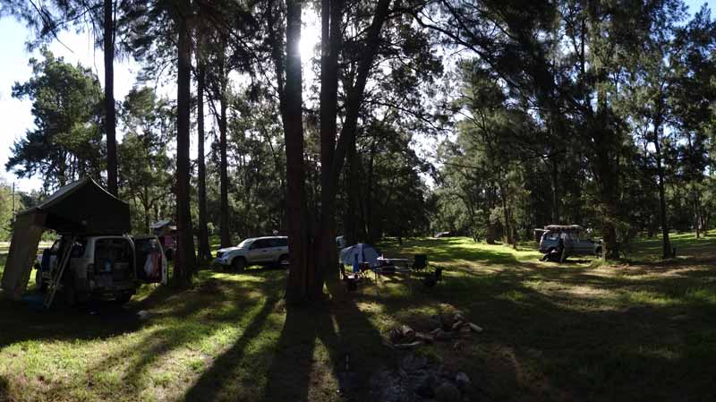 |
| A panoramic photograph of our camp site at Araluen Reserve |
We take the Araluen Road past the Cooma turnoff and head south. A few kilometres south we cross a small creek which has a lot of water. This is called Jembaicumbene Creek. Next to the main road is the old road and there are some trees. This is public land and looks like it might be a reasonable place to camp. Although it would be noisy during the day, there should be little noise at night.
I phone Gary and give him directions how to find us (in the end he meets Ron and Donna in town and comes out with them). We drop down from the plateau to the Araluen Valley. The descent is fairly windy and steep and at the bottom on the right is a road to Majors Creek. At this intersection is the Araluen Reserve. We go in and have a look around.
The reserve is adjacent to the Araluen Creek but this is basically dry (there are a couple of small pools). The main part of the reserve is in a pine forest and it extends a fair way. There are two toilets as well as garbage bins that are cleared by the council (thanks for this). We sit and read till Ron, Donna, Gary and Nancy arrive. They get here about 2:10 pm.
Kelly is not keen on staying here, although I think it is a pretty nice spot. After a lot of discussion and despite me stating that there is nowhere to camp south of here apart from in the Deua National Park (where we cannot stay due to having Veto with us), we head off at 2:35 pm.
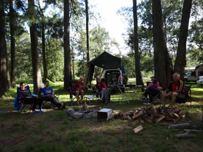 | 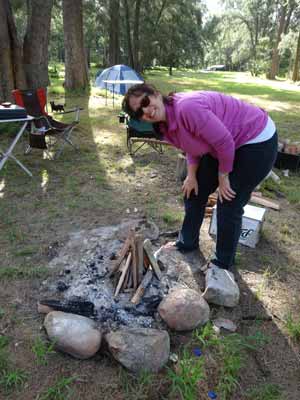 |
| Having 5 pm drinks at Araluen Reserve | Kelly preparing the fire at Araluen Reserve |
A few kilometres south of the camping area is the Araluen Valley Hotel (more later). Past here the road becomes dirt and very narrow. It is a long and winding road (great name for a song!), with care needed to pass some speeding vehicles which seem to have no regard for oncoming traffic. Bogans!
We check out a few tracks heading off towards the river but they either go to private property or there is nowhere to camp. Ron is leading and he reaches the national park camping areas without finding any suitable spot. This is 24 kilometres south of the Araluen Reserve camping area. We turn around and head back, checking out a couple more tracks on the way.
We stop at the Araluen Valley Hotel and have a beer. For the first time in perhaps 15 years, I have a Reschs Draught, not too bad. This is a nice pub and we sit on the verandah having the cool drink (it is quite warm, about 28ÂșC). Across the road is a war memorial for the Great War (WWI). There are perhaps 40 names on it, amazing that a small area like this lost 40 young men to a war tens of thousands of kilometres away. The pub has counter lunches as well as free Wi-Fi access.
We arrive back at the Araluen Reserve at 4:25 pm and set up camp at the southern end of the pine forest. We get out some of our firewood as well as setting up our shower tent so that we can have hot showers. We use about 5 litres per person for a nice refreshing clean-up.
Drinks and nibblies start around 5 pm and Ron tutors Gary in fire building (and splitting of timber). Kelly and I have chicken and leak with rice for dinner. As dusk approaches, quite a few kangaroos come down from the land near the main road and visit the reserve. Using Donna's night vision scope, we also see other interesting things, including a large cat.
After dinner we sit around the fire and read. Ron is now reading my book on the first crossing of Australia from west to east which was done in 1966 by the Leyland Brothers. The book is called Where Dead Men Lie and is probably available second hand if you search the internet. See for a review of the book. Kelly starts editing some videos on her laptop of the dives we did on the German WWI warships in Scotland in August 2013. By the end of the trip she has done a few more (see the diving section of my web site for links).
We go to bed about 10:30 pm.
Weather: Fine, maximum of 28ÂșC Arrived: Araluen Time: 4:25 pm Distance: 181 kilometres
Day 6 - Monday 30 December 2013 - Araluen Reserve
Weather: Fine, minimum of 16ÂșC
Once again we have a mild night. We get up at 8 am, even though we are not going anywhere at all today. As Tomas is leaving, he wants to depart early, so think we had better see him off! We off-load all the timber he has been carrying in two bins in his car, keeping one bin which we later put on Ron's roof rack. Tomas leaves about 9 am heads back to Sydney.
We spend the rest of the day reading and doing a few short walks around the reserve. Gary and Nancy take their Prado for a run, mainly so that they can run the fridge (my small Engel) as a freezer. As they do not yet have a second battery, they have been freezing ice sheets (and meats) and using this to keep food cool in an Esky. They head up to Majors Creek where they find that there is no camping area behind the pub. I had read on the internet there was camping there.
After Majors Creek, they head to the Shoalhaven River and report that there is a possible camping area near here that we should check out tomorrow. They also fill up our water containers so we have more water for hot showers. They come backa few hours later. After this they go for a walk along the creek to the south and encounter a red-bellied black snake. They retreat pretty quickly!
Once again we have hot showers, drinks and nibblies before dinner. Kelly and I have meatballs and spaghetti. We read some more before going to bed at 10 pm.
Weather: Fine, maximum of 26ÂșC Arrived: Did not leave Time: N/A Distance: 0 kilometres
Day 7 - Tuesday 31 December 2013 - Araluen Reserve to Lowden Forest Park
Weather: Fine, minimum of 16ÂșC
When we get up at 8 am it is already 20ÂșC, the hottest morning so far. We have breakfast and pack up camp, departing at 10 am. Today we plan to head to Lowden Forest Park which is in Tallaganda State Forest. When planning this trip I had a great deal of difficulty finding the exact location of Lowden Forest Park as the directions on the internet are confusing or wrong. For example, even on the Forestry Corporation's web site (the old NSW State Forests), the directions say to follow a road called Krawarree Road from Braidwood to Nithsdal. Neither of these can be found on Google Maps or any topographical map I have. Very annoying.
 |  |
| The Prados lined up at Clarkes Lookout | Kelly, Veto and Michael at Clarkes Lookout |
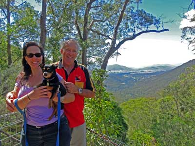
Anyway, we head off up the road to Majors Creek. This is tar at first and then becomes a very narrow dirt road. It climbs quite steeply up the mountain, zigzagging as it goes. Near the top is Clarkes Lookout. This small lookout gives great views back over the Araluen Valley.
We arrive at Majors Creek and go to the pub. There is certainly nowhere to camp at the pub, despite a web site called "Kings Highway to Discovery's" claims. We line the three Prados up in front of the hotel (not open despite it being well after 10 am) and take some photos.
We head off about 10:30 am along Wallaces Gap Road towards the Cooma Road. Right where these two roads intersect is the Ballalaba Crossing of the Shoalhaven River. We do a bit of exploring but find no decent places to camp. It is very warm (about 30ÂșC) and there is no shade apart from under the bridge and the flies are almost carrying us off. Ron has a look around a bit to the north but reports back that the travelling stock route prohibits camping and the other roads are blocked by gates.
 | 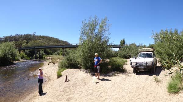 |
| The Prados lined up outside Majors Creek pub | The Shoalhaven River at Ballalaba Crossing |
We fill all our water containers and at 11:15 pm head off south along the Cooma Road. It is two kilometres to the Captains Flat Road. We turn right and about another two kilometres on turn right again into Parlour Creek Road. This is a good dirt road. About 2.5 kilometres we again turn right into Vernelly Road (which may be signposted as Old Gumms Road - not sure). You only go along here for 1.5 kilometres where you turn left into Gumms or Old Gumms Road (maps call it both), This is more like a 4WD road, but you could do it in a soft roader or a higher clearance 2WD. The alternative is to continue on a few more kilometres to Coxes Road.
Old Gumms Road goes through a lot of private property and there are about a half dozen gates to open and close. Part of the way along here Kelly takes over the driving and I get in Gary's new Prado while Nancy goes with Kelly. The road comes out into the state forest and after 3.5 kilometres you come to the Northern Road. Here you turn right and go through a lot of recently logged sections. Four kilometres along this comes out on Lowden Road (which you would also get to via Coxes Road) and again, another right hand turn. From here it is only two kilometres to the turn into Lowden Forest Park which is signposted.
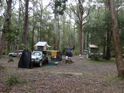 |  |
| Our campsite at Lowden Park | A very old logged tree at Lowden Park |
It is less than a kilometre to Lowden Forest Park from here. As you enter, there is a picnic area to the right and off to the left a small track that gives access to the camping area. We went into the camping area and had a look around before deciding that the first section was the best for us. There is a covered table and seats here (as well as a concrete fireplace without any barbecue plate). We have enough flat areas to set up comfortably. There are also two long drop toilets above the camping area.
It is now noon and we have travelled 38 kilometres today. The camping area is at about 890 metres so it is a lot cooler here than where we have come from. There is a steam engine and some sort of very old logging trailer part uphill from us. The picnic area is very nice, with grass and two covered tables. There is also the waterwheel. More about this later.
We set up camp and have lunch. There are lots of birds around, including yellow-tailed black cockatoos, gang-gang cockatoos and at night we hear boobook owls. There are also greater gliders in the trees and swamp wallabies.
 | 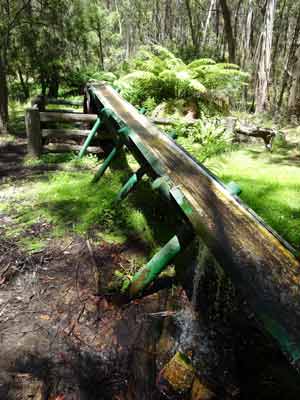 |
| The waterwheel at Lowden Park | The aqueduct that feeds water to the waterwheel |
As there are a few flies around, we set up our fly-proof tents (or anti-environment enclosures as Gary called them) and sit inside and read. We go for a walk on one of the tracks, there are lots of nice wildflowers and signs of wombats (shits on rocks). We also have a look at the waterwheel.
Lowden Forest Park was originally a logging camp, dating back to 1830s according to Forestry's web site, although I suspect it was really the 1930s. Anyway, when it was used in the mid-19th century, the loggers set up a system to provide themselves with power. They diverted water from the creek into a holding dam and then the water was allowed to exit onto a small aqueduct. This led to the waterwheel and the water turned the wheel. A generator was attached to it (perhaps a truck generator or alternator) and the resultant electricity was used to power lights and charge batteries. The wheel has been restored and runs continuously.
Today the water does not come from the dam, but from a small pool on the creek about 300 metres uphill. If you follow the walking track you will find it. It is amazing that such a small amount of water will turn such a large wheel.
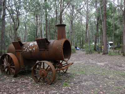 |  |
| The Davey Paxman steam engine at Lowden Park | One of the wheels of the steam engine |
I go up later and have a look at the steam engine. It was made by Davey Paxman & Co Ltd of Colchester, England. The engine is missing, but the rest of the machine is relatively intact. This was a stationary steam engine, which would have been used to run machinery, in this case, probably a timber cutting saw. On the side of the boiler is stamped "6535" over another number which is possibly "x385" where x is unknown over "150". The first number could also be 16535.
About 4 pm Ron, Gary and I walk up past the toilets and cut some more timber. We still have the stuff on Ron's roof, but as we are cooking roast dinners tonight and also staying up past midnight (it is of course New Year's Eve), we need quite a bit. There is plenty of timber all around the place and you do not need to go far to find a lot.
 | 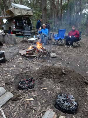 |
| Kelly on the small bridge that crosses a creek | The camp ovens are on for New Year's Eve feast |
We start the fire at 4:30 pm as we want lots of coals. Ron and I also set up our hot showers and all but Nancy have a nice 10 litres of hot water. Nancy declares that she is too cold to have one! What she did earlier was go over to the water-wheel and have a shower under the overflow of water from the aqueduct. I later check, and it is obvious why she was cold from this, the temperature of the water is only 13ÂșC.
Kelly starts preparing the sticky date puddings for dessert and I peel the vegetables. We have drinks and nibblies a little later than normal, starting at 5:30 pm. By 6 pm we have some nice coals on the fire and Ron digs a couple of small holes for our camp ovens to slot into. At 6:30 pm Ron puts his turkey breast roll on and a few minutes later I put our beef and vegies on. We again plan to cook them slow, with the aim to eat dinner about 8 pm.
Everything goes to plan and at 8 pm we take it all off. The roast beef is cooked to perfection, a dash of pink in the middle. We have a serving of roast beef, roast turkey, carrots, potatoes, pumpkin and gravy washed down with excellent Australian Brown Brothers sparkling wine.
 |  |
| Kelly and Nancy about to have dinner | Kelly, Nancy, Donna, Gary and Ron about to start our feast |
After dinner we do a communal wash up of all the plates etc as we need to get ready for dessert. Meanwhile, Kelly and Ron get the two camp ovens ready for the sticky date puddings (they need a clean out to ensure no smell permeates the puddings). Kelly puts the puddings on at 8:45 pm and they are cooked by 9:25 pm.
Shortly after we are eating sticky date pudding with home-made butterscotch sauce and double cream. Yummy!!! By now we are onto a bottle of Australian Chandon sparkling wine. It is a bit disappointing I reckon, the Brown Brothers was much nicer.
About this time a car comes in and sets up camp in the picnic area. During the day there were only three or so cars and a few motorbikes visited. This is a very quiet spot.
After another cleaning of eating utensils, it is time for the World Uno Championships. We first held these in Coolah Tops National Park on New Year's Eve 2009. Since then we have played every year. We start at 10 pm and play till midnight. Donna has a radio playing so we hear when it turns to midnight. We temporarily halt the game to celebrate the New Year. Then, back to the game. We decide to finish after 12 games. Donna ends up the winner with three wins. Gary, Ron and I won two games each and Nancy and Kelly one.
Kelly and I stay up for a short while after the others go to bed. We retire at 1:15 am.
Weather: Fine, maximum of 26ÂșC Arrived: Lowden Forest Park Time: 12:00 pm Distance: 38 kilometres
Day 8 - Wednesday 1 January 2014 - Lowden Forest Park
Weather: Fine, minimum of 10ÂșC
It was quite cool last night, as for the first time this trip it was mostly clear during the night. We get up at 9:30 am and it is sunny, but it soon becomes cloudy. About 10:30 am I cook bacon and eggs for brunch. We spend the rest of the day reading (and Kelly doing more videos).
Today is a lot cooler and the maximum temperature only 23ÂșC. It was windy for most of the day but this died down about 4 pm. I went to the waterwheel a few times and collected enough water for all of us to have hot 10 litre showers. The boys then cut some more timber for our fire. At 4:30 pm we start the fire (it is much cooler) and we all have showers.
Drinks and nibblies proceed dinner of lamb loin chops and pasta. Kelly and I have the two left over sticky date puddings from last night.
 | 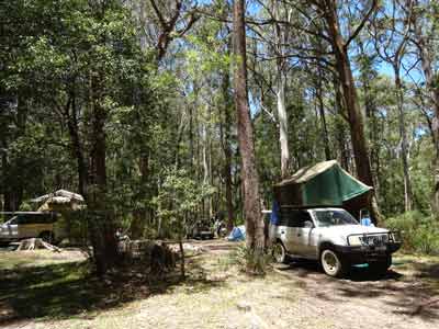 |
| Our camp fire at Lowden Park | Another photo of our camp at Lowden Park |
Sitting around the fire, Ron and Donna pull out a bottle of French Moet champagne. It is 10 years yesterday since they sort of started going out together. Congratulations! By the way, the champagne was nice, but no better I think than the Brown Brothers we had last night.
Earlier in the evening a young couple came in and had dinner in the picnic area. They then moved to the top of the camping area and set up camp. Now that it is dark they are walking around spotlighting animals. A couple of us go over to see what they are looking for. Turns out they are uni students and they have found some greater gliders in a tree.
The spotlights they and Donna were using attracted thousands of bugs. They were everywhere and I swallowed a lot of them. Some of them went down my oesophagus and I almost vomited a dozen times trying to get them out of my airway. Not a nice experience!
Anyway, we eventually went back to the fire away from the bugs and Kelly and I went to bed at 10 pm.
Weather: Overcast, maximum of 23ÂșC Arrived: Did not leave Time: N/ADistance: 0 kilometres
Day 9 - Thursday 2 January 2014 - Lowden Forest Park to Corang River
Weather: Overcast, minimum of 16ÂșC but mostly 20ÂșC
Well, that was an interesting night! When we went to bed the temperature was about 16ÂșC. At 12:30 am I was awoken (as was everyone else) by a roaring wind. You could hear it coming and going. The funny thing is that our tent was barely moving. I looked at the weather station I keep in the tent and saw that the outside temperature had risen to 20ÂșC in the space of a few minutes.
I soon figured out that the wind must be coming from the north-west or west for a number of reasons. First, the temperature increase could only come about because warm winds from the outback of Australia were now going past us. Secondly, as the land is higher to the west and north of us (over 300 metres higher), the fact that we were not experiencing any wind (apart from the occasional slight gust) meant the wind was blowing over the top of the hill.
For the next three hours the wind raged through the trees. My guess is that it was at least 50 knots (almost 100 km/h) based on the noise and what I have experienced before. At about 3:30 am the wind started to die down and by 4:30 am it was calm. Needless to say, we did not get a lot of good sleep that night as we kept thinking that the wind might break off branches from the tops of the trees.
We stayed in bed till 9 am due to the lack of good sleep. When we got up we had breakfast and pulled up camp. Today we are moving but there is no rush as we are not going too far. It is already about 23ÂșC and the sun is starting to break through the clouds.
We head off at 10:05 am. We have decided to exit the Tallaganga State Forest a different way to the route we used to come in. From looking at our state forests map as well as our computer based maps, we think we can exit out to the north and then east to the Bombay Road near the Shoalhaven River.
We go out of the Lowden Forest Park area and at Lowden Road we turn right. Only a few hundred metres along we come to a tree that has fallen across the road. It is not big and I easily move it by myself. I hope that this is not a sign of things to come after last night's strong winds. About 1.4 kilometres along we turn left into Bombay Fire Trail. This basically heads north.
The track is pretty good, a soft roader should be okay with it (we are averaging 46 km/h). We stop just up this track and cut a lot of firewood for the next two nights. After 5.4 kilometres we come to Jinglemoney Fire Trail. This comes in from our left. Apparently you can take this track and do a loop back to Lowden Forest Park. The intersection is not as shown on our computer maps and the whole road in this area deviates a fair bit from what is shown.
We continue on and a few hundred metres later meet with a track which I suspect also leads to Jinglemoney Fire Trail and is the old intersection. Just under 2 kilometres from here we come to a major intersection. The road naturally continues to the east from here but on a tree there is a very faded sign that says the road is closed ahead at a locked gate and access to the Upper Bombay Road is not permitted.
I look again at our computer map and see that the Bombay Fire Trail actually turns to the left here and runs north again. We turn around and take this. A few hundred metres on the track starts to drop (we have been at 800 to 900 metres since leaving Lowden Forest Park) and over the next 1.2 kilometres we drop about 150 metres to Bombay Creek.
 |  |
| Crossing the Shoalhaven River at Stewarts Crossing | Part of the Stewarts Crossing camping area |
At 11:15 am we come out onto Mulloon Fire Trail. This is 15.8 kilometres from Lowden Forest Park. This is a good dirt road and turns into Hoskinstown Road which 7.6 kilometres on meets Bombay Road. This is a tar road that comes out of Braidwood and which I travelled on four days ago to check out a possible camping area at Bombay Crossing (which was no good except for motorhomes).
We turn left and it is only a few hundred metres to the picnic area and then we cross the Shoalhaven River. It is nine kilometres or so back to Braidwood where we arrive at 11:40 am. Once again we need to get rid of rubbish, get fresh water, attend toilets and buy a couple of things. We visit the IGA for more bread and milk as well as some cheeses. We also go to the bakery again and get a pie for lunch (I have the curried pie this time).
We leave at 12:45 pm and head north on the Kings Highway. Only a short distance out of town we turn right onto the Nerriga Road. This heads to Nowra via Nerriga (and is called the Braidwood Road from the other end). I first travelled this road for work in December 1977. It was an awful road then but in the past 10 years a lot of money, mostly from the Federal government, has been spent to upgrade it. However, the work done has been, in the most part, very poorly done, with the road in parts already falling apart. Looks like someone did not supervise it well.
 |
| Our camp at Corang River |
The road between here and the Corang River still has a lot of dirt sections so care needs to be taken in the wet. We turn left into Stewarts Crossing Road, 22.6 kilometres from the Kings Highway. I have read on the internet that there is a nice camping area here.
It is only 2.3 kilometres to the Shoalhaven River. What a nice spot! The crossing of the river is a causeway but there is only a few centimetres of water over it. We cross the river and check out the camping area. It is very large. Today is very hot, at least 30ÂșC. The best spots are of course taken, but there are a few spots we could have used. The best spot I reckon was before crossing the river (on the south side). This is higher over the river and also closer to the water's edge.
We decide to go back and continue along the Nerriga Road and check out the camping area at Corang River. If there are no spots left there, we will come back here. Once back at the road Nerriga Road, we turn left. It is 17.2 kilometres to the Corang River and we arrive there at 1:50 pm. Ron and Gary go over the river and check out the camping area on the southern side of the road while I check on the spot on the western side of the river and north of the road. We camped here a couple of years ago.
Ron reports that there is a big contingent of trail bike riders camped on the south side. Having previously had very bad experiences with trail bike riders (loud, drunk and playing bad music), we decide that camping on the other nice spot about 100 metres from them would be too painful. We decide to camp where we are stopped.
This is next to the original causeway across the river (you can still drive it and Ron and Gary cross it to get to the spot). It is not a big area, but at least it is flat and close to the river and better still, nowhere near anyone else. We set up camp and then go for a swim. The river is crystal clear and quite warm, about 23ÂșC in the deeper parts and 25ÂșC in the shallows.
It starts to cool down a bit as the clouds come over. We set up our fly tents as there are lots around. We read for the rest of the afternoon and also have a swim or two. There are lots of birds around, including superb blue wrens, gang-gang cockatoos and more yellowtail black cockatoos. Veto is running around a lot and even goes swimming of her own accord (swimming out to us when we are in). Late in the afternoon the people camped on the property adjacent to where we are come down for a swim. Certainly a bunch of bogans, but not the worst we have ever encountered when camping. They do not stay too long.
 |  |
| Gary crossing the Corang River | Our camp at Corang River from the bridge |
We are cooking pizza for dinner tonight so Ron gets the fire going early so that we have enough coals. Around 3 pm I make the pizza dough and let it rise. About 4:30 pm I start rolling out the dough into six individual small pizzas. I use a can of drink as the roller. Once complete, I cover them and let them rise again a bit. I then cut up all the meats we are using and Gary cooks some chicken. Others cut up stuff like capsicum and onion.
We have drinks and nibblies. I also make up the batter for the apple crumble dessert I am cooking later. Each person makes up their pizza with what toppings they want. At about 6:45 pm I put the first pizza on for Gary and Nancy. This takes only four minutes to cook. Search on my web site for pizza and you will find the recipe for the dough and how I do it. The rest of the pizzas take a bit longer as the fire is not all that great and it is hard to keep the heat up to the camp oven.
Anyway, by 7:30 pm we have all eaten our pizzas, far better than you will get in any shop. About 8:45 pm I put the pudding on. It will take at least 45 minutes to cook, so we sit around the fire again. By now Veto is exhausted and has been put to bed on the passenger seat.
About 9:30 pm we take off the pudding and serve it up with double cream. Another excellent meal, even if I do say so myself. We go to bed about 10:25 pm.
Weather: Fine, maximum of 30ÂșC Arrived: Corang River Time: 1:50 pm Distance: 84 kilometres
Day 10 - Friday 3 January 2014 - Corang River
Weather: Raining, minimum of 17ÂșC
I wake up early (as I do most days) but stay in bed. I listen to the 7:45 am ABC Radio News. I then lay in bed and read till 9:30 am. Very relaxing. Last night it actually rained a few times starting about 3 am. Each time it was only for five or ten minutes, but enough fell to wake me each time. We get up after 9:30 am and have a late breakfast.
As per the other days when we have no plans to move, we spend our time reading and swimming. The day started cloudy but by 11 am it was sunny and about 25ÂșC. By lunchtime it has warmed up even more, about 28ÂșC. We spend a lot of time swimming. The flies are reasonably bad, so we sit in the fly tents when reading.
At one time Nancy was sitting on a rock in the river when she discovered a leech. This leech was in the water. We dragged it to the shore and at first we thought it had legs (and therefore was not a leech). However, closer examination showed that they were baby leeches. Disgusting! An article on Wikipedia shows that most species of leeches (almost 90%) live in freshwater and saltwater. I did not know this. Only 10% of species live on land and are the ones we normally encounter. In fact, most leeches (the water based ones) do not have the mouth to enable them to attach to humans. Kelly ended up killing it with a lighter, she has a profound hatred of them and seems to attract them far more than anyone else in our group. No spmart-arse comments about me being a leech please :).
 |  |
| A brilliant green beetle we saw here | Kelly in our "anti-environment enclosure" at Corang River |
After lunch a motorhome pulls up over the river and sets up camp and the people who pulled up earlier on the other side of the road in a camper-trailer come down for a swim. Turns out that the bloke works with one of the members of our dive club, small world!
About 3:30 pm, the others decide to go for a drive in Gary's Prado. Again, they are putting some power into his battery and cooling the fridge down. As there are only five seats, I offer to stay behind with Veto. They drive to Nerriga to visit the pub. The real reason is so the girls can use the toilets, but they also have a couple of drinks. Apparently there is a nice new beer garden out the back. They return at 5:10 pm. Meanwhile, Veto and I go for a couple of walks and swims.
After the others arrive back, we have drinks and nibblies. Dinner tonight is sirloin steak, sausages and salad with Cadbury chocolate (peppermint cream, my favourite) for dessert. Around sunset there are lots of gang-gang and yellow tailed black cockatoos in the area.
After dinner we went for another swim as it was still warm. Later we sat around a small fire. We went to bed about 10 pm.
Weather: Sunny, maximum of 28ÂșC Arrived: Did not leave Time: N/A Distance: 0 kilometres
Day 11 - Saturday 4 January 2014 - Corang River to Kareela
Weather: Fine, minimum of 15.9ÂșC
Today is going home day. We sleep in again till 8:45 am and then get up. The plan is to leave about 10 am. We have breakfast, pack up and then have a swim to cool off.
When I go to start the car it is dead. Damn, it is only a new battery. Gary jump starts us. However, I later figure out that it is the starter motor and I get it replaced. We leave at 9:55 am.
We head towards Nerriga/Nowra and then take the Oallen Road. The turn off is 8.3 kilometres from Corang River. We follow the road to Oallen Ford which is anther crossing of the Shoalhaven River. It is 13.7 kilometres to the river. There is a large camping area here on the southern side of the river. Kelly and I also stayed one night here in May 2011. It is a very nice spot, but I imagine over Easter and long weekends it could be very crowded. Surprisingly, there are not many camped here. I thought it would be full.
 |
| The bridge over the Shoalhaven River at Oallen Ford |
We pull up just before the river and walk down to the bridge. There is a bloke gold panning here, using a small gold sluice. We watch him for a while. The others have a look around at the various spots to camp. I reckon the best time to come here would be outside holidays and weekends and in winter.
We leave at 10:25 after about a 15 minutes stop. We travel back to the Nerriga Road and turn left towards Nerriga. It is only a few kilometres to the village. We do not stop as the others were here yesterday.
From the Oallen Road it is 6.8 kilometres to the Endrick River. We know that there are a couple of poor spots to camp here on the southern side of the bridge, but I want to check out another spot I have seen mentioned on the internet. This is supposed to be on the north side. We head up the road on the left past numerous signs warning that it is private property. As far as I can see, it is a public road. The spot I want to look it appears to be down a track to the left and this may be private land. As there are people sitting on the verandah of the house at the intersection, we do not go down there to look. Another time.
 |  |
| The Nerriga Hotel | A very dry Tianjara Falls |
We continue to the east towards Nowra. We pass Touga Road (we camped down there last time) and Sassafras. As we approach Tianjara Falls, we look at the Yarramunmum Fire Trail. However, the gate is locked. There is no apparent reason for this and when I search later I still see no reason why it is closed. We were going to travel via this to Yalwal. We stop at Tianjara Falls for a few minutes as Gary and Nancy have never been there. There is only a trickle of water coming over the falls today.
We decide to head straight home. We drive to Nowra and then onto Berry where we stop at the rest area just before the town. It is 12:10 pm so we have lunch here. At 12:40 pm we leave and head home. We have a good run, there is little traffic yet returning to Sydney. We are home at 2:10 pm.
Weather: Fine, maximum of 26ÂșC Arrived: Kareela Time: 2:10 pm Distance: 248 kilometres
Summary:
This was another very excellent holiday, with good weather overall, great company and excellent food and drink. For once it was a very relaxing holiday. I ended up reading eight books, Kelly read two books, some magazines and edited quite a few diving videos. The only real cost of the trip was the fuel which was $196 (since we would have paid for food and drink at home anyway). Not bad at $17.84 a day for a holiday!
Kilometres: 767 (937 km when I fill up a week later)
Litres of fuel: 136.4
Cost: $196.28
Litres/100 kilometres: 14.6
| 
 v6.00.307 © 2003-2005