I get up at 6:15 am and have a shower as I have a reasonably long trip ahead and probably wonât feel like one this evening. I load the last few things into the car and head off at 7:00 am. I travel via the Princes Highway and King Georges Road to the M5 and then the M7 to the M4.
It is cool when I leave home (8â°C). I stop at Blaxland at 8:00 am and get breakfast from McDonalds. I have arranged to meet Ron and Donna (from now on I will only refer to Ron when referring to both) here. They arrive at 8:15 am. We leave at 8:25 am and travel via the Great Western Highway and then the Castlereagh Highway.
We arrive at the small village of Ilford at 10:20 am. This has a nice little rest area with toilets. It is 226 kilometres from home. We have morning tea, I have brought along scones which I add jam and cream to, yum. We leave at 10:45 am, it is still cool at 9â°C. We stop at Mudgee at 11:22 am (281 kilometres) and I go to Woolworths to buy some things that I need fresh (roast chicken, rolls, bread) as well as a few things I forgot. We leave at 11:35 am.
We travel via Goolma Road to Goolma and then Gollan and Muronbong Roads to the Golden Highway. We stop at a nice rest area (off the highway) at Ballimore at 12:40 pm for lunch. This is 375 kilometres from home. After lunch we move to the Hair of the Dog Hotel and Ron and I have a beer. This is a great old country pub, well worth stopping at.
We leave at 1:30 pm and 20 minutes later we are on the northern outskirts of Dubbo. We go to a huge truck fuel station at the intersection of the Newell Highway and Burraway Road. I take 55.5 litres at $1.219, $67.59. For the 426 kilometres since I left home I have averaged 13.0 litres/100 kilometres (car says 12.5). This fuel station has no staff and you use your credit card to pay at a terminal. We encounter a few similar ones on the trip. We leave at 2:00 pm.
At 2:50 pm we stop for a few minutes on the side of the road to cut some firewood. We arrive at Warren Weir at 3:20 pm. This campsite is located next to the Macquarie River and is about four kilometres south of Warren. We use Wikicamps App to find most of our campsites.
This is a nice camping area but there is a lot of large, high weeds that probably have thrived because of the rain over the past few months. We find a nice spot for us not too far in (we need space for two cars and a tent and car for when John arrives). There is only one large motorhome here and later a caravan comes in.
We set up camp and Ron and I go for a walk to the weir, a few spots there but lots of rubbish. We start a fire and at 5:00 pm we have drinks and nibblies. Later we hear John calling us on the radio. He is lost as he has come to a gate. We determine that he is on the wrong (western) side of the river. We direct him to go to Warren and find the eastern road. He and Maureen arrive at 5:50 pm.
I heat up some left over Chinese from two nights ago. We later sit up and see six satellites and two shooting stars. It is clear, then cloudy and then clear again. When I go to bed at 10:00 pm it is a cold 7ÂșC.
I am awake at 6:55 am and get up at 7:10 am (I always listen to the 7 am ABC Radio News on my portable radio and sometimes the 7:45 am as well). It is clear and only 4.5â°C when I get up. I have breakfast and listen to the 7:45 news. The sun finally comes over the trees at 8:15 am, warming us up a little. I take some drone photographs of the campsite and copy waypoints to my other memory card for my VMS GPS. We pack up and leave at 9:55 am, a bit late as Ron and Donna have problems packing up their rooftop tent which they have only used once before.
We travel via Warren to Nevertire where we turn onto the Mitchell Highway. We follow this to Nyngan where we stop at 11:00 am. On the way we stop after Ron hears something making a noise. It turns out a bolt has come free from his roof rack. Donna finds it and days later Ron finds the nut. We have travelled 83 kilometres. We stop at the âBig Boganâ for morning tea. An interesting âbigâ object. There is a nice rest area here, although the toilets are a short walk down the street. We leave at 11:25 am.
At 12:30 pm we stop in a rest area 100 kilometres from Nyngan. Here we have lunch and also cut some firewood. It is now 15â°C and sunny. We leave at 1:20 pm. At 2:30 pm we arrive at Bourke. We go to the Old Wharf and look at it. It is huge, with many levels to cope with the various heights of the river. At the reserve there is a stationary 1923 Crossley 2 cylinder diesel engine. Unfortunately we arrived just after they shut it down from a test run.
After this Ron, Donna and I go to the Port of Bourke Hotel for a beer. This is opposite the old government offices where I worked for a few days in January 1980. These really are beautiful buildings. After the beer we go to refuel, I take 48.3 litres at $1.259, $60.83. For the 383 kilometres I have averaged 12.4 l/100 km.
We then head off to Mays Bend at North Bourke. John and I camped here last year but this time we have gone further in as all the first spots are taken. We get to a spot that caravans and motorhomes cannot get to and find a much better spot right on the river.
At 3:40 pm we arrive at this spot right on a bend of the Darling River. Fantastic location with space for six to eight cars. We pick our spots and set up camp and I set up my hot water shower. We all have showers, very nice. We also start the fire.
After this it is about 5:00 pm so we have drinks. Ron makes a damper as I have garlic prawns I am going to cook. When the damper is done, I cook the prawns on my new cast iron skillet, adding a touch of cream. We end up with half a dozen prawns and quite a bit of damper each. After this, I decide I do not need anything else to eat.
We have a great fire and we sit around it. Donna brings out some Tim Tams which later have with port (sip and suck)! At 10:30 pm we go to bed.
It was very cold overnight, the coldest night I have spent in the Shippshape for many, many years. My radio is not working so I cannot listen to the news in bed. I get up at 7:15 am and it is still only 2.2â°C. There is no frost around though. I listen to the news on the car radio as I make breakfast. I will have to find out later why the radio is not working.
We leave at 9:10 am and go to the Back of Bourke Museum. We pay the $21 (for seniors) to go in. It is pretty good, although a bit illogical I reckon in the order that things are shown. There are plenty of interesting things, including a large old map showing the properties from Bourke to Louth, an ingenious river chart and models of paddlesteamers and the Old Bourke Wharf.
We finish at 11:00 am. We then have morning tea and get water to replenish that used last night (there is also a caravan toilet dump spot here). Before we leave Bourke, Ron stops off to try and get a nut for the bolt from his roof rack. He finds one at a mechanic's. We leave town at 11:45 am.
We head down Kidmans Way towards Cobar and a short distance out of town we stop for five minutes to cut firewood. We turn off into Gundabooka National Park and after a short stop at the information display, we arrive at the Mulgowan Art Site at 12:50 pm. This is 90.7 kilometres from Mays Bend. We have lunch and then walk the short distance (less than 15 minutes) to the art site. Good Aboriginal art, hands, emus, men dancing, fish and more.
 |  |
| Mulgowan Art Site | The Mulgowan Creek passes the site |
 |  |
| Some of the Mulgowan art | A man, an emu and a woomera (?) |
We leave at 2:05 pm. As we head out I see something on the road. A second later I realise what it probably is, a wheel nut. I stop and have a look at my left hand side wheels and see that I am missing one from the front wheel. Shit! Not again! I check and some of the other nuts are loose and the one missing has broken. I reverse back and find the nut and remaining section of wheel stud.
I check the back wheel and find a couple of nuts loose too. I have driven the car now for well over a thousand kilometres since I put these wheels on and I checked a number of times that the nuts were tight. Back in 2004 I lost a wheel off my Prado in similar circumstances. I tighten all the left side nuts up again.I head back off and catch up to the others at Dry Tank Camping Area. It is 2:35 pm. I check the nuts again and find two loose again! Why???? I again tighten them.
We only have a look around (I camped here in 2006) and then head off to Yanda Camping Area. This is also in Gundabooka National Park but on the Darling River. We head off via the Yanda Track Road and turn left at the Louth Road. It is not far from there to the turn off to the camping area.
 |  |
| The Yanda Camping Area | The Darling River looking south at Yanda |
We arrive at Yanda Camping Area at 3:25 pm. This is 161 kilometres from Mays Bend via the way we have come, but perhaps less than 40 if you come direct. At Louth Road I check the wheel nuts again and found one loose. The camping area has a couple of shelters and tables, toilets and two gas BBQs. We set up camp in the middle section as this is the only suitable spot for tents and roof top tents. There are two caravans here.
After setting up, I walk to the river which is a short distance away. I do not understand why they did not put part of the camping area closer to the river. It would be on a lower level and more liable to flooding, but the toilet block and BBQs could have been put higher. Anyway, it is a nice spot. There is a reasonable amount of water in the river.
We start a fire at 4:50 pm and then have drinks and nibblies. Afterwards I have the rest of the Chinese that I brought from home. We have a port and a Baileys and then when the others go to bed, I go for a short walk before I go to bed at 10:40 pm. It is 13â°C.
One thing about this spot, we have full five bars of Telstra coverage but no Optus.
Weather: Sunny, max 20ÂșC
Arrived: Yanda Camp Ground, Gundabooka NP Time: 3:25 pm Distance: 161 kilometres
Day 4 â Tuesday 30 June 2020 â Gundabooka NP to Louth
Weather: Fine 9.5ÂșC minimum
It was a warm night, well over 10 degrees for most of the night. It was windy from 4:00 am and but it had dropped heaps by 7:30 am when I got up. The NPWS park worker comes and cleans the BBQ and replaces the gas cylinder which is empty, lucky we did not want to use it last night. He tells us about a shortcut from here to Bennetts Gorge where we are going this morning. I fly the drone (too windy yesterday) and take some photos.
The plan is for Ron, Donna and I to do a walk to Mount Gunderbooker (yes, different spelling) from the gorge car park. John has crook knees so he and Maureen will meet us there later.
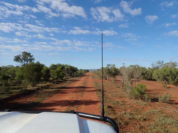 | 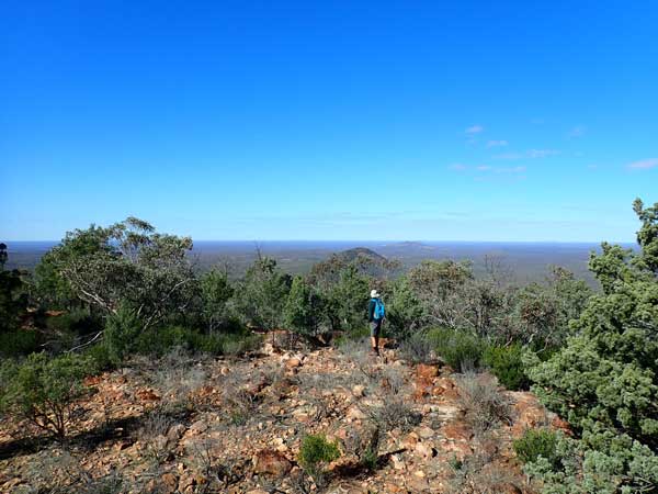 |
| The Gundabooka Western Boundary Road | The view to the south from Mount Gunderbooker |
We leave at 9:20 am and head south on the Louth Road. At the park boundary (the first cattle grid), we turn left before crossing. This road is called Western Boundary Road. We follow the fence, turning right once and left once. It is a good road, we sit on 75-80 km/h. At Ben Lomond Road, we turn left and after about one kilometre we turn right onto the road to the gorge.
This is a much rougher road but not too bad really. We arrive at Bennetts Gorge at 10:10 am. It is 50.9 kilometres to here, probably about 20 kilometres less than the alternatives. We have morning tea as we put on shorts and walking boots for the slog up the hill. It is a nice sunny 16â°C. The NPWS website page for the park says it is only 50 kilometres to here from Bourke but actually it is 91 to 111 kilometres. The directions are really, totally useless as in another spot it refers to a road that does not appear on my (good) GPS maps.
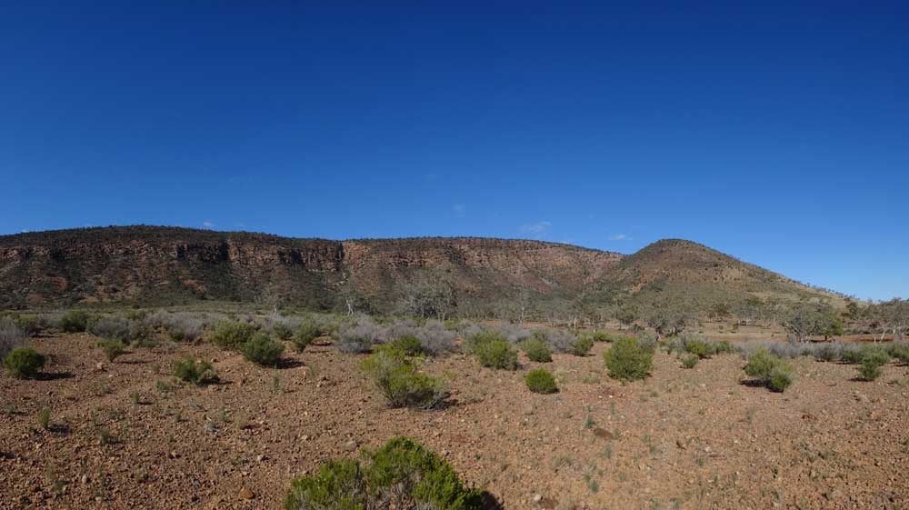 |
| The view of Mount Gunderbooker from the walking track. Mt Gunderbooker is to the left of the hill on right. |
The walk is called the Valley of the Eagles walk but it really goes up to the peak of Mt Gunderbooker. It is about 6 kilometres return. The NPWS website says it will take 2.5 to 3.5 hours to do. We head off at 10:25 am and get back at 1:00 pm, meaning it took 2.5 hours roughly. This included quite a while sitting at the top. I estimated it took me about one hour to get to the top. It is not a hard walk really, you zig-zag up the first section. I think I only stopped twice, once of which was to have some water and a mandarin.
The views from the peak are well worth the effort. I took my drone with me but it was too windy to fly. The name of the valley below is accurate, we saw quite a few wedgetail eagles soaring around. You can see almost 360â° from the top of the trig station. The height is about 495 metres and you start at about 160 metres. It takes me about 50 minutes to get back to the car park.
 |
| The view from Mount Gunderbooker looking to the north. |
When I get back at the picnic area, John and Maureen are there. I make lunch and have a look at the emus that seem to hang around here, there are at least 10. We leave at 1:55 pm and a few kilometres out of the park we stop and cut some more firewood. We travel via Gundabooka Mulgaroon Road to the Louth Road.
We arrive at Louth at 3:10 pm. As we expected, Shindys Inn is closed, no idea why when virtually every other hotel in NSW is now open after the COVID-19 restrictions were relaxed four weeks ago. I notice that there is a new toilet and shower block opposite the pub, very nice. We cross the Darling River to the western camping area (there is another one on the eastern side). There are quite a few vans here, taking all the best spots, most of which really could fit three or four vehicles.
 |  |
| A photo from the drone of Bennetts Tank looking towards Mount Gunderbooker | Our campsite at Louth |
We find a spot overlooking the river closer to the bridge and set up camp. I start the fire at 4:00 pm as we are having a roast dinner tonight. Later I walk over the bridge to the showers and have one, really nice. A gold coin donation is expected, but the box is inside the pub so I cannot pay. Back at the campsite, we have drinks at 5:00 pm and at 5:30 pm we put the roasts on in the camp ovens.
I am cooking lamb, Ron is doing beef and John pork (his first time cooking via his oven). My lamb is marinated steaks, so I put my vegies on at 5:50 pm and the lamb 15 minutes later. Everything was cooked about 6:45 pm, an excellent meal (as normal we share the meats). We sit around the fire, even though it is fairly warm. I am still in my shorts with just a flannelette shirt and not even a beanie. At 10:00 pm when the others go to bed I go for a walk over past the pub and back.
 |  |
| A photo from the drone of the bridge at Louth, our campsite is behind the bridge | The Darling River looking south from Louth |
Like last night, we have full five bars of Telstra coverage but no Optus.
Weather: Sunny, maximum of 23ÂșC
Arrived: Louth Camping Area Time: 3:10 pm Distance: 128 kilometres
Day 5â Wednesday 1 July 2020 â Louth to Paroo/Darling National Park
Weather: Sunny, minimum 9.1ÂșC
It was another warm night, the minimum being at 7:40 am when I get up. I listen to the news on the car radio as I have breakfast. I try to fix my portable radio, discovering what the problem is. The positive and negative wires from the battery compartment have both come free from where they are soldered. I attach the negative relatively successfully, but the positive is not great. It does not work, I need a soldering iron.
While we are packing up, the Royal Flying Doctor Plane comes over us and lands at the airstrip. It takes off shortly after and heads to Bourke. It returns about 45 minutes later. We leave at 9:45 am and I fill my water container at the toilets. After this I wait for the others. While I do, a couple comes into the fuel bowsers next to the pub. The sign says you need to call the hotel but their phone does not work, it is an Aldi SIM which uses Telstra but not the smaller country towers. I let them use mine.
 |  |
| Outside the Tilpa Hotel | The Darling River and the Tilpa Bridge |
 |  |
| Our names on the wall in the Tilpa Hotel | One of the walls in the Tilpa Hotel |
We leave at 10:00 am and at 11:10 am we arrive at Tilpa, 93 kilometres away. We have a quick look around (very small town) and then go to the pub for a beer. Donna puts our names on the inside wall of the pub (near bar, right corner as you enter). Lots of people stop here while we are in town, most have a drink. The barmaid says it has been very busy the past few weeks, especially for meals. Again, full Telstra coverage here.
We leave at 11:55 am and head down the Wilcannia Road. At 12:40 pm we stop at a spot a few hundred metres off the road on the Darling River. This spot is 57 kilometres from Tilpa and a possible camping area, although there are a few flies around. It is a warm 23â°C. After lunch, we leave at 1:15 pm and we arrive at the Coach and Horses Camping Area in the Paroo Darling National Park. Note that some of the signs on the way into the park call the camping area Paroo Camping Area.
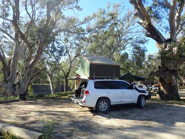 |  |
| Our campsite at Coach & Horses | The Darling River at Coach & Horses |
There are quite a few vehicles here, again, certainly not 50% of the normal limit as stated on the NPWS website. We assume most, if not all, of them have not booked. Note that there is no mention that you must book on-line at either of the camping areas we have so far stayed at nor the third one we visited. We set up camp in a good spot above the Darling River. There are two covered tables and at least one BBQ as well as a toilet.
There are lots of birds here, whistling kites, galahs, corellas and kookaburras. One kite is harassed by crows! After setting up I go for a walk around the river. The camping area is just before a sharp bend in the river, so this is the way I go. You cannot (for unknown reasons) have a fire here. We have drinks at 5:00 pm after Ron and I do another walk, this time to the north along the river edge till we cannot go any further due to soft mud and weeds.
 | 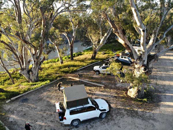 |
| The Darling River, our campsite is at right at the start of the bend | The campsite at Coach & Horses |
I cook Scotch fillet and sausages for dinner. I start on the park BBQ but it seems it runs out of gas (like the one at the last national park spot), so I finish it on my new iron skillet and gas stove. I also make a packet rice dish. The skillet works great. I pack the unused part of the rice in the Chinese food container and keep the sausages for later breakfasts.
It was warm all evening, 15â°C when we go to bed at 10:00 pm. It was windy during the afternoon, but it dropped so I could fly the drone. There are two to three bars of Telstra coverage.
Weather: Sunny, maximum of 23ÂșC
Arrived: Coach and Horses Camping Ground, Paroo/Darling National Park Time: 3:00 pm Distance: 256 kilometres
Day 6 â Thursday 2 July 2020 â Paroo/Darling National Park to Kinchega National Park
Weather: Sunny and minimum of 12.1ÂșC
It was a very warm night, although the wind got very strong at 4:30 am for 15 minutes. This was from the west, hence the warm night. I get up at 7:15 am and after a quick sausage sandwich, I leave at 8:00 am by myself. My plan is to try and find a mechanic in Wilcannia to try and get the broken wheel stud replaced. While here I have not been able to find a mechanic via the internet, but I presume there must be one.
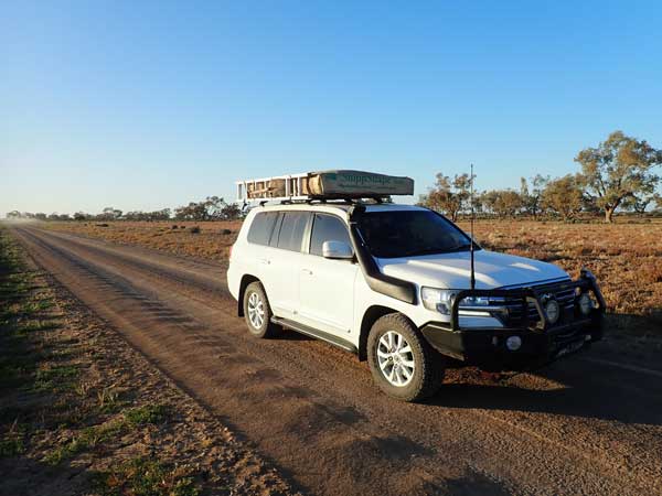 | 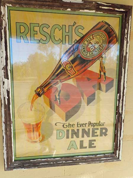 |
| The Wilcannia/Louth Road on the way to Wilcannia | An old Resch's DA sign on a former hotel. Resch's beer was first brewed in Wilcannia |
I arrive in Wilcannia at 8:40 am and go to the BP fuel facility which is off the main road (use fuel app, much cheaper). I refuel and ask the owner about a mechanic. He tells me there is now no-one, the young bloke moved to Broken Hill! Bugger. I ask about Menindee but he said the mechanic is away this week on holidays (it is NSW School Holidays). Looks like I will be travelling all the way to Wentworth missing a wheel stud. I take 71.8 litres at $1.289 $92.58, an average of 13.1 l/100 km.
While I wait for the others to arrive, I have morning tea and walk around town. It really is a town in decline, no café, no restaurant, only two fuel stations (main highway from Broken Hill to Sydney) and only one pub. However, it is worth stopping at to look at the beautiful buildings. These are made from sandstone, the best being the Police station, the Court House, both built in 1880.
 | 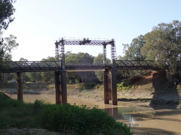 |
| The Wilcannia Post Office | The old Wilcannia lift bridge |
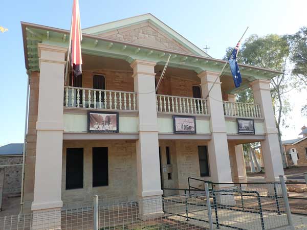 | 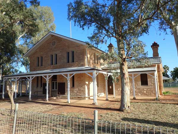 |
| The Wilcannia Police Station | The Wilcannia Court House |
On one of the buildings that was a former hotel there is an old Resch's Dinner Ale sign. For those that do not know, Resch's beers were for a long time the best selling beers in NSW. In fact, Resch's beers were first brewed in Wilcannia when Edmund Resch opened the Lion Brewery in 1879. The remains of the brewery are now part of the Wilcannia Golf Club building and his former house is next door.
The Anglican church is also great and the ruins of the old convent looks like it would have been a great building in its time. There as the Wilcannia Athenaeum, originally a school of arts and an old Art Deco theatre. There are plenty more old buildings, especially along the river. There is a nice park on the river south of the highway, clean toilets too.
 |  |
| The Wilcannia Anglican church | The former Wilcannia theatre |
The others arrive at 10:10 am and they go to the IGA (it is good they say) and refuel. There is a bit of a queue for fuel and later it is even longer. Ron and I leave at 11:10 am, John will follow. We are travelling via the western road (there is an eastern road too) as the fuel station owner said it is better. As he forecast, the first 20 kilometres is rough, but the rest is very good.
We stop at Malta Lake for lunch at 12:22 pm, 98 kilometres from Wilcannia. It is still a cool 16â°C, but sunny. While we have lunch I fly the drone to get some photographs. We leave at 1:00 pm and stop for 10 minutes a short way along the road to cut some firewood. We arrive at Menindee at 2:10 pm. We go to the Maidens Hotel which is where Burke and Wills stayed at the start of their ill-fated trip in 1860.
 |  |
| A drone shot of Malta Lake | Looking south along the road at Malta Lake (left) |
We have one beer and leave at 2:50 pm and head into Kinchega National Park. Our plan is to camp along the Darling River. There are 35 different camping spots along here, so plenty of spots to choose from. After a bit of back and forth driving, we settle on site 22. There are only a couple that have toilets near them, but they are all full. We set up camp at 3:20 pm.
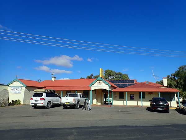 | 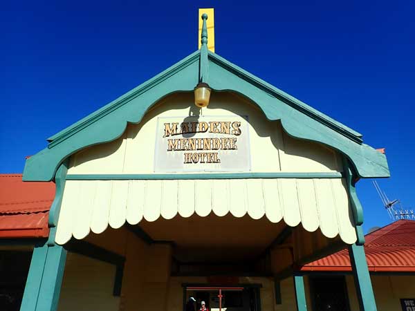 |
| Maidens Hotel | Maidens Hotel sign above the entrance |
There is a lot of water in the river here as we are above the Menindee weir which is only a kilometre or so downstream. Later John and Maureen arrive. We have showers using my system and I have a cuppa. At 5:00 pm as normal we have drinks around the camp fire. I make Madras currey chicken and rice for dinner. Very nice. We go to bed a 9:50 pm when it is still a warmish 9.5â°C.
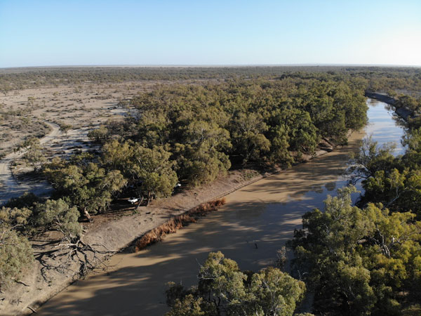 | 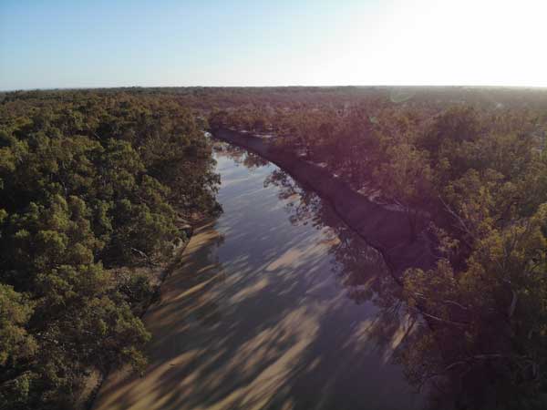 |
| A drone shot of our campsite in Kinchega NP | Looking south along the Darling River |
Weather: Sunny, maximum of 17ÂșC
Arrived: Darling River Camping Ground, Kinchega NP Time: 3:20 am Distance: 231 kilometres
Day 7 â Friday 3 July 2020 â Kinchega National Park
Weather: Sunny and a minimum of 3.2ÂșC
Another cool night after a few warm nights. It was a calm and clear night, hence the cold morning. It is still only 3.2â°C when I get up at 8:15 am. I read the newspaper on my tablet (good phone coverage here). I cook bacon for breakfast, something I only do a few times on a trip. I fly the drone as it was too windy yesterday afternoon.
At 10:00 am we leave, after making sure our site is clearly marked as being fully occupied (there is of course, only one tent here). We drive the rest of the Darling River and past the lower Menindee Weir. The level of the Darling below here is much lower than where we are camped. Further on we pass a tree that has markers for all the major floods. The height of the 1976 flood is simply amazing, no wonder Lake Eyre filled and there was still water in normally dry lakes and rivers in 1978 when I went to Tibooburra.
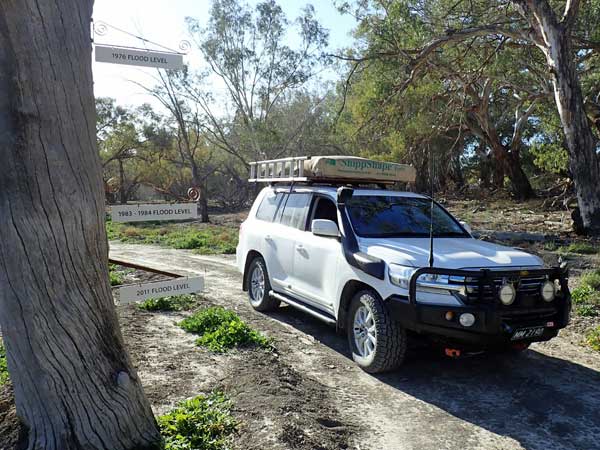 |  |
| A photograph of the tree with markers for flood levels, 1976 is the highest one and 1984 below it. | The lower weir at Menindee |
We end up at the wreck of the PS Providence which blew up in 1872 and killed all but one of the people on board. Apparently they had been at the pub and left without refilling the boiler with water. Today the only remaining part of the wreck is the boiler which is on the top of the bank. You can clearly see where the steam blew open the boiler. We stop here for 10 minutes or so and then continue on.
We then stop at a parking area near a toilet which marks the start of a walk to the Old Kinchega Homestead and around the homestead billabong. The original homestead was at the start of the walk and then the second one further on.
The homestead is quite interesting, even though it is just ruins. There is lots to see, including tanks, windmills, old bottle piles and more. After here we continue on the walk around the billabong (which has some water in it) back to the cars. It is 2.3 kilometres and it takes us about 90 minutes to do the walk and look at the ruins. We leave at noon.
 |  |
| The boiler of the PS Providence | You can clearly see where the steam blew out the boiler |
 |  |
| An old boiler at the Old Kinchega Homestead ruins | The ruins of the Old Kinchega Homestead |
Ten minutes later we are at the Kinchega Shearing Shed. This is a very historic building, once the largest shearing shed in Australia. It is still in very good condition, even better than when I last visited in 2006. Here I run into some people who know lots of my diving friends. They are from the Georges River Overlanding and Recreation Club (GROC). I was a member of the club for a while in the mid-2000s.
I have a chat with a few of the members, some of whom I recall from back then. I even take their photos for them. They are on a trip and all have caravans. We leave at 12:40 pm and go back into Menindee to the Maidens Hotel for lunch, the trip takes 17 minutes. We all order hamburgers and with a beer it costs me $20. It was a very nice burger and the chips were great.
 |  |
| The Kinchega Shearing Shed, once the biggest in Australia | This steam engine was "walked" from Melbourne! |
We leave at 1:50 pm and go to the Burke and Wills Park where there are some water taps. We refill our containers, leaving at 2:05 pm. We drive back towards Broken Hill and then head to the Main Weir. We arrive here 15 minutes later. This weir is where they divert water from the Darling River into the Menindee Lake system. Currently only the top two lakes are full as not enough water has come down to fill all four.
There are lots of good camping spots along the edge of Lake Pamamaroo. We come back along Pamamaroo Creek to where the Burke and Wills Expedition set up camp and left a carved tree. You cannot read the carving now, but you can see where they marked it. We then take the very rough road around the lake to Copi Hollow, but there is nothing to see there except a caravan park. We head back to the campsite arriving at 3:50 pm.
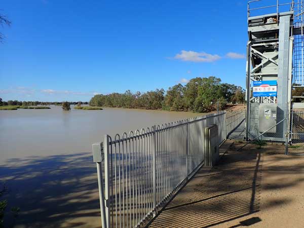 |  |
| The Menindee Main Weir | The Burke and Wills Exploration Camp at Menindee |
It is overcast now and windy, quite cool considering the maximum was 18â°C. We start the campfire and Ron makes a damper. After the large burger for lunch, we do not want a big meal, so I have a cuppa soup with damper. It is still windy at 7:30 pm and we have a few spots of rain. We get a message that Ian and Sharon will be meeting us the day after tomorrw at Mungo National Park. We go to bed at 9:30 pm and it is still windy but much cooler at 9.0â°C.
Weather: Sunny then overcast and windy, maximum of 18ÂșC
Arrived: Darling River Camping Ground, Kinchega NP Time: 3:50 pm Distance: 96 kilometres
Day 8 â Saturday 4 July 2020 â Kinchega National Park to Mungo National Park
Weather: Sunny, minimum 4.0ÂșC
The wind dropped sometime before midnight. Another cold night and it is only 4.0â°C at 7:30 am when I get up. I listen to the news on the car radio (FM for once) as I have breakfast. We leave at 9:30 am, although Ron needs to get more water. We leave town at 9:55 am and head down the Pooncarie Road.
Along the way I have a phone call from one of my diving friends who I had called to tell him about our encounter yesterday. We arrive at the small town of Pooncarie at 11:20 am, 134 kilometres travelled today. The road is mostly dirt, although there is a section of tar about 30 kilometres long about 25 kilometres north of the town. We have morning tea in the park near the old wharf, although the toilets are about 300 metres away behind the community hall.
 |  |
| The view of the Walls of China from the main viewing area | The Walls of China from the Red Top Lookout |
John and Maureen decide to stay and have a coffee at the café and also stay tonight in the main camping area in Mungo tonight rather than where we intend to camp. We head off at 11:50 am and find the road south is all tar. We turn off to Mungo NP at 12:10 pm and stop a short time later to cut firewood. At 12:35 pm we stop for lunch, only 16 kilometres from Pooncarie.
I make a jaffle using chicken and cheese with avocado. We leave at 1:00 pm. The road in is pretty good. Like the past few days, we see plenty of Victorians heading north, escaping the COVID crisis which has suddenly worsened in the past few days and appears to be heading towards a lockdown of the NSW/Victorian border. We arrive at the Mungo NP Visitor Centre at 1:35 pm, 42 kilometres from our lunch stop.
 |  |
| The Walls of China from the Red Top Lookout | Belah Camping Area |
We have a look through the centre, it seems to have been updated since my visit in 2006 and is pretty good. We pick up some brochures and head off at 2:00 pm. Six minutes later we are at the Walls of China car park. It is very windy and cold, even though it is 14â°C. The Walls of China a famous as this is where the oldest known remains of humans have been found in Australia.
We walk to the lookout, but it seems now that you cannot actually walk amongst the sand dunes unless you are on a guided tour. Later a tour comes along, 13 people on it at $50 a person. Too expensive for what is in reality only a bit over an hourâs tour.
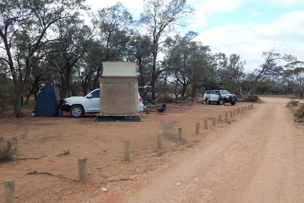
We head off after perhaps 20 minutes and stop for a short time at the Red Top Lookout which gives a nice view back over Lake Mungo (which is permanently dry). From here the road is one way only and at 3:15 pm we arrive at Belah Camping Area. It is quite nice, only two other groups set up. We find a spot away from them and set up camp.
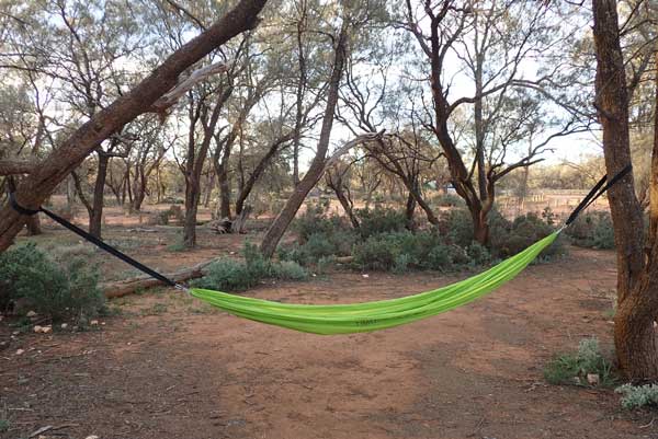 | 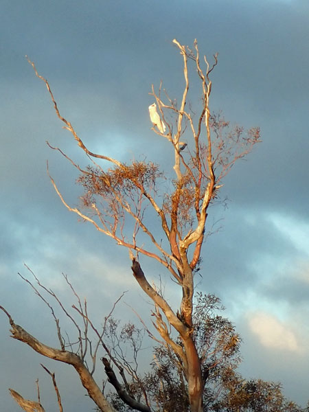 |
| My new hammock | One of a few pink cockatoos we see at Belah Camping Area |
No fires are permitted here for some strange reason, although you can have fires at the main camping area. There are lots of tables in the trees and one toilet. We see a few pink cockatoos, they are perhaps the most beautiful of the Australian birds. We have a shower. It is now overcast and windy, but on the ground we do not really feel the wind which appears to be in the top of the trees. We have had no phone coverage since Pooncarie, unusual on this trip.
I cook chicken sausages on Ronâs biji and have with canned carrots and potatoes. Later Donna pulls out the Galway Port! We go to bed at 9:50 pm when it is 6.0â°C. It did not really seem that cold. The wind had dropped about 6:00 pm to nothing.
Weather: Sunny and windy, maximum of 15ÂșC
Arrived: Belah Camping Ground, Mungo NP Time: 3:20 pm Distance: 250 kilometres
Day 9 â Sunday 5 July 2019 â Mungo National Park
Weather: Overcast, minimum 8.5ÂșC
The temperature went up to about 9.0â°C about midnight and was still 8.5â°C when I get up at 8:00 am. It got windy again at 5:00 am. We have breakfast and I listen to the 9:00 am news as I want to see who won the Eden Monaro By-election yesterday, looks like the ALP will retain so I am happy. There are more pink cockatoos and we have some misty rain a few times. We leave at 9:30 am.
We stop at Round Tank which is just down the road. There is a goat trap here but it is obvious that it has not worked for a long time. It must have rained along the road past here as there is a fair bit of mud on the road. We also stop at Paradise Tank and then go off the main road to Vigars Well. From here you can walk to the top of the sand dunes and look back towards Lake Mungo. There is also the old well to see. While here I use the drone to take some photographs. We leave at 10:45 after a 40 minute stop.
 |  |
| The sand dunes behind the Walls of China from the Vigars Well | Looking towards Lake Mungo from Vigars Well |
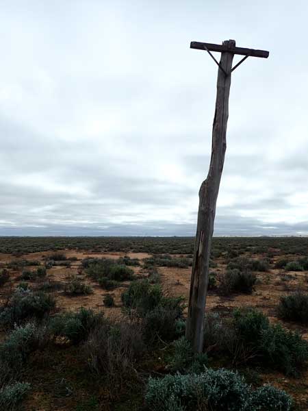 | 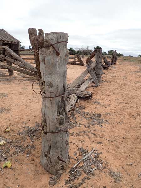 |
| One of a number of telephone poles along the road | A fence near the Zanci stables |
As we head back towards the main visitor part of the park, we see the remains of an old telephone line, just some small tree trunks all in a line stretching off into the distance. We arrive at the Zanci Homestead ruins at 11:10 am. We have morning tea while looking around the ruins of the house and the nearby stables and shearing shed. After this we drive to the Main Camping Area arriving at 12:25 pm.
We can see where John has camped but there is not enough room for three other cars. We find a spot and as we do, Ian calls us on the UHF. He is about 15 kilometres out. When he arrives we decide on our camping spots and I make lunch after this. I then set up my camp site. Ian left Sydney at 8:00 pm last night and stayed overnight at Jugiong on the Hume Highway. They left early and drove non-stop across the Hay Plain.
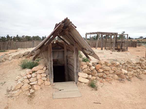 |  |
| The entrance to the underground room at Zanci | The remains of the meat locker at Zanci Homestead |
 |  |
| A soft drink can from 1977, Graham Kennedy's Blankety Blanks Lemonade from the TV show! | The Zanci Shearing Shed |
After this I walk to the visitor centre and then do the loop walk. This is a nice walk. I get back at 3:30 pm. I then have a shower using my own set up as the showers are at the visitor centre for some strange reason, not at the camping area. I discover that Ian has a soldering iron and a large 240 volt invertor. I use this to fix my portable AM/FM radio. Woohoo, it now works.
 |  |
| The Mungo Main Camping Area | The Mungo Shearing Shed |
At 5:00 pm we have drinks around the campsite firepit but this is not great. It is a tractor wheel and sits very high off the ground. This means that unless you are standing, the heat from the fire totally misses you and so it is useless. We pull out Ronâs portable one and use that. Much better.
I have the rest of the chicken curry I made last night. I listen to South Sydney play Canterbury on the radio, Souths win! John and Maureen are talking about going home after Broken Hill but I suggest that they perhaps stay another night in the Hill and then go to Tibooburra direct along the tar road. They say they will consider this. We go to bed at 10:00 pm. It is a nice 10.4â°C.
Weather: Overcast, maximum of 15ÂșC
Arrived: Main Camping Ground, Mungo NP Time: 12:25 pm Distance: 36 kilometres
Day 10 â Monday 6 July 2019 â Mungo National Park to Wentworth
Weather: Overcast and minimum of 8.9ÂșC
Another warm night. Luxury to be able to listen to the ABC news in bed again! Up at 8:00 am and breakfast. We leave at 9:20 am, John will follow later. We head back the way we came in as we want to do as much of the Darling River as possible, so forsake the shorter more direct route.
 | 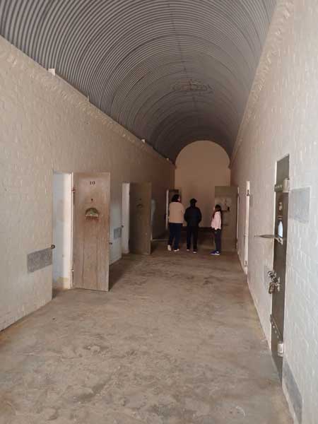 |
| John stands outside the main doors of Wentworth Gaol. He used to work in the NSW Gaol system. | Looking done one of the corridors in the gaol |
We stop at 9:55 am at the place we had lunch two days ago and cut firewood. This is 43 kilometres from the camping area. Ian uses his brand new chainsaw for the first time. We leave 15 minutes later and at 11:10 am we stop at a small camping spot on the Darling River 87 kilometres from the firewood stop for morning tea. This is nice, but a few kilometres along is a much bigger and better stop that will become our stop tonight.
While here we notice Ronâs tyre is flat. He pumps it up and it seems to not be leaking. While here Ian tries to pay for last nightâs camping as he had not paid on-line. This was perhaps the hardest thing ever to do, hopeless system. We leave at 11:52 am and arrive in Wentworth at 12:10 pm, 151 kilometres today. The first fuel station we go to is out of diesel, so we go to the second one. Here I take 100.2 litres at $1.219 $122.17. This works out at 13.7 l/100 km since Bourke.
 |  |
| One of the jailers' office rooms | The old partially restored paddle steamer, PS Ruby |
While paying, I ask if there is a mechanic. There are two, so I go to the one just up the main street. The owner tells me he has a wheel stud to fix it. He goes to his office (opposite the fuel station) and gets the part. He then takes me into town and says once the car is done in an hour, they will park outside the office and the keys will be inside.
I buy a pie for lunch and then go for a walk to the south and west of town. The others have gone to a spot where the Darling and Murray Rivers meet, but where I end up is much easier to get to and better. I have a look around and then walk back to town and see my car outside the office, only 45 minutes has passed. I pay for the repair, a very reasonable $140. It is 1:55 pm.
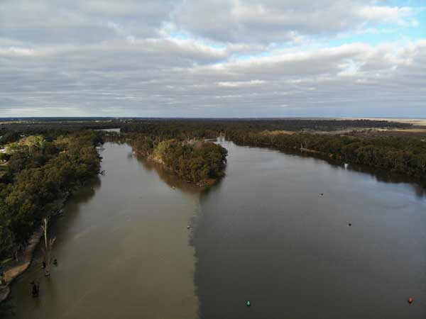 |  |
| The conjuncture of the Darling River (left) and Murray River at Wentworth | The Wentworth Weir on the Murray River |
I find out where the others are and go there via the PS Ruby which is being restored (since 1995!). It is a wood burning steam powered paddle wheeler. I meet the others at the car park where they walked from and then we go to the Old Wentworth Gaol. We pay $8 and spend about an hour looking around it. Quite fascinating.
At 3:15 pm we go to the Captain Sturt Hotel and have a beer. The NSW Government has announced that in a few days time, all people from Victoria will need a permit to come into NSW. As Wentworth is right on the border, this will affect most businesses. Outside the Service NSW office there are long queues to change addresses and get permits.
 |  |
| Drone shot of our campsite on the Darling River north of Wentworth | The fire is on at our campsite |
After the pub the others head out to the camping spot west of town where we plan to camp. Meanwhile, I go to the park that I visited earlier to see the conjunction of the two rivers. I use my drone to take some photographs. While here, Ron calls and says they are not going to camp there as the place is pretty full. They have decided to go back to the place we looked at this morning, back about 18 kilometres out of town on the Darling River.
I arrive at 4:08 pm, few minutes after the others. We have a look around at the many available spots and at 4:25 pm, we set up camp. We are right on the river in a spot where we all fit. Sharon starts a fire and we soon have set up our chairs around it and have drinks and nibblies. I fly the drone to take some shots of the river but soon have to land it as a hawk has taken a bit of an interest in it.
 |  |
| Sitting around the campfire | The great sunset at our campsite |
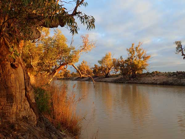
Wow, what a great sunset! It is very orange and the light on the river red gums looks great. After drinks, I cook pork fillet steaks on Ronâs biji and heat up carrots and potatoes. After dinner we have Baileys and ice, a brilliant end to the night. We go to bed at 10:00 pm, it is 12â°C.
Weather: Fine, maximum of 17ÂșC
Arrived: Darling River, 18 km north of Wentworth Time: 4:08 pm Distance: 136 kilometres
Click here to go to the next part of this trip.
 |  |  |  |
