|
Click here to read the previous part of the trip.
Day 34 â Monday 26 July 2021 â Cobbold Gorge
Weather: minimum of 10.1ÂșC and fine
I woke at 2:15 am when a baby started crying. This went on and off (mostly on) for the next two hours. The parents did not seem to be doing much to try to stop it! I am awake most of the two hours and then I sleep till 7:00 am. I listen to the news and then read the SMH. It seems that the resort has a private repeater which rebroadcasts the Telstra signal here, much like Adels Grove. I have access in the rooftop tent but not on the ground.
I get up at 8:10 am and have breakfast. Most of the people camped near me leave over the next hour. After breakfast I do some more work on my windscreen. I think it may work but the main crack is very long now. At 10:20 am I go for a bushwalk on the Diggers Track. Nothing special really, but nice to have a bit of exercise. I am back at 11:05 am, I have walked 2.5 km.
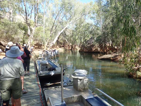 |  |
| The boats and the wharf | The lower section of Cobbold Gorge |
I walk to the office and get phone coverage and find that my ex-wife has sent me a message that a bloke I worked with for 30 years at NPWS died yesterday. She used to work with his son. Vale Cec Bartlett, one of the pioneers of NSW NPWS. I go back to the campsite and have a cuppa and read some more in the hammock. Before lunch I have a swim and then at 1:15 pm I walk to the office to go on the 1:30 pm tour.
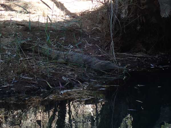 | 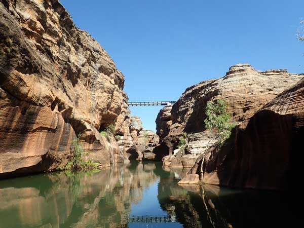 |
| A freshwater crocodile in the lower part of Cobbold Gorge | In Cobbold Gorge approaching the new glass bridge |
The gorge is located on Cobbold Creek, a permanent water source that feeds into the Robertson River. After being allocated into groups, we all jump into the three mini-buses for the 10 minute ride to the start of the tour. We get out in a huge shed where there is a briefing. The different buses do the parts of the trip in different order. We do the boat trip up the gorge first. This takes just over 60 minutes in a small electric powered boat.
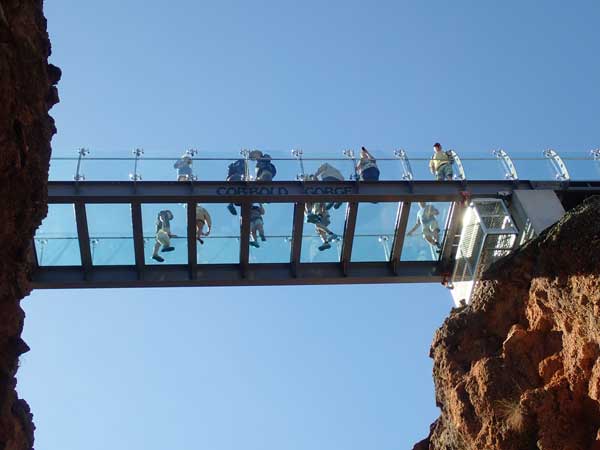 |  |
| The glass bridge from below | The narrow section of Cobbold Gorge above the bridge |
The gorge is very narrow but extremely spectacular. It is only a few hundred metres long, but do not be put off by the small size. In spots the gorge is only the width of the boat and we scrape on the rocks. We see a small freshwater crocodile at the start. A new attraction here is a glass bottomed bridge which takes the walking track over the highest section of the gorge.
 |  |
| The boats are only just narrower than the gorge | The glass bridge from above |
Once back at the boat landing spot, we head off for our walk. This takes 80 minutes. It is an easy walk, the highlight of which is crossing the gorge on the glass bridge. To do this you need to put on socks over your shoes so you do not scratch the glass. We head back to the buses and then back to the resort. We get back there at 4:40 pm.
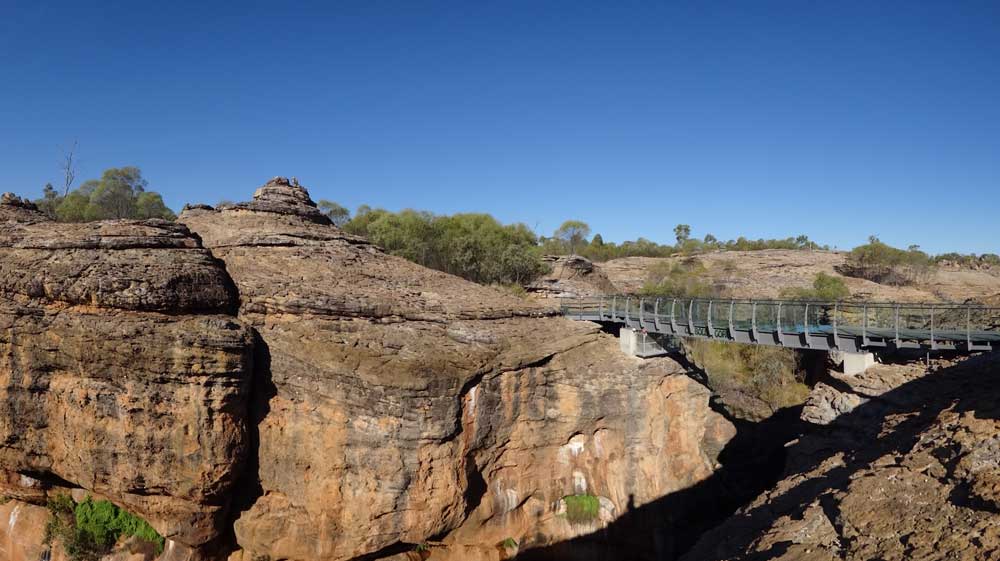 |
| A panoramic photograph of the bridge and Cobbold Gorge |
I go for a swim and then a shower. The solar panel has been out all day but has been in the shade for quite a few hours. At 5:30 pm I have drinks and nibblies and at 6:45 pm I cook a nice steak with some sausages on my newish grill on the fire. I have these with some heated up canned potatoes.
I then sit around the fire with some neighbours till 9:30 pm when I go to bed. I read till 10:00 pm.
Weather: Fine, maximum of 26ÂșC
Arrived: N/A Time: N/A Distance: 0 kilometres
Day 35 â Tuesday 27 July 2021 â Cobbold Gorge to Undara Resort
Weather: minimum of 12.2ÂșC and fine
I wake at 6:05 am and download the SMH to read offline. I have a few internet problems at first but then it works okay. I read till 7:00 am, listen to the ABC news and then get up. I have breakfast and pack up. I leave at 8:05 am as I have to be at Undara Resort by lunch as I have a 1:00 pm tour.
I travel via Forsayth and onto Einasleigh. The road between these two towns is mostly tar, but I sit on 90 km/h for the majority of the dirt sections. There are some windy sections as the road drops from 770 metres to 530 metres. I later discover I should have stopped at Einasleigh for a night or two as Copperfield Gorge is located here and people will tell me it is very good. Anyway, I pass by at 9:55 am and take the Gregory Highway north. There are some nice camping areas here on the Einasleigh River. This is a good dirt road.
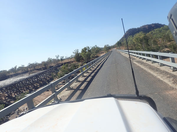 |  |
| The bridge over Copperfield River, note the railway bridge to left | The causeway across Einasleigh River |
The road is a bit windy in sections and at 10:15 am stop for morning tea at Jardine Lagoon Camp. This is a private camping area, very nice with hot showers and flushing toilets. It costs $10 per person a night. I leave at 10:25 am. I arrive at the Gulf Developmental Road at 10:50 am (160 km today) and turn right onto the tar road which surprisingly still has single lane sections. I pass through Mount Surprise at 11:15 am and at 11:50 am I arrive at the Undara Resort. The road in is now tar till the entrance of the resort.
 |  |
| Jardine Lagoon | My camping spot at Undara Resort |
I book in (cost $70 for two nights, tour $63) and head to my nominated site. It turns out to be a pretty good spot, I had problems when booking as I did not know if a I needed a caravan or tent site. This is a tent site. These are individual spots set apart from each other and in amongst the trees.
I set up camp, including my solar blanket and have lunch. At 12:45 pm I walk to the tour meeting site. We get on board our bus and 20 minutes later we are at the start of the Undara lava tube walk. I am doing the Wind Tunnel Explorer tour.
 |  |
| The first of the tubes on the Undara Wind Tunnel Explorer tour | The entrance to the larger tunnel |
The guide is great and gives a very good talk about the volcanos in the area and how the lava tubes were formed. I had always assumed that they were hollowed out by rainwater, but they were actually formed as the hot lava cooled on the outside as they flowed down like a river but continued to flow inside. Then, once the volcano stopped erupting, the flow of lava also stopped coming out. However, the lava already inside the tubes kept flowing till it cleared the tubes. This left behind the train tunnel-like tubes.
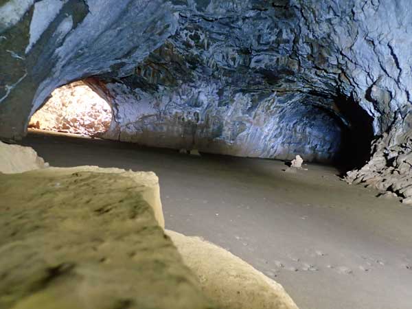 | 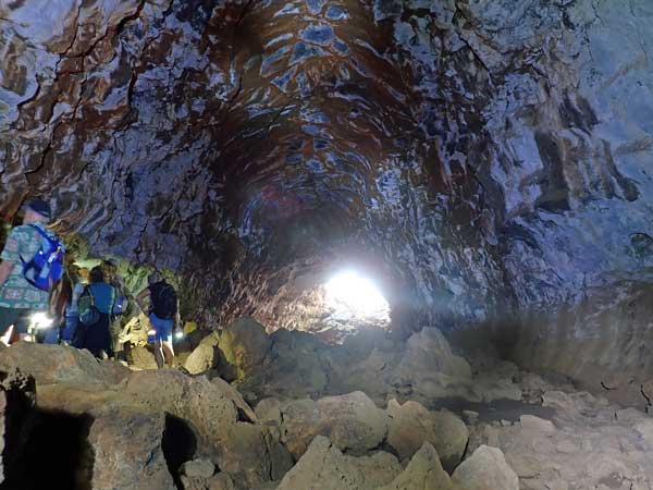 |
| Inside the larger tunnel looking back at the entrance (left) and the main tunnel | Just past the middle of the longer tunnel |
Anyway, we get to go inside a couple of the tubes, they really are huge. The first one is not so long, you can see the exit from the entrance. The second one has an entrance into a tube like a Y. This one is so dark you cannot see anything in the middle, so make sure you bring a torch.
There are also bones of animals that have blundered into the tubes and were not able to find their way out as well as some very large spiders. There are also small insect eating bats. Undara is a really worthwhile place to visit and you must do one of the tours.
 |  |
| Kangaroo or wallaby bones | There were quite a few of these large spiders |
We are back at the resort just after 3:00 pm. I have an ice cream, very nice after the tour. I go back to my campsite and set up the hammock and read. At 4:45 pm I walk to the showers which are not that far away really. After the shower I have drinks sitting by my campfire. I cook Mongolian lamb for dinner with canned potatoes.
An Royal Australian Air Force Hercules flies overhead and around and then lands to the east. Thirty minutes later a Chinook helicopter lands there. They are both there for ages, with engines running the whole time. Later the Chinook takes off and the Hercules is quiet. I have no idea what then happened as I never heard the Hercules take off.
I sit around the fire till 8:55 pm and then go to bed and read my Kindle. About 9:30 pm the Hercules and Chinook come back again and land. Twenty minutes later they take off and leave. I learn tomorrow that there are war games on with the USA and other forces in northern Queensland.
Weather: Fine, maximum of 26ÂșC
Arrived: Undara Resort Time: 12:00 pm Distance: 244 kilometres
Day 36 â Wednesday 28 July 2021 â Undara Resort
Weather: minimum of 12.1ÂșC and fine
I wake at 4:45 am and read the last of my book till 6:00 am when I fall back asleep till 6:55 am. I read the newspaper till 8:00 am. They have a Telstra phone tower repeater here too, the internet is slow, but it works (I have since purchased my own mobile phone repeater for the car, works good at home where I only have one bar at most). I have breakfast and then go and wash my sheets and clothes.
After the washing is finished, I put it on the clothes lines and at 10:10 am I head out on a short walk to Atkinsons Lookout. I get back about 11:20 am, the walk was 4.4 km. Nothing special, but good to do some exercise. I am hot after the walk so I for a swim in the pool and then collect my washing which is mostly dry. A cuppa while laying in the hammock is interesting, I broke the tree I had connected one end of the hammock to!
 |  |
| Old trains are some of the accommodation at Undara Resort | one of the views from The Bluff |
I have lunch at 12:45 pm, it is a hot 28°C. After lunch I book Porcupine Gorge for 3 and 4 August. This means I need to fit in two nights before then as my plan was to go there 1 and 2. I then do my tax return for last financial year and get a good refund! This will pay for my whole trip this year. At 2:40 pm I go on another walk, this time the Swamp/Bluff Walk. This is a combination of two walks and is a very nice walk. There are lots of kangaroos and wallabies along the edge of the swamp. There are some nice views from the Bluff and also some rock wallabies here too.
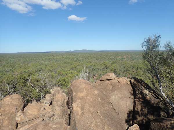 | 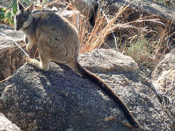 |
| Another view from The Bluff | A rock wallaby on The Bluff |
I am back at the pool at 3:25 pm after the 3.2 km walk. When in the pool a tall bloke looks familiar to me. I finally ask him who he is when I hear him say he worked for NPWS. He is Brian Curle who I worked with in the late 1970s for a couple of years. He left NPWS to join the NSW Fire Brigade and then had his own business. He now lives near Nelson Bay. We have a chat while in the pool about the old days.
Back at the campsite I start a fire as I am slow cooking a green beef curry. I prepare the onions, capsicums, meat and put it in my small camp oven with the curry and coconut milk. I place it on some coals to slow cook for a few hours. I then go off for a shower and at 5:50 pm I have drinks while waiting for the curry to cook. I also put on some rice. I have dinner about 7:15 pm, the curry is excellent.
I hear some noises and see a very small wallaby next to the fire. It has very small arms and I find out later it is a pademelon. Later I go to the campsite above mine and have drinks around the fire with the two girls and a couple of blokes. At 10:05 pm a bloke from another campsite complains about the noise of the music, it was quite low but he was probably right to complain. At 11:10 pm he again complained, this time about the talking which was definitely not loud. I had left at 11:00 pm and I could hardly hear them and I was a lot closer.
Weather: Fine, maximum of 28ÂșC
Arrived: N/A Time: N/A Distance: 0 kilometres
Day 37 â Thursday 29 July 2021 â Undara Resort to Archer Creek
Weather: minimum of 13.1ÂșC and fine
I wake at 6:30 am and read the SMH and listen to the ABC radio news. I get up at 7:55 am and have breakfast. I then fill my water tank and containers. I have only used 15 litres from the tank since I last filled it. I leave at 9:10 am and drive to the Kalkani Crater. This is the crater from one of the volcanoes. I get there at 9:25 am.
I do the crater rim walk. This is pretty easy, even the walk up to the rim from the carpark. It is easier to do anti-clockwise. There are great views of the crater and the surrounding land from the walk. It is 2.34 km to do the whole walk and it takes 38 minutes.
 |
| A panoramic photograph from the highest point of Kalkani Volcano Crater across the crater |
I leave at 10:10 am and travel again via the Gulf Developmental Road to the Kennedy Developmental Road which I take to the north. A short distance from the intersection I stop at the Forty Mile Scrub NP picnic area. It is 10:35 am. There are picnic tables, toilets, information boards and a nice little walk here. I have morning tea and head off at 10:55 am. At 11:40 am I stop at Mount Garnett where I refuel and buy some things in the small shop attached to the service station. I take 111.3 litres at $1.409, $158.81. I have averaged 13.0 l/100 km for the 859 kilometres since I left Karumba.
 |  |
| The picnic area at 40 Mile Scrub | Innot Hot Springs, the water in creek is extremely hot in spots |
I then stop at small shop that sells nick-knacks. I get a book for $2 and a bar of soap for $1 as I have almost used the only one I brought with me (since I was originally going to be home in a few days). I go to the information centre and get some brochures and then at 12:20 pm I leave town. Ten minutes later I arrive at Innot Hot Springs. This is a small spot with a caravan park next to the creek which has the hot springs in it.
I go to the water to try to have a swim in the hot springs. This is harder to do than you would imagine, as the water is very shallow and either too hot or too cool. I find a reasonable spot but have to lay down to get wet. Very overrated as a hot spa, although understand that you can go to a spa in the caravan park. I should have done this. I have lunch and then leave at 1:15 pm.
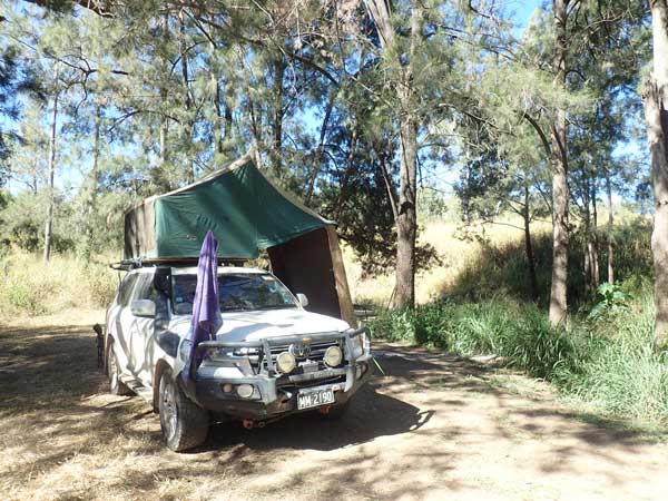 | 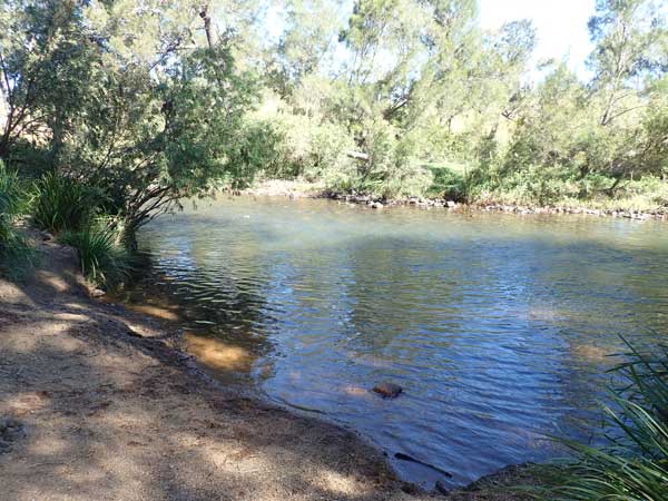 |
| My campsite at Archer Creek | The Millstream |
At 1:25 pm I arrive at Archer Creek. This is a creek that feeds into the much larger The Millstream and has a large flat area next to the highway for caravans and campervans and below that, a smaller area for tents, small campervans etc right next to The Millstream. This is the pick of the spot and I get a site on the creek as the ones next to the main water are all gone.
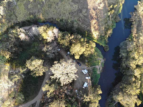 | 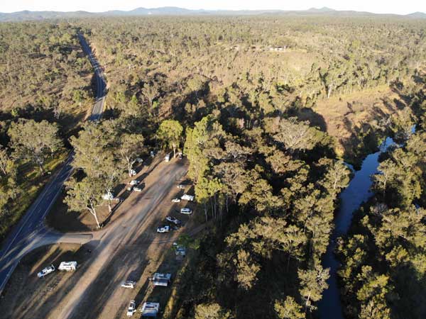 |
| A shot from my drone of the lower area, Archer Creek is the small waterway | Looking to the east showing the highway and main camping area |
I set up camp and put out the solar blanket and move it around to keep it in the sun. I have a few swims in The Millstream. This water is flowing and there are some nice waterholes. It is a warm 20°C. I talk to a few people here, including Jack from Byron (funny girl). I have a few cuppas, fly my drone and relax the afternoon.
Weather: Fine, maximum of 26ÂșC
Arrived: Archer Creek Time: 1:25 pm Distance: 133 kilometres
Day 38 â Friday 30 July 2021 â Archer River to Jumna Dam
Weather: minimum of 8.1ÂșC and fine
This morning is the coldest morning since 14 July, freezing for up this way. I am awake at 4:15 am as there are a huge number of cars and trucks after 5:00 am, especially for the next 45 minutes. I have no idea why so many as when I am back here in a few days there is nothing like this traffic. I sleep from 6:00 am till 7:00 am. I listen to the radio news and read the SMH. I get up at 8:00 am and have breakfast. I should also mention that there is a toilet block here, old, but fairly clean.
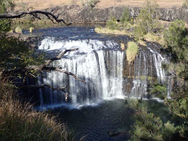 |  |
| Millstream Falls | This was a flagpole area at Millstream Falls |
I pack up the Shippshape and when I go to leave I discover I do not have the car fob. I realise it must be in the rooftop tent where I normally put it at night. Luckily this is not too far from the door, so I reach my hand in and after a while I find it. Didnât want to have to open it up again. I leave at 9:30 am and then go to Millstream Falls. These are said to be the widest in Queensland. It is only ten minutes to here.
After this I walk around the former US Army base which is located near the carpark for the waterfalls. This was set up during World War II. You can see the walking paths, some roads, the parade ground and some toilet and shower floors. There are also some machine gun pits. I leave at 10:15 am and five minutes later I am in Ravenshoe. This is the highest town in Queensland at 930 metres, almost as high as Katoomba in the Blue Mountains and 75 metres higher than Jindabyne in the Snowy Mountains.
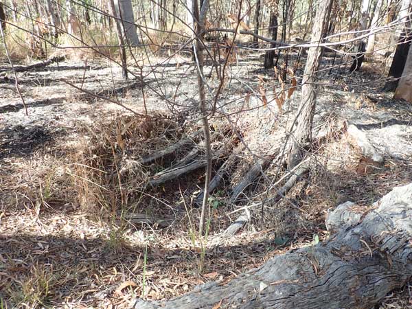 |  |
| A machine-gun hole at Millstream Falls | A church at Herberton |
I go to the bakery and buy some things for morning tea for the next few days. I then head to the local park to have morning tea. I ring my sister Janelle to discuss the offer that has been made for Mumâs house. Mum has moved into aged car, so we need to sell the house to fund the new place. The offer is amazing, far more than we expected. I agree that if we get nothing higher in the next few days, we accept this one (Janelle is selling the house via Facebook!).
I leave at 11:00 am but five minutes later I have to stop as the snorkel is loose again. This first happened in 2019 and is because the screws holding the snorkel to the car were poorly fixed in the first place and have now created a larger hole. I have put in larger screws but they are loose again. I tighten them up again. I will have to do something else as this will happen again if I donât.
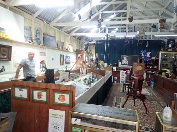 |  |
| Inside the Spy Camera Museum | A very old underwater camera in the Spy Camera Museum |
I am back on the road 10 minutes later. I arrive in Herberton at 11:40 am. This is almost as high as Ravenshoe, just 20 metres lower. It is an old copper mining town. I decide to go to the Spy Camera Museum which has not just spy cameras, but all sorts of still and film cameras. It costs $10 to go in or $20 for a guided tour. I do the guided one, it is extremely interesting, led by the owner Michael. It takes 40 minutes. There are even underwater cameras which, of course, are of interest to me. One is very old and others are like ones I owned. While here, the people who are finishing the tour say they saw me in Karumba and at Gregory River. I donât remember them.
 |  |
| One of the buildings from the Great North Mine | Machinery from the Great North Mine |
I go to the small park at 12:25 pm to have lunch. After this I go to the Herberton Mining Museum. Entry is by a donation and there is a floating guide who tells you about certain parts of the museum as you move around. The museum is really quite good and worth doing. After this I walk to the Great Northern Mine, 1.2 km return.
I leave at 1:50 pm and try to find the Baldy Mountain Forest Reserve as this is said to have a camping area in WikiCamps and also the Queensland national parks website. However, I do not think it actually exists as the WikiCamps directions are wrong and the national parks website has no map or directions. I lodge a notice with WikiCamps that I do not think it exists and I notice that in January 2022 it has been removed from the app. A total waste of time going down numerous very rough tracks.
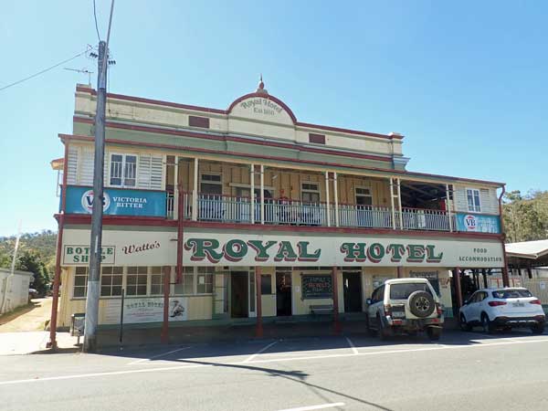 | 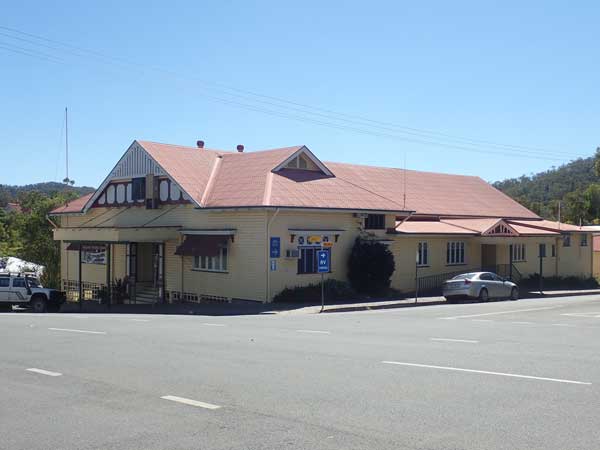 |
| The Herberton Royal Hotel | The former town hall in Herberton |
At 2:40 pm I go to the Royal Hotel (1881) in Herberton and have a beer. I then walk to the hardware store as I need a bolt to repair my chair as once again one has fallen out. I buy a few bolts to fit. I leave town at 3:15 pm and head west towards Irvinebank. I stop to collect some firewood and arrive at Jumna Dam at 4:00 pm. I miss a turn on the way in but eventually end up on the lakes edge.
 | 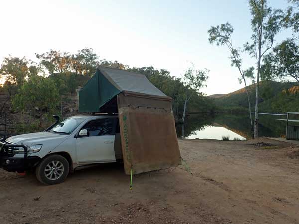 |
| My campsite at Jumna Dam | A later shot at Jumna Dam, look how calm the water is now |
However, there is a problem, well a few problems. First, there is very little flat land, and of the small bit that there is, it is taken by a bunch of local rednecks (well from Cairns) with quad bikes and loud music. They are apparently having a birthday party this weekend for one of them and more are coming. I go looking for another spot but one couple tell me that there is nothing else on the water edge near here. They do tell me that there are a couple of spots near the dam wall.
I head back out towards the main road (the track is definitely 4WD only) and head up to the dam wall. Here I find a small area for a couple of rooftop tents or camper trailers and another area a hundred metres away a bit bigger. The spot I like is just near the water and has a nearby shed and table. I set up camp at 4:25 pm. The ground is very hard and I bend a few screw pegs putting them in.
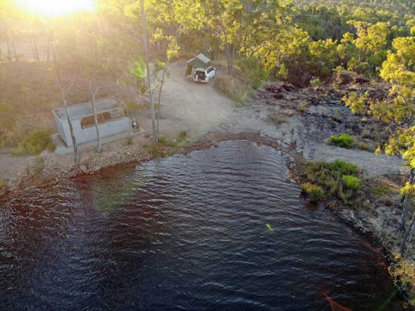 | 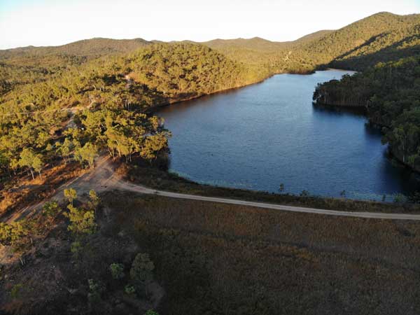 |
| A drone shot of my campsite at Jumna Dam | A drone shot of the Jumna Dam, I am camped left of middle, the other people are down the far end |
I have a shower and at 5:30 pm I have drinks and make rice to have with leftover curry from two nights ago. It is very lucky I did not stay at the spot I first went to. During the evening at least another eight cars come in, most with quad bikes on their trays. All but one come the wrong way and end up where I am and I have to redirect them to where the party is on.
I listen to the NRL on the radio. All the time I can hear the music from across the lake and also the quad bikes running around everywhere. I go to bed at 9:25 pm.
Weather: Fine, maximum of 29ÂșC
Arrived: Jumna Dam Time: 4:25 pm Distance: 108 kilometres
Day 39 â Saturday 31 July 2021 â Jumna Dam to Irvinebank
Weather: minimum of 13.2ÂșC and fine
The bogans had music, quad bikes and screaming till 3:30 am! It got a bit quiet at one time and I fell asleep but woke at 2:15 am. I finally get to sleep again at 3:45 am. I wake at 6:50 am. I do the usual and get up at 7:40 am as the sun is on the tent and it is too hot now. I cook a bacon sandwich for breakfast, nice to have something different to my normal muesli and yogurt.
 |
| A panoramic photograph of the camping area at Irvinebank |
I read some more SMH till the internet stops for some reason. I put the solar blanket out as I will not be moving for a while and I am not going far today either. I pack up the rooftop tent and then have morning tea. I leave at 10:35 am and at 10:45 am I am in Irvinebank. It is only 5.8 km. I start to set up camp and realise I have left the screw pegs and bungee cords at the dam. I head back and find them, not where I left them, but in a different location. Obviously someone has been here but did not take them. I am lucky as I do not have extra bungee cords.
 |  |
| Some old buildings as you come into Irvinebank | Irvinebank Hotel |
I am back at Irvinebank at 11:25 am. I set up and have a cuppa. This is an excellent free camping spot. Nice grass, trees, some tables, opposite the hotel, toilets and hot shower a short walk away.
I walk over to the hotel to see if they have food, but none due to lack of staff. I speak to my Mum on the phone, my sister has fixed her phone which has been mucking up. My sister showed another person through Mumâs house, we cannot believe the interest in the house, all done via Facebook. I have a Mongolian lamb and cheese wrap for lunch, excellent.
 |  |
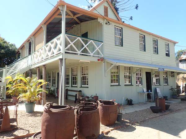
| The Irvinebank School of Arts | The Queensland National Bank at Irvinebank |
 | 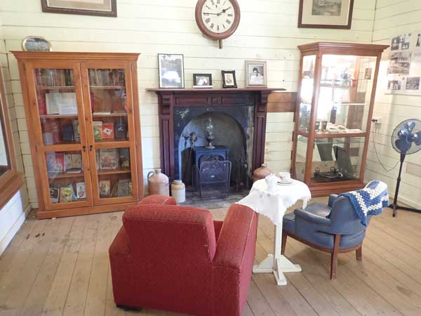 |
| Loudoun House | Part of the museum inside Loudoun House |
It looks like the Souths and Saints match this afternoon is off due to Covid (it is later rescheduled for tomorrow evening). At 1:05 pm I walk to the School of Arts Hall (1900), the Queensland National Bank and managers residence (1905), the tramway station (1907) and then to Loudoun House (1884). This was the residence of John Moffat, the owner of the mine at Irvinebank. It is now a museum to the mine and the town. Cost to enter is $6 for seniors. It is a really good museum, well worth visiting. I am back at the campsite at 2:05 pm, the walk was 1.2 km.
 | 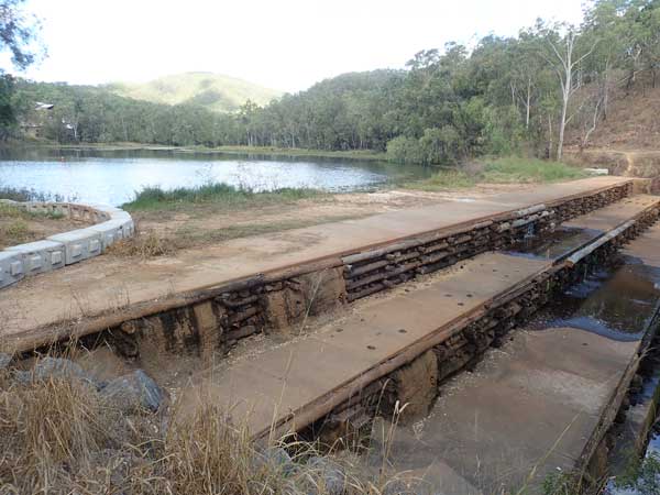 |
| Another shot of the museum inside Loudoun House | Irvinebank Dam, built for the mine. |
At 2:20 pm I go for another walk to the school (1888), police station (1886) and the Vulcan Mine Headframe (1889). This is 2.8 km and I am back at 3:05 pm. I find some timber to cut tomorrow when I am walking and I carry back a few smaller pieces to burn tonight. It is overcast now, the first time for weeks I think. I have a cup of tea and read my book before going for a shower. This is a gold coin donation. A great shower!
 |  |
| A sign in the wall at Vulcan Mine | Minehead at Vulcan Mine |
At 5:00 pm I walk over to the Irvinebank Tavern and have a few XXXX Gold ($5.50 each) while chatting to some locals. I am back at my camp at 6:50 pm and I heat up some curry for dinner and then sit around the fire. I am onto a new book. I go to bed at 9:30 pm and read till 10:00 pm. There have been a few kangaroos around since dark and also lots of birds during the day. A great spot. It also cleared up in the evening after the very cloudy afternoon.
Weather: Fine Fine, maximum of 27ÂșC
Arrived: Irvinebank Time: 11:25 am Distance: 17 kilometres
Day 40 â Sunday 1 August 2021 â Irvinebank to Archer River
Weather: minimum of 10.7ÂșC and fine
It is fairly high here (730 metres) so the nights are cooler. I wake at 6:45 am, the best nightâs sleep I have had in weeks. There are plenty of birds around, making lots of noise. I read the paper and listen to the news (but never, ever Macca!!!). I get up at 8:00 am and have breakfast. I then fill my water tank from my container and pack up.
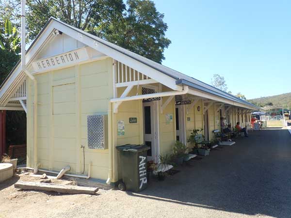 |  |
| The Herberton Station | Inside Herberton Station |
I drive to the Vulcan mine and cut some very old and dry timber. After this I drive to the toilet block and fill my water containers with water from a water tank. I leave town at 9:35 am and drive back to Herberton. Here I go to the railway station. On Sunday you can go for a ride in a small railway work vehicle along a section of track that is being restored so they can eventually run their steam train on. The cost is $5.
 |  |
| The work vehicle you can go for a ride on | A beautifully restored train carriage |
 |  |
| Inside the train carriage | The restored steam engine |
After the ride, they take you to the train shed where they have some trains they are restoring. There is a beautifully restored steam engine and carriage. There are also some other old unrestored trains. I also purchase some biscuits from them and give another donation. After this I have morning tea in the park.
I leave at 11:15 am and take Queenslandâs highest road (1162 metres) to Ravenshoe. I arrive there at 11:45 am and go to the IGA and buy some food items, then to the Ravenshoe Hotel (Queenslandâs highest) where I buy a XXXX Gold 30 pack and a wine cask for $72. I also have a beer in the pub (XXXX Gold $6). Nothing else is open in town.
 | 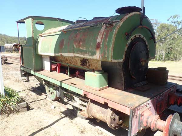 |
| The steam engine's boiler | An unrestored steam engine |
I leave town at 12:25 pm and go looking for the Little Millstream Falls. This is hard to find as despite there being some signs as you come out of town and towards the falls, there is no actual sign at the road that leads to them (it is signposted Misty Mountains Carpark). I arrive there at 12:37 pm after a few wrong turns. I have lunch and then walk to the falls, about 300 metres each way. The falls are quite nice, a lot of water is flowing over them.
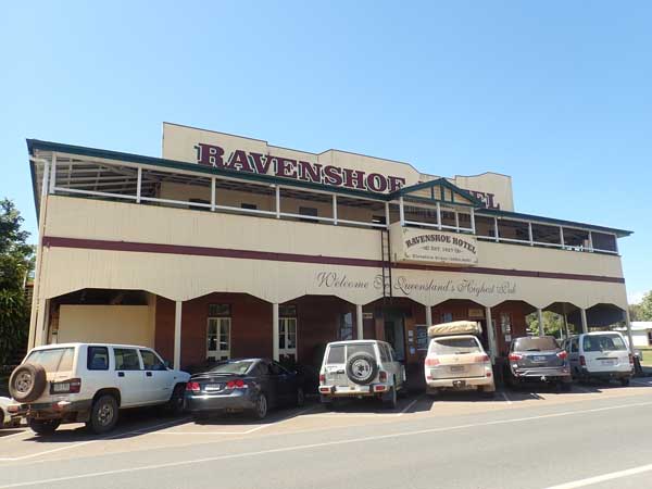 |  |
| The highest hotel in Queensland, the Ravenshoe Hotel | Little Millstream Falls |
I leave at 1:00 pm and arrive back at Archer Creek at 1:15 pm. This time I camp right on the Millstream where I swam three days ago. I set up camp and have a swim. I spend the afternoon listening to the NRL, reading and having a few cups of tea. At 5:00 pm I have drinks and at 5:30 pm I start a fire. I cook a nice pepper steak, sausages and potato on my grill over the fire.
I listen to the delayed Souths match which we win 50-14. Poor old Saints! I read till 9:30 pm and then go to bed. It is a cool 15â°C.
Weather: Fine, maximum of 26ÂșC
Arrived: Archer Creek Time: 1:15 pm Distance: 96 kilometres
Day 41 â Monday 2 August 2021 â Archer Creek to Eight Mile Creek
Weather: minimum of 8.1ÂșC and fine
Equal coolest night for three weeks. Another great sleep, woke at 7:00 am. Much less vehicular traffic and noise than three days ago, strange. I read the paper and get up at 8:00 am. I have breakfast and do some washing and hang it up. I also put the solar blanket out. I read my book and have morning tea. A very relaxed start to the day.
At 10:50 am I pack up, then read some more while my washing dries. I leave at 11:45 am. I am back at Mount Garnet at 12:10 pm. I refuel, but only after I queue at the normal pumps and then realise there is no diesel there. I have to move to the truck filling point which can only handle one vehicle at a time. I take 45.2 litres at $1.409 a litre for $63.74. I have averaged 16.2 l/100 km since I was here four days ago. High, but a bit of hard four wheel driving in this lot.
I leave at 12:20 pm and stop again at 1:00 pm at the Forty Mile Scrub NP where I have lunch. I am back on the road at 1:20 pm and just before 2:00 pm I stop to cut some timber. I have dropped about 200 metres in altitude since lunch and my fuel economy on the computer has been 10.3 l/100 km. The timber is really good stuff, best I have seen for weeks. About 15 minutes later I leave. At 2:25 pm I arrive at Eight Mile Creek.
 |
| A panoramic photograph of 8 Mile Creek |
This is a small creek that crosses the Kennedy Developmental Road which runs east-west here. On the northern side of the road there is the old road which crosses the creek via a causeway. I camp on the edge of this road, on the north-eastern side of the bridge. There is space for a few rooftop tents or one caravan here. On the other side of the creek, accessed from over the bridge rather than the causeway, there is a much larger area suitable for caravans and motorhomes.
 |  |
| A drone shot of my campsite at 8 Mile Creek | Looking to the east at 8 Mile Creek. The other camping area is at bottom |
I set up camp and then go for a swim as it is a very hot 30â°C. Well, really, a lie down in the creek as it is very shallow. Best spot I find is on the creek crossing itself. I then go for a walk up the old road parallel to the new road to see if I can get phone coverage. No luck, although I pick up some timber on the way back. I take my chair and sit on the causeway above the water in the cool shade and read. I go for another walk and collect some more wood and then have another swim.
I then fly my drone as the wind has dropped (must be under 30 km/h) and then at 4:30 pm I start the fire as I am cooking chicken Maryland and potato in the camp oven. At 5:30 pm I put the chicken on and it is cooked by 6:00 pm. This is the first time I have cooked chicken Maryland in the oven, I am very happy with how it turns out.
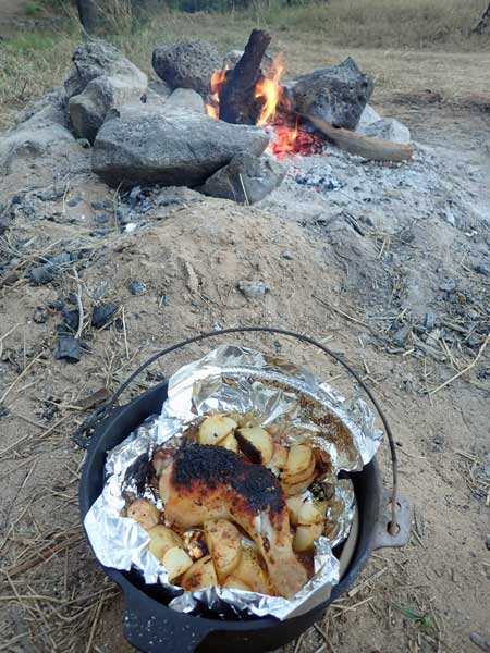 |  |
| The chicken Maryland and vegies | A night shot of my campsite |
I am the only one camped here, brilliant. Quite a few road-trains go past in the afternoon and early evening, most heading south. I have a great view of the sky and see four satellites and three shooting stars. Two of these were brilliant This is a great spot. I go to bed at 9:30 pm.
Weather: Fine, maximum of 30ÂșC
Arrived: Eight Mile Creek Time: 2:25 pm Distance: 163 kilometres
Day 42 â Tuesday 3 August 2021 â Eight Mile Creek to Porcupine Gorge
Weather: minimum of 6.8ÂșC and fine
Last night was the coldest night I have had since 13 July at Clem Walton Park. It was also very quiet, despite being only metres from a âmainâ highway. I heard one truck at 3:30 am and then none till 6:30 am. I was awake for a while early on, so much for the two previous nights of great sleep. I wake at 6:20 am and read my book (no phone coverage here) till 7:40 am when I get up.
 |  |
| A foggy start to the day | My campsite at Porcupine Gorge |
It is quite foggy as I have breakfast. The temperature has risen to 10â°C as I start to pack up. I depart at 9:00 am and go via the creek crossing to the other camping area. About 27 kilometres down the road I approach the intersection with the Gregory Highway at 90 km/h. My intention is to go down the Gregory Highway which comes off to the right at a Y intersection called Lynd Junction. I have the right of way as vehicles coming from the south along the Kennedy Developmental Road (which is also the road I am on coming from the north) have to give way at the intersection.
However, a car approaches the intersection heading towards me at such high speed I take the left fork and stay on the Kennedy DR as I do not think it is going to stop. It does, but only by slamming on its brakes and stopping a bit over the line. It scares me a lot. If we had of hit, both cars would have come off badly, but they would have been dead for sure. A LandCruiser hitting a small sedan is never going to go well for them. At least the husband passenger waved sorry.
 |
| A panoramic photograph from the top of the walk down into Porcupine Gorge |
I take the next turn to the right as the intersection is a sort of triangle and get onto the Gregory Highway. I stop at 10:20 am at Moonstone Hill Camping Area for morning tea, 120 kilometres from Eight Mile Creek. The road to here is mostly tar but there are three sections of dirt and yet another section that is currently being tarred. The camping area is in a fossicking reserve within Brackbraes NP, but is crappy considering you need to pay to stay there and there are no facilities. If free it would be okay I suppose.
I leave at 10:42 am and the next section is mostly tar with a couple of smaller dirt sections. I arrive at Pyramid Camping Area in Porcupine Gorge NP at 12:10 pm. I go looking for my campsite as they are all numbered. Luckily the one I have chosen turns out to be pretty good, hard to tell from the website. I set up camp and then have lunch.
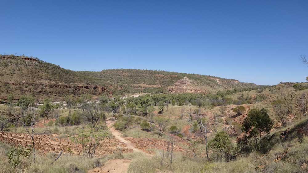 |
| A panoramic photograph near the bottom of the walk down into Porcupine Gorge |
At 1:35 pm I set off to walk down into the gorge which has been formed over millions of years by Porcupine Creek. The gorge is sort of like a mini-Grand Canyon, the creek is way down below the top level. The walk down is easy and you can walk north or south along the bottom. In spots there are pools of water where you can have a swim. Some spots are deeper than others. I pick a spot that is shallower and I slip over going into the water as the bottom has a green growth that gives no grip at all.
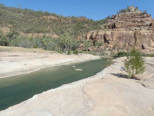 |  |
| Porcupine Creek to the south | The northern end of Porcupine Gorge |
The walk back up is hard, you need a swim when you get to the top! I walked a total of 4.4 kilometres and am back at 3:10 pm. I put up my hammock and start a new Kindle book. It comes over cloudy and the wind picks up. It now feels cool. At 5:05 pm I put on the fire and sit around it having a beer or two. I have some visitors, bettongs, they are so cute. There are quite a few around the place.
For dinner I cook a pepper steak on the grill and make a cheesy rice dish. I also cook some sausages I brought from home (vacuum sealed) which I will make into a curry in coming days. I sit around the fire and read till 8:55 pm when I go to bed. This is probably the earliest I have gone to bed this trip, apart perhaps from when it rained.
Weather: Fine, maximum of 26ÂșC
Arrived: Porcupine Gorge NP Time: 12:10 pm Distance: 237 kilometres
Day 43 â Wednesday 4 August 2021 â Porcupine Gorge
Weather: minimum of ??ÂșC (forgot to record) and fine
I am awake from 3:10 am to 4:10 am so I read till I get tired. I then sleep till 6:30 am. I listen to the news and then make the bed with clean sheets. I get up at 7:25 am. I have breakfast and then try to fly the drone but it is too windy already. I read some more.
At 9:25 am I do the Gorge Rim Walk. This is not signposted at all and I found where I think it starts on my trips to the toilet. It is 1.4 kilometres to the end where there are excellent views back along the gorge. I walk back and have a look at other parts of the camping area, walking 3.2 kilometres in total. I am back at 10:05 am and read and then have morning tea. I am in the hammock and the breeze is quite cool, I have a hoodie on most of the time.
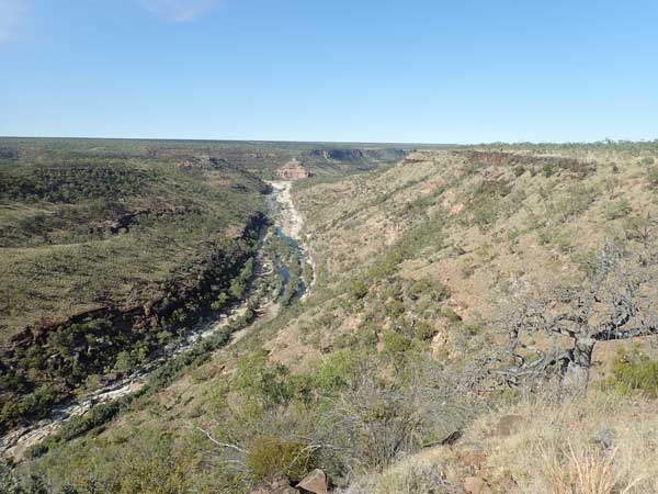 |  |
| Looking to the south at the end of the Porcupine Rim walk | Looking north from the same spot |
The sun comes out occasionally, but mostly it is cool. I have lunch and at 1:00 pm I walk to the road that comes off the highway. It is 2.73 kilometres there, totally contrary to the sign at this intersection which says it is 2 kilometres to the camping area. From memory, the sign on the highway is also totally wrong with the distance to the camping area.
I am back at the camping area at 2:15 pm, total walk 5.96 kilometres. It is now sunny again. I have a couple of cups of tea and later pack up the hammock and solar blanket which I have had out since yesterday when I arrived. I put the fire on at 5:00 pm and have drinks and nibblies. At 5:30 pm the wind drops so I take the drone to the top of the gorge walk and fly it. However, the shadows in the gorge are too long and the gimbal (the camera mount) is jamming.
 | 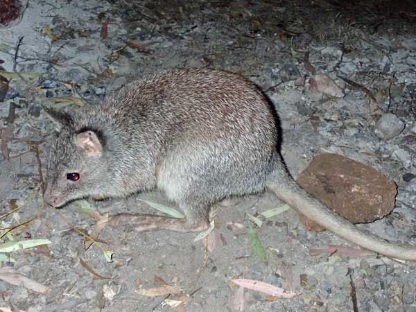 |
| A drone shot looking west over the plateau | A very cute bettong at my campsite |
I go back to the car and clean the gimbal which has picked up a little fine sand. This is common and happens when you take off or land on dirt. There is little wind now but it is cold, I have my jumper on at night which is the first time I have had to do this for weeks. I cook a chicken Maryland again in the small camp oven. Again it takes 30 minutes. I have with more of the cheesy rice.
I read for a little but then watch the stars. I see four shooting stars but no satellites. Two planes fly over to the north-west, a rare occurrence this trip as so few planes are flying due to Covid. I go to bed at 9:30 pm and it is only 9â°C, the coolest evening for a long time.
Weather: Fine, maximum of 26ÂșC
Arrived: Porcupine Gorge NP Time: N/A Distance: 0 kilometres
Day 44 â Thursday 5 August 2021 â Porcupine Gorge to Corfield
Weather: minimum of 5.3ÂșC and fine
An even colder night that two nights ago, but I sleep extremely well, only waking at 6:30 am. I listen to the ABC 7:00 am news and then get up. There is no wind finally so I decide to fly my drone to get some photographs rather than have breakfast.
 |  |
| A drone shot looking to the south at the end of the Porcupine Rim walk | A drone shot looking north from the same spot |
I walk the 1.4 kilometres to the end of the Gorge Rim Walk and fly my drone. I get some really nice photographs of the gorge. I am back at 7:55 am and have breakfast and then download the photos to my laptop. I also try to download my other cameras but once again I have problems. I forgot to bring the proper cable and the one I have works sometimes and at other times, does not.
I then sharpen my chainsaw. I am having problems with it as the chain is not getting oiled automatically as it is supposed to do. I have not been able to figure it out and cannot afford to use mobile phone data to look at YouTube videos in the hope I can find one to help me. I have been manually oiling it since the first week of the trip. I decide I need a small bottle or perhaps an eyedropper or syringe. Later I will get a syringe which makes it easier to put the oil on the chain.
When I get home, I pull the chainsaw apart and finally find a YouTube video that shows me how the oiling mechanism is supposed to work. I pull this apart and discover that the oil has black clumps in it. I think these are actually a sort of algae. I empty all the oil and blow out the pick-up tube that moves the oil to the chainbar. It then works!
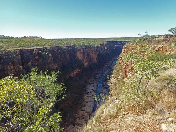 | 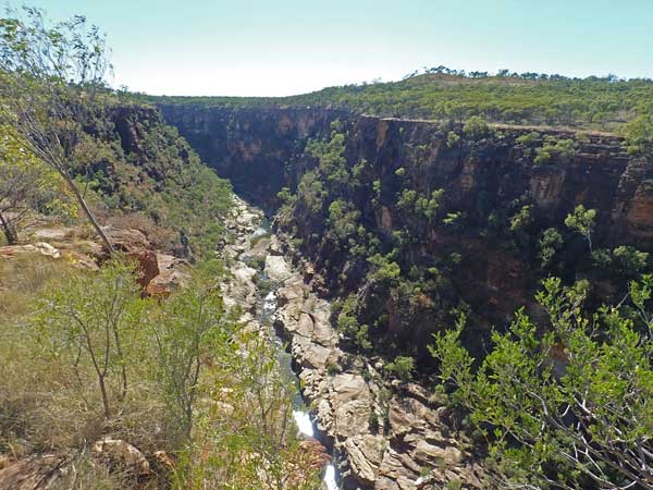 |
| At the Porcupine Gorge Lookout looking south | At Porcupine Gorge Lookout looking north |
Anyway, I leave at 9:40 am and then stop at the Whistling Bore which is just down the highway from the turn-off. This is a capped bore that goes down 500 feet. Air is being sucked into it and causing a whistling noise. Quite an interesting phenomenon. At 9:55 am I arrive at the Porcupine Gorge Lookout. There is a 170 metre walk from the carpark to the lookout (during which I see a red-bellied black snake). The views from the lookout are spectacular. The gorge here is far more amazing than at the campsite.
 | 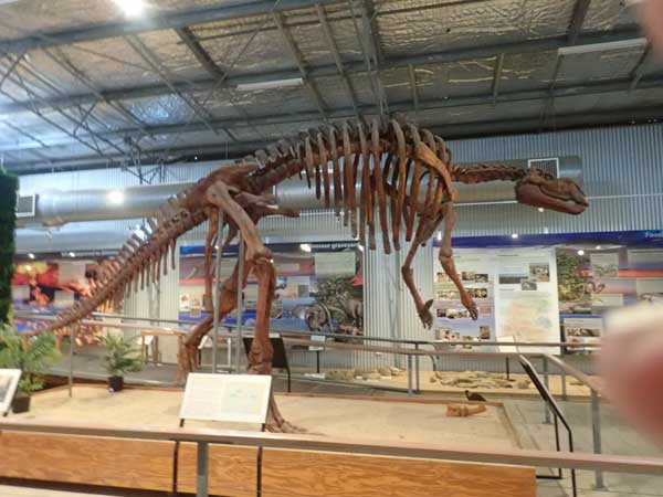 |
| The Flinders River at Hughenden | A replica dinosaur in the Hughenden museum |
I leave at 10:10 am and at 10:50 am I arrive at Hughenden, 76 km from the camping area. I stop at a nice park on the Flinders River and have morning tea. I also attend to some emails as this is the first internet access I have had for three days. I leave the park at 11:30 am and go to the Flinders Discovery Centre in town. This has a small museum about dinosaurs and the local area, $5 entry. Itâs pretty good.
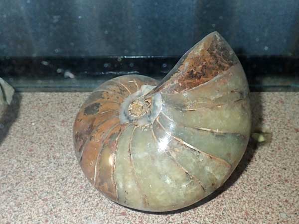 |  |
| A fossilised nautilus, from nearby Richmond I think | Fossilised shark teeth from Richmond, Queensland |
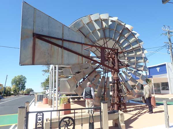 |  |
| A windmill sculpture in the main street of Hughenden | All the garbage bins in Hughenden look like this |
At 12:10 am I walk to the post office as it is quite a nice building and then to the main street. I have lunch at the FJ Holden Café. A hamburger and a milkshake cost $14.50, both are quite good. As I leave I see some religious people sprouting what seems to me to be illogical claims that I do not even really understand. Wackos even out here! I drive to the Coolabah Tree which was blazed by Frederick Walker on 22 October 1861 during the search for Burke and Wills. Walker later died on the return trip from The Gulf. I leave town at 1:20 pm.
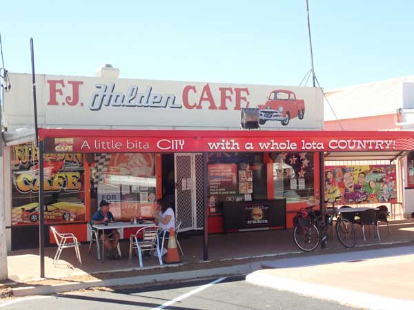 | 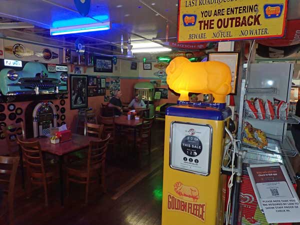 |
| The FJ Holden Cafe | Inside the FJ Holden Cafe |
 |  |
| Me and the FJ Holden | The blazed tree at Camp 23 |
 |  |
| The plaque at Camp 23 | A mural on a water tower |
I take the Kennedy Developmental Road south-west out of town. There are plenty of budgerigars and emus along the road. At 2:55 pm I arrive in Corfield. This is a small âtownâ which was based around the railway line. There is a hotel here but it seems to be closed down, although I note that it appears to open every now and then according to reviews on WikiCamps. The town has a free camping area opposite the hotel and I go in and setup. However, the spot I have chosen is affected by the strong wind, so I move and end up in a spot protected by some trees. Much better. There are nice clean toilets here as well as a wood barbecue.
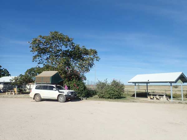 | 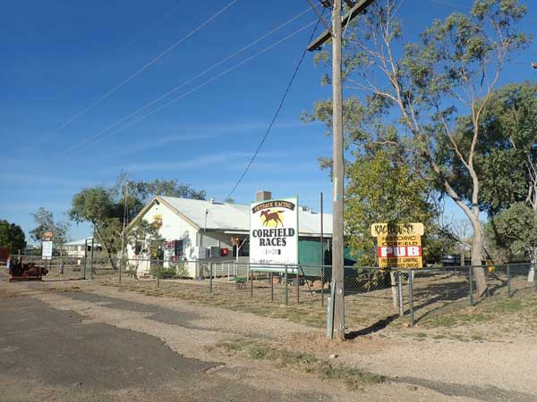 |
| My campsite at Corfield | Corfield Hotel - closed |
I set up my shower and shower tent and warm the water using the engine. I have a nice shower and then a late afternoon tea. Later some more vehicles come and set up, some inside the fence and some on the northern side outside. There ends up four caravans and four cars. I end up having drinks with two couples from two of the vans, they are from Riverina and Mornington Peninsula. After I cook curried sausages and rice for dinner.
 |  |
| A drone photograph looking south, hotel bottom left | A drone photograph of the camping area |
Later Kelly rings me back, I had phoned to see how Veto was going. She is apparently okay. I miss Veto a lot. I also phone Ron to see where they are and also speak to my friend John in Melbourne. It is now very cold and I have a jumper, jacket and trackies (no fire). I go to bed early at 8:30 pm.
Weather: Fine, maximum of 22ÂșC
Arrived: Corfield Time: 2:55 pm Distance: 210 kilometres
Click here to read the next part of the trip.
| 
 v6.00.307 © 2003-2005