|
On 29 November 1954 a new trawler was launched at the Hall, Russell and Company Shipyard in Aberdeen, Scotland. The ship was named the Sir William Hardy by Mrs G. A. Reay, the wife of the superintendent of Torry Research Station, Aberdeen. It was 40 metres long, just over 9 metres wide and a gross tonnage of 418 tonnes. The new ship was presumably named after Sir William Bate Hardy (1864 - 1934) who was a British biologist and food scientist.
 |  |
| The Sir William Hardy is launched | The bell of the Sir William Hardy |
She entered service with the Ministry of Agriculture, Fisheries and Food to carry out research work on fish as food. She was the first diesel electric trawler to be built in the United Kingdom (a diesel engine runs a generator which then powers an electric motor which turns the props - similar to some old Manly ferries in Sydney). The ship carried a crew of 16 and a laboratory and accommodation for four scientists.
She served in this role till 1977. The ship was sold for £40,000 to the environmental organisation Greenpeace. It is said that when Greenpeace purchased the ship, it was a bit of a rust bucket. After a four month refit, she was relaunched on 29 April 1978 as the Rainbow Warrior. The diesel engine was replaced in 1981 and sails fitted in 1985.
 |
| The plans of the Sir William Hardy |
The Rainbow Warrior was Greenpeace's first ship and she sailed the world raising money and getting publicity for the rising environmental organisation. In early 1985 the Rainbow Warrior was in the Northern Pacific on a campaign against nuclear testing. In May 1985 the ship removed about 300 Marshall Islanders from Rongelap Atoll which had been polluted by radioactivity from past American nuclear tests.
After this the Rainbow Warrior sailed to New Zealand to lead a flotilla of yachts which were to sail to Mururoa Atoll in French Polynesia where the French Government had been conducting nuclear testing.
 |  |
| The bridge of the Sir William Hardy | The Sir William Hardy at sea |
During previous nuclear tests at Mururoa, many of the protest vessels had been boarded by French commandos when they were in the shipping exclusion zone around the atoll. Greenpeace's aim was to escort the smaller yachts and monitor the impact of nuclear tests (past and present) and land protesters on the island to monitor the blasts. It was later learnt that the French Government had infiltrated Greenpeace and discovered these plans.
On 10 July 1985 the Rainbow Warrior was at wharf in Auckland Harbour, North Island, New Zealand. Sometime that evening, operatives of the French intelligence service (DGSE) using rebreathers, crossed the harbour and planted mines on the ship's hull. One mine went off (allegedly a smaller one to give the crew time to leave the ship). The crew successfully left the vessel, but some time later photographer Fernando Pereira returned to the ship in an attempt to retrieve his equipment. He was killed when a second and larger explosion rocked the ship, sinking it almost immediately.
A murder enquiry began and a number of the French agents were tracked and arrested. For more details of what happened, Google "Sinking of Rainbow Warrior".
 |  |
| Rainbow Warrior after it sank | The hole blown in the hull is visible after it was salvaged |
The wreck of the Rainbow Warrior was refloated on 21 August 1985 and moved to a naval harbour for forensic examination. Although the hull had been repaired to enable the ship to be reflaoated, the damage was too extensive for economic repair. After representations by the New Zealand Underwater Association, the Rainbow Warrior was scuttled in Matauri Bay in the Cavalli Islands on 2 December 1987.
Today the Rainbow Warrior sits on a sandy bottom at at 26 metres at GPS S34º 58' 29.1" E173º 56' 04.8" (using WGS84 as a datum). There is a mooring here, although it is not actually on the wreck. The Rainbow Warrior is located about two kilometres from Motukawanui Island and at least 25 kilometres (in a straight line) from the nearest town of Kerikeri. The wreck is not all that protected, as it sits within a series of very small islands that do provide some protection, but large seas will always cause problems.
It took us a bit over one hour to travel from where our boat launched (Te Uenga). We have flat seas so it was not a bad trip, but as it is well over 40 kilometres, good sea conditions are needed to come from here or Russell/Paihia. I am unsure where other dive operations run from to get to the wreck, but I assume they run out of boat ramps much closer.
 |  |
| A satellite photo of the area showing the anchor spot for the Rainbow Warrior | The islands to the north-east of the Rainbow Warrior |
The Rainbow Warrior faces south. The mooring is connected to a concrete block and is located about 10 metres north-west of the stern of the wreck. Once you get to the bottom you should be able to see the wreck. If not, head south-east and you should see it within a few metres.
Head to the area under the stern and you will see the prop shaft sticking out of the bottom of the keel. There is no rudder visible, just what appears to be the remnants of the steering gear. head up to the rear deck of the stern. Follow the starboard side of the ship forward and you will swim past cabins and doors. There is a passageway of sorts on this side, but there is no corresponding passageway on the port side.
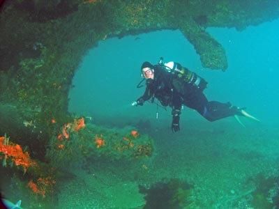 | 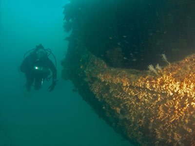 |
| The prop shaft of the Rainbow Warrior | The stern of the Rainbow Warrior |
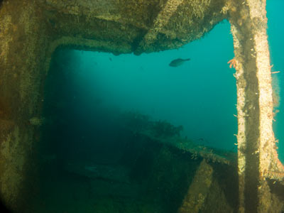 |  |
| Looking forward along the starboard outside passageway | The same passageway, under the bridge area |
Once in front of the bridge, head to the bow. You will see that both anchors have been removed. The forecastle has some bollards and winches/capstans. There are two doors that give entry into the forecastle. You can easily swim inside, but there is little to see.
Behind this there are a couple of large hatches that give access to the lower deck. As this used to be a trawler, these were presumably the holds. You can enter them easily, although only one person should enter at a time. There is a hatch close to the bridge and this lets you see into the area under the bridge and even into the bridge. On my dive here, I found a very heavy weight pocket down here so I moved it up to the bridge for later collection (I later took it to the engine room where a friend took back to the mooring - unfortunately he dropped it!).
Back up on the deck, there is an entrance to the area under the bridge. You can see the door behind the winch in the photograph of the Sir William Hardy above. The bridge area has a lot of stuff hanging down, so you need to be careful when swimming in there.
Behind the bridge you can access the engine room. The engines (both diesel and electric) have been removed as has a lot of other equipment. There is still some equipment here as well as things like ladders and gangways. Above the engine room the funnel is missing. You can enter and exit through here. It also lets a lot of light enter the engine room
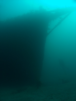 | 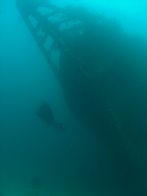 |
| The bow from the starboard side | The bow from straight on shows the list of the wreck |
 |  |
| Looking up out of the engine room | Kelly at a hatch |
Once back outside, you can see the stern part of the wreck. You can enter through the doorways either side of the wreck. It is fairly cramped in this deck, so care needs to be taken if you go inside.
You should still have time and air to explore further, so you can head back to the bridge area or go along the port side towards the bow. If you do go inside the lower deck areas, you will notice that there are some holes in the hull.
Head back to the stern and spend your remaining time here before crossing over to the mooring and ascending.
Visibility when we dived it was only about 10 metres and in spots a bit worse. The water temperature was 22ºC in March.
Return to the Bay of Islands menu.
| 
 v6.00.307 © 2003-2005