|
In mid-June 2012 Kelly and I had planned a trip to dive the wreck of the SS Catterthun at Seal Rocks in NSW. This was being organised by a friend using his boat. However, his video camera housing had a problem and had to be sent back for a repair, so, as the main aim of the trip was to get footage of the wreck for his upcoming DVD, the trip was cancelled.
Rather than cancel our booked holidays, we decided to do a trip back to the Murray River to attempt to do the section of the river downstream from where we had to abandon out attempt over the Christmas 2010/New Year 2012 period due to floods. This gave us eight days and seven nights for the trip.
 |
Our route as recorded by our GPS using OziExplorer and uploaded to Google Earth
Sydney top, Jingellic bottom right, Echuca bottom left |
You can download the Google Earth track of this trip by clicking here and looking at it in Google Earth.
Day 1 - Saturday 16 June 2012 - Sydney to Jingellic
We headed off at the leisurely time of 7:40 am as there was not a lot to see on the way that we had not already seen. It was raining lightly as we left home and it continued all the way, getting much heavier in some locations.
At 10:25 am we stopped at the Mundoonen Rest Area which is just east of Yass. This is a not a bad rest area, with shelter and tables as well as shelter for some cars. Of course there are also toilets and this time they were pretty clean (once before they were filthy). We have our dog Veto with us on this trip so we also need to give her a wee break. It is 251 kilometres from home to here, so we have had a good run. There is little traffic on the road. It is drizzling and cold and we use one of the shelters for our morning tea break.
After morning tea we leave at 10:45 am with Kelly driving. At 11:50 am we stop at Gundagai to see the Dog on the Tuckerbox. For those who do not know, this is a famous monument to the pioneers and features a dog sitting on a tuckerbox (lunch box) and was inspired by a story called Bullocky Bill written by an unknown person using the name Bowyan Yorke. It was published in 1857. A later poem by Jack Moses was published in the 1920s. Around this time a very simple monument was erected and on 28 November 1932 the current monument was unveiled by the Prime Minister of Australia, Joe Lyons.
In 1937 a song called Where the Dog Sits on the Tuckerbox (5 miles from Gundagai) was written by Jack O'Hagan. This became a hugely popular song and even today is considered one of the most famous of all Australian songs.
 | 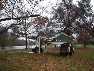 |
| The Dog Sitting on the Tuckerbox | Our camp site at Jingellic Reserve |
As you can see from the name of the song, the monument is five miles (eight kilometres) from Gundagai. It is now just off the highway on the old road and we stop to have a look. I have seen it once before but have never taken a photograph of it. Kelly decides to get a coffee while I take some photos. We are back underway at 12:05 pm. The Murrumbidgee River at Gundagai is really flowing as we cross over the new bridge that was being built the last time we came this way. This bridge, which duplicates the older one, is the longest bridge in NSW, beating the Sydney Harbour Bridge by one metre.
At 12:45 pm we pull into a rest area south of Tarcutta for lunch. It is 442 kilometres from home, meaning we have averaged 88 km/h even including our stops. We head off after about 20 minutes and the rain gets heavier. My original plan was to turn off just after Tarcutta but since they put in the by-pass of the town, the road I want no longer connects to the highway. I did not realise this and we should have went into the town. We turn off on the Tumbarumba road and then take some dirt roads through state forests at Carabost, then some other minor roads.
We arrive at Jingellic at 2:20 pm. It is still raining. Jingellic consists of a small general store, a few houses and a pub. It is on the Murray River (NSW side) and right next to a bridge across into Victoria. There are two camping spots here, both called Jingellic Reserve. One is in NSW and the other in Victoria. In December 2010 we stayed at the Victorian one, this year we are staying in NSW.
The NSW Jingellic Reserve is below the Jingellic Bridge Hotel (the old bridge crossed the Murray River right next to the pub). Our plan is to camp here and later go to the pub for a drink. There is only one other couple camped here (in an old caravan), a very strange pair who have a 23 month old son. They hardly talk at all as you will soon see. When we arrive we see that the ground is very wet and there are only a few relatively dry spots. One of the spots is right next to a shelter that does not have a table or barbecue under it, meaning there is some room. It does have a pile of timber there.
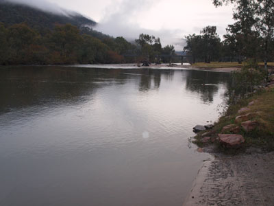 | 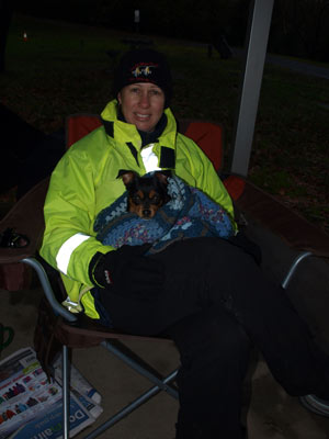 |
| The Murray River at Jingellic | Kelly and Veto at Jingellic after dinner |
We pull up and decide to park next to it, with our Shippshape awning stretched out to join up with the shelter, giving us a fair bit of dry space. It also means that we can sit on the concrete and not have wet feet etc. I push all the timber off the concrete, as well as a pair of sneakers. I assume that the last person using the shelter has left all this behind.
As it is still raining, we initially just set up our chairs under the shelter. We have a cup of tea and read our books. Meanwhile, Veto goes for a run around the reserve, getting very wet and muddy. At about 4 pm the rain eases a bit so we open up the Shippshape and also put out the rear awning. Around this time the bloke from the caravan comes and grabs the timber and shoes, appears they were his wife's. He does not say a word. At 4:30 pm it stopped raining (well, almost).
At 5 pm we have drinks and nibblies. As it gets dark, the bloke and his wife come out and try to start a fire. They are not going very well as everything is quite wet. I give them a firestarter to use and some more paper but even this is not enough. I get my flamethrower attachment and add it to one of our almost empty gas bottles (for our gas stove). Using this means eventually the fire catches alight. All this time not more than a grunt from either. We come to the conclusion that he is an ex-crim (as he has P plates on his car but is well past 30).
At 6 pm Kelly puts on our dinner, her famous creamy garlic prawns. I cooked the rice last night and put it in a Chinese food container I saved for just this purpose. It is really a pain cooking rice out in the bush and this works much better. We have the prawns and rice with some nice bread sticks. The only thing missing is a fire.
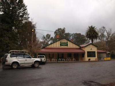 |
| Outside the Jingellic Hotel |
At 7 pm we put Veto on her bed in the passenger seat and we had off to the pub. South Sydney is playing Parramatta tonight and I think we will be able to watch it. Wrong, they do not have pay TV as it costs too much. At least it is warm. We discover that Australia is playing Wales in the Rugby so we watch this. There are some cricketers from Wodonga here and we talk to them.
It is a great little pub, with food (lunch and dinner). We had lunch here on our last visit and it was very good. We end up having a few beers, a bottle of wine and a few Baileys between us. Australia wins the Rugby in the last minute and Souths win as well (I am watching results on my iPhone app). We have a game of pool and Kelly beats me on the black ball!
We end up leaving at 10 pm and are in bed by 10:10 pm. It is very cold, but at least the rain has basically stopped. Veto sleeps up in the Shippshape with us, she alternates from being at our feet to being in between us with her head on the pillow. I swear that she thinks she is human.
Weather: Raining, max 12ÂșC Arrived: Jingellic Time: 2:20 pm Distance: 520 kilometres
Day 2 - Sunday 17 June 2012 - Jingellic to Burrowye Reserve
Weather: Overcast, 6.6ÂșC minimum
It rained for a few minutes at 6 am which woke us but none after this. We get up at 9 am and there is a very cold wind blowing. It is only 7ÂșC but seems much colder. We have breakfast and actually speak to the bloke in the caravan. He is a lot more communicative today, but still not a great talker. We end up telling him about a few camping areas nearby.
We leave at 11:25 am. We only plan to go a short distance so we have read a bit after breakfast and to let the tent dry out a bit. We cross into Victoria and head west towards Albury. Five minutes down the road is Gadds Reserve (or perhaps Gadds Bend Reserve). We go in and have a look. It is a nice spot, a better camping area than at the pub, but no facilities.
 |  |
| Gadds Reserve | Our camp site at Burrowye Reserve |
At 11:50 am we arrive at Burrowye Reserve. This is also on the Murray River. It is 25 kilometres from Jingellic (probably a few less when you take off our side-trip to Gadds). Like Gadds, this is quite a large reserve. There are a number of different levels where you can camp. We end up driving along the whole reserve and pick a spot towards the northern end. It is just above the river's edge and is flat and grassy.
There is no-one else here, so we have the pick of the place. There are quite a few other good spots, including some right at the northern end past the trees (you cannot see the way through till you are close) and also at the southern end. We set up our campsite and then go for a walk along the river to the south. Veto has a great time, exploring everything. However, when she sees the cows grazing on the reserve (there are about half a dozen) as well as the ones across the river in NSW, she barks and barks at them.
 | 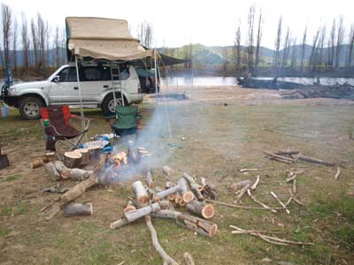 |
| Another shot of our camp site at Burrowye Reserve | Our campfire at Burrowye Reserve |
There is a lot of timber here, all washed ashore in one of the many recent floods. I use the chainsaw to cut up a lot. This is about 75 metres from our campsite so it takes us a bit of time to transport the timber back to the car.
It has been overcast all morning but after midday there are some glimpses of the sun. It is still cold. We have set up the side and back awnings as it looks like there will be some rain. We have lunch and then read for the rest of the afternoon, broken only by some more timber cutting and gathering. There are some light showers during the afternoon and later the farmer from across the road comes in a tries his luck at fishing (he got nothing).
As it is so cold, I have started the fire very early and we have been sitting around it as we read. We are also having a roast dinner so we need coals for the camp oven. I set up the Twine hot water shower and we have showers (luckily before the farmer turned up!).
 |
My artwork on a tree trunk on the river edge at Burrowye Reserve
MM Loves KM! |
We have drinks and nibblies at 5 pm and at 6 pm I put the roast on. Kelly has made a Waldorf salad to go with it, so we are not doing vegetables tonight. The meat is done about 6:45 pm. The pork is a Woolworths one and probably the best pork we have had (most are a bit too fatty).
After dinner we read around the fire. There has been no more rain, but it is very cold once you move from the fire. We take some coals every 30 minutes or so and put them under our chair. This heat then warms up your bottom and back. It is a trick I learnt about 10 years ago from members of the Jeep Club of NSW.
We go to bed at 9:50 pm.
Weather: Overcast and only a few showers, max 10ÂșC Arrived: Burrowye Reserve, Victoria Time: 11:50 am Distance: 25 kilometres
Day 3 - Monday 18 June 2012 - Burrowye Reserve to Murray Valley Regional Park, Collendina Precinct
Weather: Overcast, 4.4ÂșC minimum
It was quite cold last night. In addition, we were continually awoken as the cattle over the river in NSW have been mooing on and off all night. Who knows what has been upsetting them. We get up at 8 am and it has warmed a little to 6ÂșC. It is foggy and overcast. After I have breakfast I take Veto for a walk to the other end of the reserve. On the way back Veto decides to roll in cow shit! She now stinks. We have to get some paper towels and water and clean the smell off her. Bad girl!
We pack up and leave at 9:50 am. Just a kilometre or so along the road (Murray River Road) is the top end of Lake Hume. More about this later. Twelve kilometres along is Kennedy Reserve. There is no sign here saying that you cannot camp here. We continue on, having a look at the ferry at Wymah that takes you over a narrow section of the lake to NSW. This only carries two cars at a time.
The views along the lake are very nice, with lots of small picnic areas (no camping permitted). At Bellbridge there is a bridge across the lake to NSW. It is called the Bethanga Bridge and was built between 1927 and 1930. In 1961 the whole bridge was raised by 300 mm due to the capacity of the dam being increased.
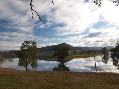 |  |
| Lake Hume | The Wymah Ferry across Lake Hume |
We go to the dam wall and stop here for morning tea. There are some nice shelter sheds and tables for picnics. It looks like you can walk across the dam wall, but certainly today there is no access. It is still cold and overcast. Hume Dam was built from 1919 to 1936 and holds back what is now called Lake Hume. When it is full (as it is now, it holds five Sydharbs (the volume of water in Sydney Harbour). In 2007 it was only 1% full.
It was 11:05 am when we arrive and we leave 20 minutes later. We go into Albury (87 kilometres from Burrowye Reserve) getting there at 11:45 am. We need fuel and also a couple of things from the supermarket. We leave at 12:10 pm.
On the way out we notice a monument at the east end of town on top of a hill. We need to go almost past it and as we approach we see the signs to it. We head up Monument Hill and find that it is a war memorial. There are nice views back across the city and also some tables and toilets. We are only here 10 minutes or so before leaving.
 |  |
| Bethanga Bridge | The Hume Dam wall and spillway |
We are heading for the Collendina Precinct of the new Murray Valley Regional Park in NSW. This used to be Collendina State Forest but in about 2010 it was added to the national park estate. We head out to the north-west on the Riverina Highway to Howlong.
At 1 pm we arrive at Howlong and after passing through the town, we head over towards Victoria. We cross over a bridge (but not over the Murray River, but a branch of the river). There is a park down on the left and we decide to stop for lunch. It is a very nice park, with tables, a children's play area and toilets. We did not see any sign banning camping. It is on the edge of the anabranch (an anabranch is a minor branch of a river, normally only carrying water in times of flood).
 |  |
| The Albury Monument Hill War Memorial | The view from the war memorial back over the city |
We leave at 1:30 pm. Before we exit the reserve we go down a track towards the south. This goes to another part of the reserve. There are spots to camp here, but it is not the greatest location, there is a derelict caravan camped here and there is lots of rubbish. Back on the Chiltern-Howlong Road and just before the actual river, we see another track down to the left. There is a better spot here, but still not great.
We cross over into Victoria and then take the Gooramadda Road to the west. All along here are the Rutherglen wineries. There are plenty of places to taste and buy wines. We pass through Rutherglen and then cross the Murray River again back into NSW. Just over the bridge as you enter Corowa there are more nice picnic areas.
We were going to stop for a beer in one of the pubs in Corowa but the ones that were open did not have a beer garden where we could take Veto. We head out of town on Spring Drive. It is only a few kilometres to Collendina. We find the turn off easily and though there are no signs on the road itself (there are signs just inside the fence and you will see these). We entered the first section. The reserve is mostly level with the main road and high above the river/anabranch. There are spots down lower, but they are very muddy and the area probably flooded in March.
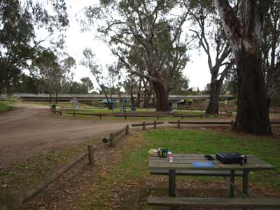 |  |
| The picnic area at Howlong | Our camp site at Collendina |
We examine the whole area and pick a nice spot. There is a fire still smouldering here and it is flat and grassy. I get the fire going with little effort. It is still only 2:30 pm but cold.
There is a lot of water in the anabranch and it is flowing quite well. You can just see the Murray River through a channel that connects the anabranch to the river. We read for the rest of the afternoon, also watching the birds. There are lots of cockatoos, but what interests us are the wrens. There are plenty of them, but they are not the normal ones we see back home. I have a look at our bird book and figure out that they are eclipse superb blue wrens and female blue wrens. The eclipse means they are juvenile males, not yet fully mature. They hop all over the campsite, catching insects. There are sometimes as many as 10 around us.
We gather some firewood. There are pieces left at the campsite we are using as well as pieces at other nearby campsites. We also bought with us a lot that we cut yesterday and we use some of that as well.
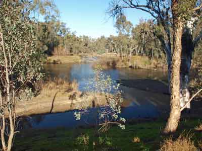 |  |
| The Murray River and anabranch at Collendina | Michael and Veto at Collendina |
We decide to have showers. I discover that it is a bit hard to get water from the anabranch as the banks are so steep and the bottom is very muddy. I end up using a rope tied to the water container and throw it into the water. I then use a large stick to sink it so it will fill and then haul the container back ashore.
We have our showers using our Twine hot water shower and then drinks and nibblies. Like last night we are the only people in the whole reserve. There is a bit of traffic on the main road which we can see less than 500 metres away. We figure that once it gets dark there will not be much traffic and we are right.
 |  |
| Kelly drying her hair via the fire | Another shot of our camp the following morning |
We are having steak and sausages with salad for dinner. I gather some very small twigs to use for the cooking. We have a Biji Barby which is a small metal barbecue on collapsible legs. I have found that it is best to use small twigs when cooking as you need flame. Coals are no good as the metal does not have enough thickness to retain heat. I cook up the steaks and sausages very quickly.
After dinner, Kelly puts on her sticky date puddings. She has made this up during the afternoon. She cooks them in the camp oven and we have one each with her home made butterscotch sauce and double thick cream. A little before this at about 6:30 pm a sort of mist comes over. It is not too bad, but at 8:30 pm it turns to a light shower. We go to bed then and read till 9:30 pm.
About midnight there is a very heavy shower, but it does not last long. It is a lot warmer during the night.
Weather: Overcast with a few light showers in the evening, max of 12ÂșC Arrived: Murray Valley Regional Park, Collendina Time: 2:30 pm Distance: 170 kilometres
Day 4 - Tuesday 19 June 2012 - Murray Valley Regional Park, Collendina to Murray Valley Regional Park, Mulwala
Weather: minimum of 9ÂșC and overcast
As mentioned, it was a lot warmer last night. As normal, once I am awake I listen to the main 7:45 am ABC Radio news. Normally I would get up after this but as we are not moving much, there is no need to rush. I stay in bed for 30 more minutes and listen to AM. It is nice to be able to relax and not rush. For the first time on the trip it is sunny. However, the wind is still blowing and it is cold. Everything that got wet during the night dries out nicely. We have breakfast and then read for a bit. We pack up and leave at 10:40 am.
We get back on the main road (Spring Drive) and head north-west. A few kilometres along we notice another entrance to the regional park. We miss it at first but turn around and go back for a look. It is a nicer spot than where we camped last night. We head along the track that runs parallel to the main road and come back out on another entrance. We continue to the west.
At 11:10 am we come to Lake Mulwala. This is really a back up of the Murray River created by a weir at Mulwala which causes the river to flood across some low country, filling anabranches and billabongs. We stop at Kyffins Reserve which is 24 kilometres from the Collendina reserve.
 |  |
| Lake Mulwala | Kelly with Veto at Lake Mulwala |
Kyffins Reserve has dozens, if not hundreds, of campsites. There are lots of trees and it runs along the edge of the lake. The lake is full, but you can see from Google Maps that this is not always the case. We drive in and have a look. At the moment there are a few people camped here, but it is not too busy. There are some very nice grassy spots too. There are no toilets at all, even though there is over one kilometre of camping area. Seems you have to bring your own chemical toilet.
We stop and have morning tea here. The dead trees which go right across the lake are a sight reminiscent of Lake Menindee in Western NSW. We leave at 11:35 am.
 |  |
| An interesting tree at Lake Mulwala | Alongside Lake Mulwala at Kyffins Reserve |
We arrive in Mulwala at 11:40 am and stop at a boat ramp and reserve to use the toilets. A pity there are none out at the other spot (or for that matter in the regional park). We do not stop long and head through Mulwala to Yarrawonga in Victoria. Yarrawonga is a lot larger than Mulwala and is even bigger than I thought it would be. There are hundreds of shops in the main street. We head back across to NSW and go into Club Mulwala car park.
We do not want to go the club, but we noticed that they have a DC-3 perched on a pole in the car park. In addition, there are two tanks and some artillery alongside the access road. We stop for a few minutes while I take some photos. The tanks are a Centurion and a Leopard. I even find a floating mine near one tank.
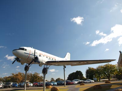 |  |
| The Douglas DC-3 at Mulwala | The floating mine |
 |  |
| The Centurion Tank | The Leopard Tank |
We go to the newsagents to get a paper and then attempt to head out of town. However, we take a wrong turn and go down a road past a huge factory complex. Looking at the barbed wire fence, I figure this is not the normal sort of factory. It turns out that it is a former Australian Defence Industries armament factory, now owned by Thales. It must employ quite a few people as there are lots of cars in their car park.
We find the right road and head west towards Tocumwal. It is 12:15 as we finally get out of town. About seven kilometres out we come to the entrance to the Murray Valley Regional Park, Mulwala Precinct. We enter and start checking out some of the tracks. There are no signs at all, so we have no idea of where each of the roads goes to. The first one which goes off to the left and then left again comes to a long and very muddy puddle. As our winch is not working (we had some work done on the car just before we left and it looks like they removed the bulbar and undid the cables and did not put back together correctly), we are not prepared to risk crossing it. We head back and eventually come to an area where there are some vehicles camped by the river.
 |  |
| Our camp site at Mulwala | Another view of the camp site |
There are lots of camping sites here. There are probably only three or four groups camped here, but we prefer to be alone, so we head towards the south (or south-east). We pass some nice spots, but unfortunately many of the spots have heaps of rubbish. Why do fishers (and I am assuming that they have been fishing as there are bait wrappers and fishing line everywhere) never seem to clean up after themselves? We come across this at wharves and boat ramps where they leave bait bags and fish guts everywhere.
We come to the southern end of the road (it continues on, looping back) and decide that this is the best spot. It is on an intersection of the Murray River and an anabranch. It is a very nice spot indeed. It is now 12:55 pm. We set up camp on this flat grassy site. The sun is out so it is quite nice, although it is only 13ÂșC.
We have lunch and then sit and read for a while. The main point of this holiday is to relax as we have had a stressful start to the year, especially for Kelly. After a while we decide to go for a walk. We follow the track around past where we are camped. We find another very nice camping spot about 400 metres from us.
 | 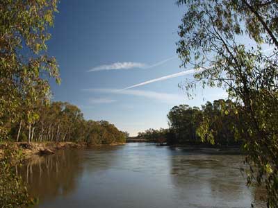 |
| The view out of the Shippshape Tent | The actual view from outside looking up the Murray River |
We return to the camp site and read some more before having another walk back along the way we came in. This is where we find even more rubbish left by previous campers. I collect as many of the cans (rum and cola or VB as usual). There is even a whole tree stump on fire. From experience as a professional bushfire fighter, I know there is no point putting water on it as it will restart again. Why the hell would you light a fire around a tree stump unless you were an idiot?
Back at the camp site it starts to get cooler so I set up the Twine hot water shower. It is really nice to have a full 10 litres shower. I have already started the fire and we have drinks and nibblies. There was a bit of timber here so we have not needed to collect any more today. Kelly cooks her pesto chicken pasta which is one of my favourite meals.
After dinner we sit having another drink and reading. All of a sudden, at 8:56 pm, a dog over in Victoria starts howling. About 30 seconds later, my chair starts shaking . What is happening? I look at Kelly's wine glass which is in her chair's cup holder. The wine is rolling around all over the place. We both yell "Earthquake!". After about 30 seconds of shaking it stops. All of a sudden thousands of white cockatoos take off from the trees to the north of us, all squawking their heads off.
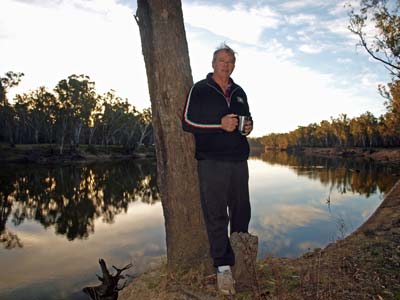 | 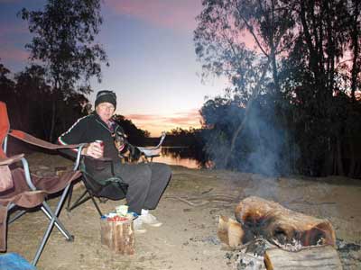 |
| Michael having a cup of tea on a walk | Michael and Veto at sunset |
I go to the car and turn on the radio. I find a station in Melbourne and they are talking about it. Over the next hour we hear people call in from all over eastern and southern Victoria reporting the earthquake. It turns out that it is centred near the small town of Moe which is south-east of Melbourne. The quake measured 5.4 (was at first said to be 5.3) and was quite shallow. This was the equal strongest earthquake ever recorded in Victoria. It certainly made the earth move for us!
We go to bed at 10:00 pm and read for a while and listen to more radio reports about the earthquake. Luckily there was little damage. It is very cold overnight due to the clear skies.
Weather: Fine, max of 13ÂșC Arrived: Murray Valley Regional Park, MulwalaTime: 12:55 pm Distance: 58 kilometres
Click here to read about the last part of this trip.
| 
 v6.00.307 © 2003-2005