|
Michael McFadyen's Scuba Diving - Manta Alley, Indonesia
In September 2012 Kelly and I did a week long liveaboard dive trip in Indonesia which went from Bali to Komodo and back. We went on the MV Mermaid II. Click here to read about the boat. This is one of the dive sites we did on the trip. The trip heads north-east from Benoa Harbour on Bali out north of Lombok and then north of the other islands to Komodo Island and then down the eastern side of Komodo to the southernmost point of Komodo. For all dives on this trip we used 31% Nitrox, so bear this in mind when considering the bottom times we did.
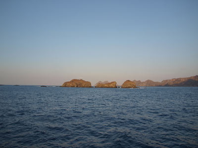
Manta Alley is located at the southern end of Komodo Island. Famous for its dragons, the southern end of Komodo is one of the most spectacular places I have ever visited. The southern end has very large bay that has a small island to the east and extremely steep cliffs on Komodo that drop straight from perhaps a thousand feet to the water. In addition, there are a number of rocks that provide a bit of protection to the south. An approximate GPS mark for the dive spot is 8Âș 44' 9.7"S 119Âș 24' 55.8"E (using WGS84 as the datum). The site is to the west from the GPS mark.
 |  |
A satellite photo from Google Earth that shows the
location of the dive site around rocks left of arrow
GPS is at tip of arrow | A photo of the dive site |
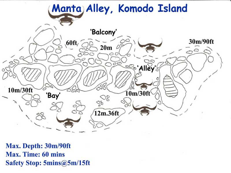
The actual site is located in a large bay on either side of a series of five rocks that jut up from the sea. The name Manta Alley comes from a channel that runs north-south between the westernmost rock and the next one. You can dive anywhere around these rocks, but I will explain in detail the preferred way.
 |
A map of the dive site - north is at the right of the map
Used courtesy of Mermaid Cruises |
As with virtually all dive sites that you do when on MV Mermaid II, you use the RIB (rigid inflatable boat) to get to the start of the dive (and also to get back to the boat). The RIB will drop you normally about on the western side of the rocks, probably towards the south western most spot.
Once you enter the water, you drop to the bottom which looks amazingly like the terrain around Fish Rock in New South Wales. We drop to about 14 metres and then heading for the north, we drop gradually to 26 metres.
We are looking for manta rays, but we see none. The bottom is much deeper here, reaching down to 30 and further on, 40 plus metres. At that depth the bottom appears to be sand. The reef we are on is a sloping rock.
 |  |
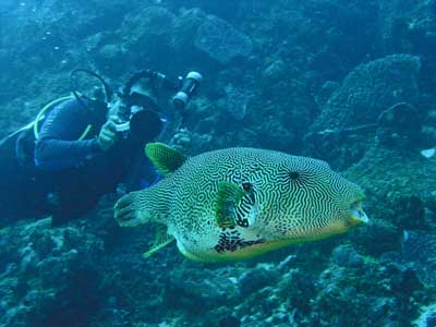
| Kelly on the southern side of the site | Starry pufferfish I think |
After about 15 minutes we enter the Alley. This is a gully that runs to the east and the other side of the rocks. We enter it and start ascending a little. This is supposed to be the best place to see mantas, but we see none.
At about 10 metres we exit the Alley and head to the south. Again, the bottom is similar to Fish Rock. We continue going to the east and see lots of small yellow sea cucumbers. There are hundreds of them, some in large groups.
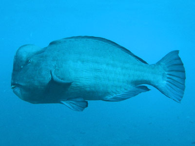
When we get towards the southern side we turn around and head back towards the Alley. There are lots of small fish around and we even see one large hump-headed wrasse.
 |  |
| A large hump-headed parrotfish | Bright yellow sea cucumbers, having an orgy? |
Back near the Alley, we do our safety stop on the reef.
Although we did not end up seeing any manta rays, it was an enjoyable dive. The visibility was 30 metres and the water temperature was about 27ÂșC.
Click here to return to the list of sites we did on our MV Mermaid II trip.
| 
 v6.00.307 © 2003-2005