|
For most of the past decade, Kelly and I have attempted to get away camping for the period between Christmas and the New YeaLinkr. For 2012, we decided to leave before Christmas Day and spend 11 nights visiting the Victorian High Country. We have visited there three times before, a big trip back in 2007 and smaller trips in 2010 and earlier in 2012.
For this trip, we are visiting a couple of spots that we saw in 2007 but which we did not get a chance to spend more time exploring. Other places will be totally new and some other bits we are doing again as Ron and Donna are also coming with us and they have not been there before.
On the trip are Ron and Donna in a Toyota Prado 120 series and Kelly and I in our 1999 Toyota Prado 90 series. However, Ron and Donna cannot leave till about 1.5 days after we do so we plan to meet on Christmas Eve at a pre-planned location.
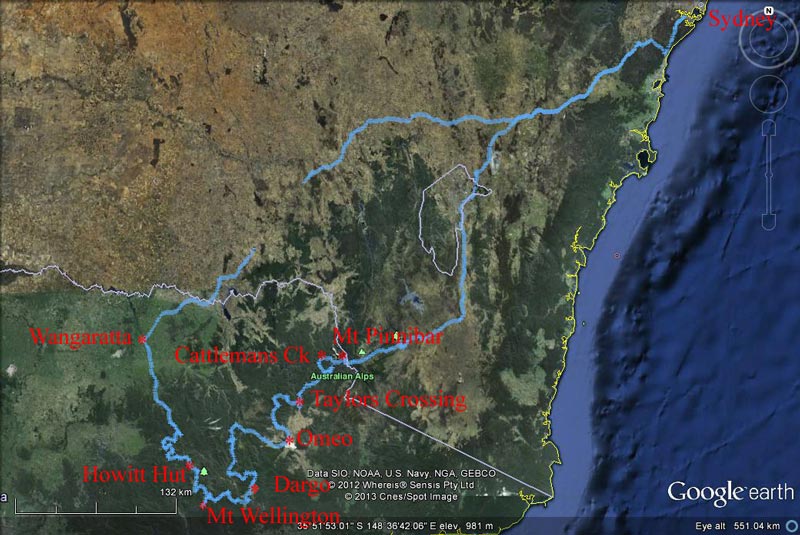 |
| Our route as recorded by our GPS using OziExplorer and uploaded to Google Earth |
You can download a self-extracting Zip file which contains Google Earth, Garmin and OziExplorer tracks of this trip by clicking here.
Unfortunately, on the Thursday before we leave we had to fly to Melbourne for the funeral of my father's brother Bobby McFadyen. That was a long day and on the Friday we have to stay up late finishing many things we had originally planned to do on Thursday afternoon.
Day 1 - Saturday 22 December 2012 - Sydney to Bennies Camping Area, Alpine National Park
We are up early and depart home in Sydney at 6:55 am, five minutes earlier than planned. This is a first, we are normally late! We have a long way to travel today, at least 700 kilometres as far as I can figure out. Most of it will be on freeway where we will average about 100 km/h so it should take perhaps 8 driving hours. It is 20ÂșC and light cloud as we leave home.
As normal when we head south-west, we travel via the Princes Highway and M6 to Bulli Tops and then via the Appin Road to Appin. From here we head via Broughtons Pass to Wilton and then onto the Hume Highway. Without any traffic we reach the Hume at 8:00 am. This way is not a lot quicker than heading straight to the M5 via King Georges Road, but it is a lot shorter distance. Once on the Hume we head south.
As can be expected we have a good run and sit on our normal freeway speed of 100 km/h. I have found that our fuel economy is hugely better if I cruise at this speed rather than the limited 110. As we have been this way many times before, we will not be stopping anywhere for sightseeing.
At 9:45 am we stop at the Mundoonan Rest Area which is just east of Yass. This is a not a bad rest area and we stop there quite often. There are shelter and tables as well as shelter for some cars. Of course there are also toilets and this time they were again pretty clean (once before they were filthy). It is 251 kilometres from home to here, so we have had a good run. There is little traffic on the road. After morning tea we leave at 10:05 am with Kelly driving.
Fifteen minutes and 17 kilometres later we come to a complete halt. The traffic is stopped dead and there are signs saying "Roadworks". I think "what a bunch of idiots, who would do roadworks on the main road out of Sydney on the Saturday before Christmas". The traffic starts moving slowing and we notice that no-one is in the left lane, everyone is moving to the right. We go up the left and about one kilometre on we finally have to move to the right lane. Turns out it was not roadworks, but a semi-trailer had caught fire sometime during the night. The trailer was on the side of the road totally burnt out and they were attempting to remove things from it with a front-end loader. Still idiots, they should have left it till the afternoon, it was causing no problem where it was. We get through in about 10 minutes.
We pass by the exit to Jugiong, a place we have a love/hate relationship with (read why in this link). We do not stop at Albury for fuel as normal as I will get it in Wangaratta.
At 11:45 am we pass by Tarcutta (the highway now by-passes the town), 415 kilometres from home in 4.5 hours travelling time (92 km/h). We stop at Holbrook for lunch at 12:30 pm. It is now very warm, 29.5ÂșC and sunny. The rest area next to the submarine is extremely busy, but we have no problems finding a table where we can make our lunch. We leave at 12:50 pm. I am back driving.
We arrive at Wangaratta at 2:15 pm. We find the Coles petrol station and refuel (I have a good discount voucher to use). We take 87.5 litres at $1.39 $121. We have averaged 13.7 litres/100 km since Sydney at an average driving speed of 93.5 km/h for the 623 kilometres. We also have a toilet break and find a chemist to purchase some forgotten things. We depart at 2:25 pm and head out on the road towards Whitfield. To access this road you have to come through Wangaratta as there is no link to the highway. It is now even hotter, 32ÂșC.
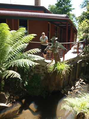 | 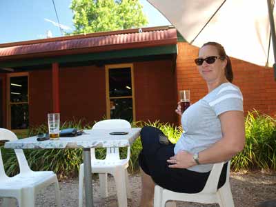 |
| The Mountain View Hotel, Whitfield | Kelly enjoying a beer at the Mountain View Hotel, Whitfield |
There is a nice camping area called Edi Camping Area 37 kilometres from Wangaratta alongside the King River in, funnily enough, a village called Edi. Just past this on the left there is another camping area. There are lots of wineries along the river.
At 3:05 pm we come into Whitfield (51 kilometres from Wangaratta). We stop at the Mountain View Hotel for a beer. I have a Beechworth Pale Ale and Kelly has a Beechworth Red Ale. It is nice and refreshing. This is a very nice hotel with some accommodation and a restaurant. I do not think there is any fuel here, even though there was a place with fuel bowsers. We leave at 3:30 pm.
Ten minutes down the road we stop and cut some timber for a fire. This only takes five minutes. We drive through Cheshunt. We are following the Upper Rose River Road. Around here it becomes dirt but it is a reasonably good road and we arrive at Bennies Camping Area at 4:10 pm. This is located on the Rose River.
 |  |
| Bennies Camping Area | Another shot of the camping area |
There are three parts to the camping area. The first one is the best, it would hold 10 to 15 cars. Then next one is second best and could hold five or seven cars, the last one only a few. Another car turns up as we are checking out the far sites, but we return to the first one and are alone.
We set up camp in a very nice camping area, grassy and right next to the river. Normally I would also set up our Twine hot water shower and have hot shower. However, it is still very warm, so we go for a swim/wash in the river. We later discover a deep hole to the south of where we camped.
At 5 pm we have some nibblies and drinks. It is so warm we do not bother starting a campfire. We watch the small finches and wrens around the camping area. There is also what I think is a juvenile kookaburra which makes a funny sound like "help help".
 |  |
| Our campsite showing the Rose River | The deep pool in the Rose River |
About 7 pm I cook up a Thai beef curry and serve it with rice I cooked before leaving home. This is a nice easy dinner after such a long day's driving. We are exhausted, so we go to bed at 9:00 pm and are asleep by 9:15 pm. It is still 17ÂșC when we go to bed despite it being 470 metres high.
Weather: Sunny, max 32ÂșC Arrived: Bennies Camping Area Time: 4:10 pm Distance: 706 kilometres
Day 2 - Sunday 22 December 2012 - Bennies Camping Area to King Hut, Alpine National Park
Weather: Fine, 11ÂșC minimum
We got a bit cold during the night with only a blanket, so I had to get the sleeping bag out and spread it out as a doona. I did not think I would have to do this for a couple of days.
Today we do not have to travel far. We have visited most of the spots we are going to, so we can start late. I get up at 8 am after listening to the 7:45 am ABC Radio News. The back door of the car is locked. Bugger! I have to climb in over the fridge and move things away. It seems that some things have become jammed between our shelves and the door lock, causing it to stay locked. Soon fixed!
I have breakfast. Last night I started reading the first of the books I have brought along. I only get time to read books when away on holidays. I will probably read about three large novels over the coming 10 days. I continue reading a book on the Marx Brothers and their movies. Kelly gets up at 8:40 am and at 9 am we go for a swim in the deeper hole. It is nice and refreshing
This is a nice camping area and it is pleasant staying here for the first part of the morning. We eventually pack up and head off at 9:35 am. Our first destination originally was to be Pineapple Flat Camping Area. However, I have had to modify the route we take as a section of the Circuit Road near Mount Stirling is closed and this affects which way we can go.
 | 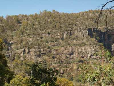 |
| The mother and baby deer | The two waterfalls coming off the Cobblers plateau |
We decide to head for Lake Cobbler. We follow Lake Cobbler Road which is two wheel drive standard. Twenty minutes along we come to Whites Bridge. There is a camping spot about one kilometre past it. Around here we come across three deer. There is a male and female and a baby. The baby does not follow its parents off into the bush and we follow it for about a kilometre till it finally decides to leave the road.
We pass Little Cobbler Track which we intend to take after the lake. At 10:20 am we come to Abbeyard Road and turn right. This road is the way we came in last time we were here. It is 17 kilometres from the camp site. We stop and take some photos of the waterfalls just past here. We arrive at Lake Cobbler at 10:30 am. It is sunny and warm, 29ÂșC already, especially considering it is 1114 metres. We have morning tea here and read for a while.
 |  |
| Parked next to Lake Cobbler | Cobbler Hut - the trees behind have a lot
more growth compared to 2007 |
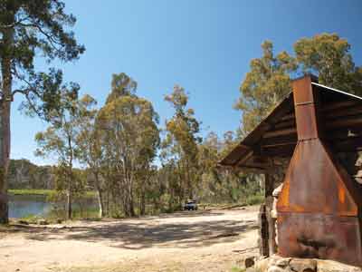 | 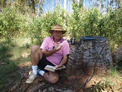 |
| Cobbler Hut and Lake Cobbler | Me having morning tea and reading at Lake Cobbler Hut |
We finally head off at noon. We backtrack to Lake Cobbler Road and then turn left into Little Cobbler Track. This is a proper 4WD track, with steep sections requiring first and second gear high range and one bit low range. The road skirts around the very spectacular Mount Cobbler which is very rocky. There are some great views of it in spots. We get to 1200 metres and it is 32ÂșC.
At 1:05 pm we get to Speculation Road. This is 20 kilometres from Lake Cobbler. You can also come down this way via the Staircase (we did this last time). Four kilometres along we come to King Basin Road and then King Hut. It is 1:20 pm. There is only one other car here but they appear to be only having lunch. As they are right near where we would like to camp, I ask them if they are staying. They confirm they will be leaving. Great.
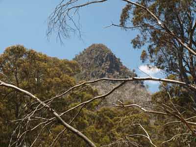 |  |
| Mount Cobbler from Little Cobbler Track | Mount Cobbler and the Prado on Little Cobbler Track |
King Hut is on the King River (which of course we were near yesterday afternoon). The hut is different to when we were last here in late 2007. Back then it was a timber hut. Now it is made of corrugated iron. What happened in the meantime is that someone left a fire going inside and the hut burnt to the ground. It has been rebuilt but not in the same manner. It looks similar, but it is not the same. A pity!
There are lots of cow patties here and some smell quite awful. There are plenty of places to camp, but the cow droppings limit the useable areas. We park in the shade to have lunch and wait for the other car to leave. We have lunch and soon after, the car leaves. I move to the spot and we set up camp.
 |  |
| King Hut | The camping area at King Hut |
As mentioned, there is a really nice camping area here, with a toilet as well, but the cow shit makes it less appealing. We have a swim in the river. It is cool but not freezing. We spend the rest of the afternoon reading and going for a few short walks. There are more camp sites to the east of the hut and a few more along the river to the west. There are nice ones just as you cross the river the first time and the second time.
Later on another car comes in and they camp at the opposite end of the hut.
For the first time ever, we have tried to bring along ice cream to use for dessert on Christmas Eve (tomorrow). I purchased some dry ice and put that in a new little Esky I purchased specially for this purpose. However, the Esky appears to be crap and is not holding the cold and the dry ice is almost all gone. The ice cream is still solid in the middle but the outside has become Mr Whippy-like. I turn the fridge right down to get about -5ÂșC and pull out some stuff so I can fit the ice cream in. We will see what happens.
As I do not have much room in the fridge, I put Kelly's next bottle of sparkling wine in the river to cool. Once she finishes the one she started last night I will move it into the fridge. I also set up the solar panel as I figure that we will not get too much power into the battery today and we will be taking a lot out since we are running it as a freezer.
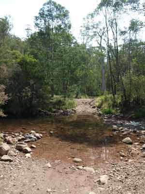 | 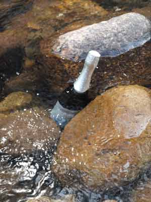 |
| One of the King River crossings | Cooling Kelly's champers in the river |
There are lots of birds around, especially crimson rosellas and even some king parrots. I think we even had another swim. At 5 pm we have our traditional nibblies and drinks. I start a small fire as it can get quite cool here once the sun goes down. The sun disappears behind the hills relatively early but sunset is not till 8:32 pm and it does not get dark till 9 pm.
Dinner tonight is scotch fillet steak, sausages with salad and haloumi cheese. The steak was excellent. After this, we had some of the softer parts of the ice cream.
As usual, after dinner we sit around the fire and read some more. By 9 pm the temperature has dropped to 20ÂșC. We watch the stars after this and see 13 satellites but no shooting stars. We go to bed at 10 pm.
Weather: Sunny, max 32ÂșC Arrived: King Hut, Alpine National Park Time: 1:20 pm Distance: 45 kilometres
Day 3 - Monday 24 December 2012 - King Hut to Craigs Hut, Alpine National Park
Weather: Overcast, 13.4ÂșC minimum
Even though it was only two degrees warmer than last night, it feels a lot warmer. I listen to the ABC news at 7 am and get up at 7:45 am as I could not find a local radio ABC station to listen to the main news. Once she got up, Kelly cooked the potatoes for our salad for tonight's Christmas Dinner (Kelly has Czech parents so that is when they celebrate Christmas). After this Kelly has a swim in the river and even washes her hair (not in the river).
Once again today we do not have far to travel, in fact, we have to meet Ron and Donna today at about 1 pm at a spot about half way to our final destination for the day. I will attempt to phone them once we get higher as I expect we will then have phone coverage to Mount Buller Ski Area.
I read for a while and we finally pack up and depart at 9:30 am. The sun has now come out and it is 23ÂșC. However, while packing up a mini-disaster has struck! One of Kelly's thongs has suffered a near fatal accident. She has to repair it using electrical tape. This works for the rest of the trip.
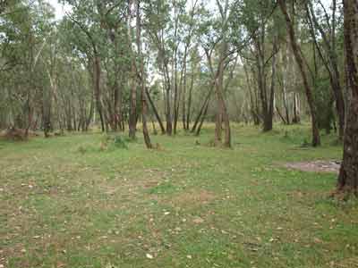 |  |
| Pineapple Flat Camping Area | Kelly's thong repair |
As we need to be near the top of Mount Stirling by lunch time, the original plan was to head off east from King Hut and then take Speculation Road (or King Basin Road - maps and on-site differ) which leads up to Circuit Road. This, as the name implies, does an almost 360Âș loop around Mount Stirling, albeit a lot lower than the summit. However, the road is closed in one section making this impossible.
We visited this spot back in late December 2007 and as per that time, we follow the King River to the west. We cross it six times (as well as a creek) before we get to Pineapple Flat Camping Area. This is located near the intersection of Kings Basin Road and Burnt Top Track and is 11 kilometres from King Hut. It is on the King River and is quite good and large. It is also on the river and there are a few people camping here. There are toilets as well as tables and BBQs.
We cross back over the King River and take Kings Basin Road towards Mount Stirling. It is second gear high range most of the way up to Circuit Road on this, the north side of Mount Stirling. There are lots of beautiful ferns and views to Mount Cobbler. We come to the intersection with Circuit Road. This is the same way we came up from the King River last time we were here. We turn right continue on and 2.2 kilometres along we come to what may be called King Saddle Road.
 | 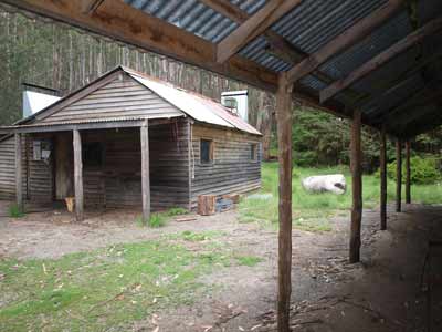 |
| Razorback Hut and the bunkhouose | Razorback Hut from the bunkhouse |
Near here there is a track which leads to Razorback Hut which is just off this intersection. We arrive here at 10:40 am (14 kilometres from Pineapple Flat). This is a very nice hut which has an adjacent accommodation bunkhouse. There is also an excellent camping area. There are tables, BBQs and toilets. This would be a very nice place to stay. However, it is very windy today and the temperature up here (1200 metres) is only 20ÂșC.
Just as I get out of the car there is a call on the radio. It is Ron. They are almost here. I also get an SMS from him. I try to call but he is out of range. They are well ahead of schedule, so I decide we will just have morning tea and then head off. They arrive at 10:55 am. We have morning tea while we show them around. The huts have new fireplaces as well as new roofs.
 |  |
| Inside Razorback Hut | Inside one of the bunk rooms |
After morning tea we depart (11:30 am). We go back to King Saddle Road (if that is indeed its name) which crosses King Saddle. Right in the saddle there is a brand new hut. This is an open plan thing constructed for the cross-country skiers. There are also toilets. Very nice.
We arrive at another section of Circuit Road at 11:42 am. This spot is called Telephone Box Junction but, guess what, there is no telephone box here. This obviously used to have one but now it is the main building for the Mount Stirling Ski Field.
We turn left and follow Circuit Road to the south-east for just over seven kilometres to the intersection with Howqua Gap Road. We go up this road and within a few metres we see Howqua Gap Hut. You can also camp here. We stop here and have a look. There is a very nice new hut here as well as toilets. The old hut is also still here. It is 11:55 am. We leave 10 minutes later.
 |  |
| The new King Saddle shelter hut | The new Howqua Hut |
 | 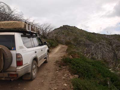 |
| The old Howqua Hut | Howqua Track approaching Mt Stirling |
We follow Howqua Gap Road. This is a fairly difficult track, very slow and we use mostly low range. We only average 12 km/h over the four kilometres to Mount Stirling. If you have little experience in four wheel driving, this is not a section of track to drive without being accompanied by someone with experience.
We arrive at the Mount Stirling summit at 12:25 pm. This is the highest peak in the area apart from Mount Buller and at 1745 metres, has great 360Âș views to Mt Buller and other hills. The track goes between a gap between two peaks and it is only a very short walk from the rough parking spot to the summit. You can see the buildings at Mount Buller very clearly. I really recommend stopping here. It is blowing very strongly from the north and we have difficulty standing upright.
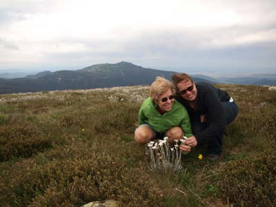 |  |
| Kelly and Donna on Mount Stirling | Michael and Kelly on Mount Stirling |
 | 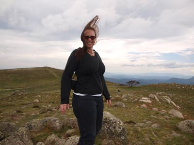 |
| Michael with the old snow gum, Mount Stirling | This is how windy it was |
As I have discovered before, the other peak to the south appears to be higher according to my maps (1748 metres) and it is worth walking there as well as it gives views down into Howqua Valley and back to the main summit. We spend about 45 minutes in total at these two spots. On a clear day, the views really are spectacular.
After Mt Stirling we continue to the north-east along the same track which here is called Clear Hills Trail. There is another hut just after this called GGS Hut but the road is blocked to it. The track is a little better but still slow going. After just over four kilometres we are approaching Craigs Hut. There is a nice spot to camp about 350 metres before the hut in a saddle and another one 200 metres before the hut. At this second one there is a bloke with a dingo and some goats! More about this later.
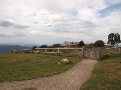 | 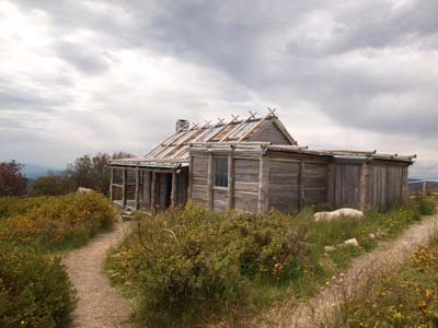 |
| Craigs Hut | Craigs Hut |
At 1:30 pm we turn into the track to the left that leads a few metres to the parking area for Craigs Hut. There are six cars here and it is still very windy. We have lunch and then walk to the hut.
Craigs Hut was constructed for the 1983 movie, "The Man from Snowy River" which was partly filmed in this area. It was at first just a film set (not a real hut) but in 1993 it was rebuilt as a real hut. When we visited it in late December 2007 it was almost complete after being totally rebuilt again as it was destroyed in the 2006-7 bushfires. It now looks quite aged from the outside. This is one of the nicest locations with fantastic views from the 1455 metre high spot. This has views for 180Âș to the north.
Back in 2007 Kelly and I vowed to one day come back and camp here. There was a small camping area not too far from the hut, but now there are signs banning camping. This is strange as there are pit toilets, a shelter shed, BBQ and picnic tables. We decide to try another couple of spots. The best one is where the goat man is but there is another just past the parking area. It is good, but very open to the strong wind that is blowing.
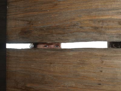 |  |
| Kelly peering through the timbers at Craigs Hut | Kelly on the verandah of Craigs Hut |
We go back to the first one we saw and decide this is very nice. It is a flat area on a saddle on the ridge as you approach the summit area of Craigs Hut. It is surrounded by trees which protect it from most of the wind, although there are a few trees rubbing against each other and making loud noises. It is also a nice grassy area. We set up camp. You could fit perhaps half a dozen cars here.
We start a fire as it is going to be cold tonight. At 3:10 pm it starts to thunder and there is some rain. Kelly and I put up the rear awning, but there are only a few heavy drops. Soon after this Kelly starts the preparation of her potato salad as well as the apple strudel we are having for dessert.
 | 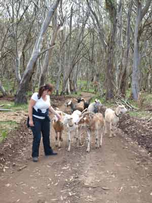 |
| Beau the dingo and some of the goats | Kelly being followed by the goats up to Craigs Hut |
At 4:30 pm or so we walk up the hill to the hut with some drinks and nibblies. On the way up I stop and talk to the goat man. His name is Owen and he has been walking for six weeks. Again, more later! By the way, the goats followed Kelly and I when we went past his camp.
Once at Craigs Hut we sit the verandah of the hut and have a beer and wine. It is really nice sitting here enjoying the view, even though it is quite cool due to the wind. It rains again so we move to the protected side of the hut to finish our drinks (of course we could have sat inside).
We head back to camp and I make up the veal schnitzels we are having for dinner.
 |  |
| Kelly having a sparkling wine on the verandah | Michael on the verandah of Craigs Hut |
As mentioned, Europeans mostly have their main Christmas meal on Christmas Eve and Kelly is Czech (fully imported but locally assembled as we say), she is planning a big meal. We are having veal schnitzels with potato salad and beetroot salad. The veal and potato dishes are traditional Czech Christmas meals.
At 6:15 pm the strong northerly wind totally dies off. However, at about 8 pm a strong southerly wind comes up and blows for the rest of the night.
About 6:50 pm I cook the schnitzels and we have a great meal as normal, with the great location making it even better. After dinner I walk up to Owen's camp and ask him to come down and have a beer and apple strudel with us. He agrees to come down at 8:00 pm.
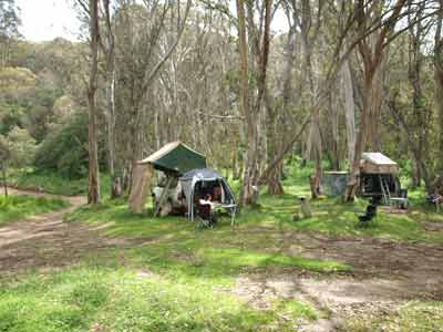 |  |
| Our camp site at Craigs Hut | Kelly and our dinner |
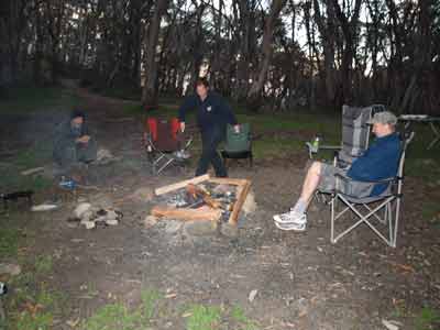 |  |
| Owen, Kelly and Ron get smoked out | Kelly and her cooked apple strudel |
Kelly finishes the strudel and puts it in the camp oven. It takes about 30 minutes to cook. Owen comes down and has a beer with us. He tells us that his name is Owen Davies, he is 56 years old and comes from Mareeba in Queensland. When I wrote this I thought that he said he previously did a walk with the goats north-west from Birdsville to a place called (I think) Muncoonie Lake. He then walked across the Simpson Desert with the goats. However, I later hear him on an ABC Conversations podcast and it was Camooweal to Birdsville and the Simpson desert trip was as part of a camel trek. Anyway, he did the first part from September 2011 (last year) and the finished it off early in 2012 (this year). Google him and you will find the podcast, it has been played at least three times, 2012, 2020 and 2023. I also find out later he used to own the Hebel Store on the border of Queensland and New South Wales.
For this trip he and his nine goats and northern dingo, Beau, left six weeks ago from Tom Groggin on the Murray River near Thredbo.
They have walked via Davies Plains, Wonnangatta Valley, Howitts Plains to here. He has just been resupplied with food and expects to finish his walk in Whitfield in a week or so. His goats carry all his gear and food, he has a Spot device like us for safety and even a mobile phone (may even have been a satellite phone).
Kelly serves up the strudel and the ice cream. Fantastic! We talk more till about 10 pm when Owen goes back up the hill to his camp. He really had some great stories to tell. Owen is back before we go to bed, he has lost Beau. We find him lying down in the grass near our cars, looks like he did not want to walk back up the hill!
We are in bed by 10:15 pm.
Weather: Fine and very windy, max of 20ÂșC Arrived: Craigs Hut, Alpine National Park Time: 1:30 pm Distance: 47 kilometres
For the next part of this trip, click here.
| 
 v6.00.307 © 2003-2005