|
Click here to read the first part of this trip.
Day 11 â Tuesday 7 July 2020 â Wentworth to Broken Hill
Weather: Minimum of 9.1ÂșC and fine
Another warmish night. I am awake at 6:45 am and I listen to the two ABC news and read the newspaper on my tablet. I get up at 7:55 am and have breakfast. We leave at 8:52 am and head back into Wentworth. After a toilet stop at the paddlesteamer, we go to the bakery to buy something for morning tea. I was after scones, but none. I get two small tea cakes instead.
While in town, Ron books us all into the Lakeview Caravan Park at Broken Hill. We leave town at 9:25 am and head up the Silver City Highway. This is a tar highway so we get along at a good speed, although there are a couple of spots undergoing work where we have to stop at red lights.
 |  |
| The piano at the rest area. | A library in a fridge! |
We stop at Popiltah Rest Area at 10:45 am for morning tea, it is still a cool 13â°C. This is a nice camping area 130 kilometres north of Wentworth. This also has a piano for people to play and a book library! I pick up a book but have nothing to leave. John and Maureen arrive at 11:00 am. We head off at 11:20 am.
We arrive at Broken Hill at 12:20 pm (South Australian time for rest of the day and tomorrow morning â 12:50 pm NSW). We go to Woolworths as we all need to stock up with groceries. I also get some wine. We leave at 1:25 pm. I then refuel, 44.8 litres at $1.219 $54.55 for 12.5 litres per 100 kilometres. At 1:50 pm I book into the Lakeview Caravan Park which is on the eastern outskirts of town.
 | 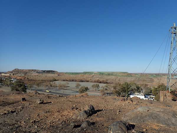 |
| Lakeview Caravan Park (no lake view!) | The view from Block 10 Lookout |
The cost for an unpowered site is $24 for a night, pretty good value considering what some of our national park sites have cost! The camping section is a nice grassy area with a nearby camp kitchen and the toilet block is also nearby. After lunch, Sharon, Ian and I head off to do some sightseeing. We first go to Block 10 Lookout. This is near the Coles and has views over the main mining area as well as lot of the town.
We then go to the Royal Flying Doctor Service display at Broken Hill Airport. It costs $12.50 for a guided tour of the museum and the three old planes in the hangar. The museum has old radios and medical equipment and lots of great photographs. The planes include a Beechcraft King Air, a CAC Nomad (Australian made) and a DeHavilland Drover. The tour takes about an hour and is well worth doing.
 |  |
| A recreation of an outback station's Flying Doctor radio | Ian in front of the CAC Nomad |
We leave here and go to Bells Milk Bar which is nearby. This is an authentic 1950s milk bar. I have a milkshake, brilliant. I really would have loved to stay here longer, but it is getting late. We then go to the main lookout on top of the mining dump. This is called The Lode Lookout. However, the museum is closed as it is late and the view is not great as the sun is low. We only stay for a short time and then head back to the caravan park.
We arrive at the caravan park at 4:55 pm. I put on a load of washing and then have a shower. We have decided to go out for dinner at the Palace Hotel. This is where part of Priscilla, Queen of the Desert was filmed. Before we leave, I put my washing in the dryer. We head out at 6:35 pm in Johnâs car (Ian and Sharon in theirâs).
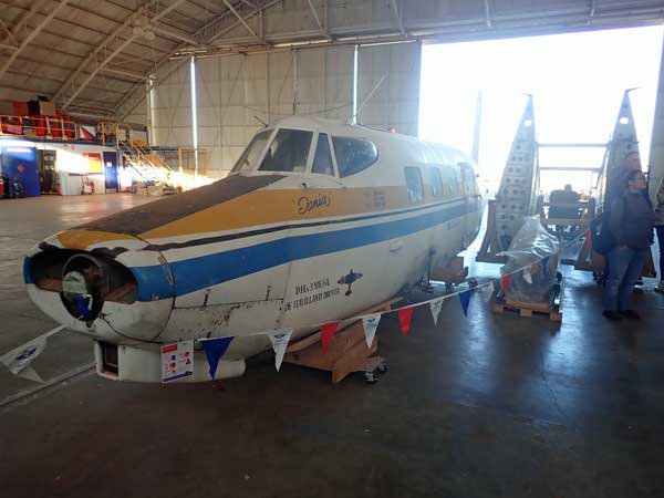 |  |
| The DeHavilland Drover that will be restored as a display | The outside of Bells Milk Bar |
 | 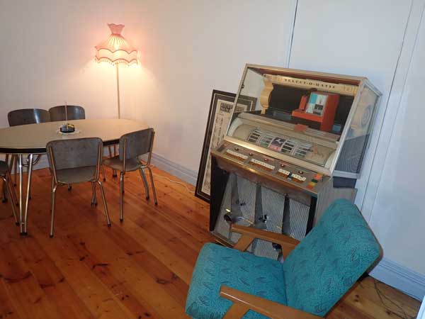 |
| Inside the main section of Bells Milk Bar | The juke box inside the back section of Bells Milk Bar |
The Palace Hotel is in the main street and a nice old hotel. However, the restaurant is all booked out but we can have dinner from a limited menu in the bar area. We have a drink and then order dinner. It is a nice pub, but most of the service is very crappy (apart from the new barmaid). My dinner when it finally arrives is lukewarm, the person who delivers is very rude and just dumps the food on the bar without even attempting to find who it is for.
Later, another patron has a big argument with him when their food (which they ordered before us and he had to complain about not coming) is again dumped on the bar when it finally comes. A local goes off at him, abusing him for not been a local. He finally shuts up when we come to his support, telling the local that the service has been crap and the bloke delivering food very rude and hopeless. Ruins the night really!
 |  |
| The Big Seat at the Lode Lookout | The entrance foyer of the Palace Hotel |
We leave at 8:00 pm or so and after dropping by the Coles liquor store so I can get a bottle of sparkling wine for tomorrow nightâs dinner, we go back to the caravan park. My clothes are not dry after one run through the dryer so I put them on again. We go into the camp kitchen for a beer as it is very cold outside. We go to bed at 9:50 pm, it is only 5.0â°C.
Weather: Fine, maximum of 13ÂșC
Arrived: Lakeview Caravan Park, Broken Hill Time: 3:50 am Distance: 317 kilometres
Day 12 â Wednesday 8 July 2020 â Broken Hill to Packsaddle Creek
Weather: Minimum of 0.5ÂșC and fine
A freezing night, frost on the grass near Ronâs car, but not mine! I get up at 7:45 am and after listening to the SA news and reading the paper. It is still very cold! We have breakfast and leave at 8:40 am. I stop off at Coles as I have forgotten to get a couple of things. We arrive at Silverton at 9:45 NSW time (9:15 am SA).
 | 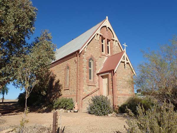 |
| Outside the Silverton Hotel | The Silverton St Carthage Catholic Church - 1886 |
We walk around Silverton which is really almost a ghost town. The highlight is obviously the pub, the Silverton Hotel. It is not yet open of course. There are a few art galleries, a church or two and the Mad Max 2 (Road Warrior) Museum. This does not open till 10 am SA time, so we have to wait around. There are also a few VW Beetles done up like Mad Max vehicles and an old Suzuki 4WD.
At 10 am the museum opens and I pay the $10 to enter. The wall outside is a part replica of the compound in the movie and above the wall is a replica of the Main Force Patrol headquarterâs sign. Inside there are many original vehicles and props as well as some replicas, lots of photos and a good video, although it is on a crappy old TV and should be on something bigger and better really. They also sell mementos. It was not too bad, plenty of people went in, so the owners obviously make a good living out of it.
 |  |
| Outside the Mad Max Museum | The original bus from the movie |
After this we go to the hotel and have a beer. We leave at 11:10 am SA and go to the Mundi Mundi Lookout. This has great views but is also famous for being in the Road Warrior (Mad Max II) movie where key scenes were shot, including the opening chase and the final truck crash scene. We leave at 11:20 am SA time (all future times NSW). Shortly after we hit the dirt road where we stop while Ron and Ian air down their tyres (I donât). The road is pretty good, very few corrugations and we make good time.
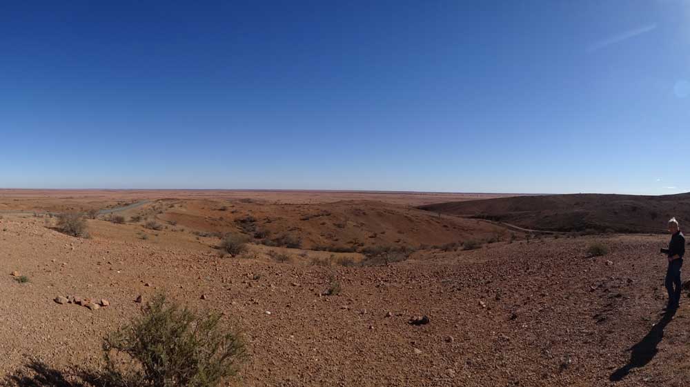 |
| Panoramic photograph at Mundi Mundi Lookout |
At 12:35 pm we stop for lunch in the bed of Smiths Creek. We have travelled 79 kilometres today and I have averaged 13.3 l/100 km since Silverton. It is a cool 15â°C but sunny. We also cut timber for our fire tonight. We leave at 1:10 pm. At 2:00 pm we stop 46 kilometres on to take some photographs as it is quite a stunning spot. I fly the drone too. Here five other vehicles pass us (they were stopped for lunch back further).
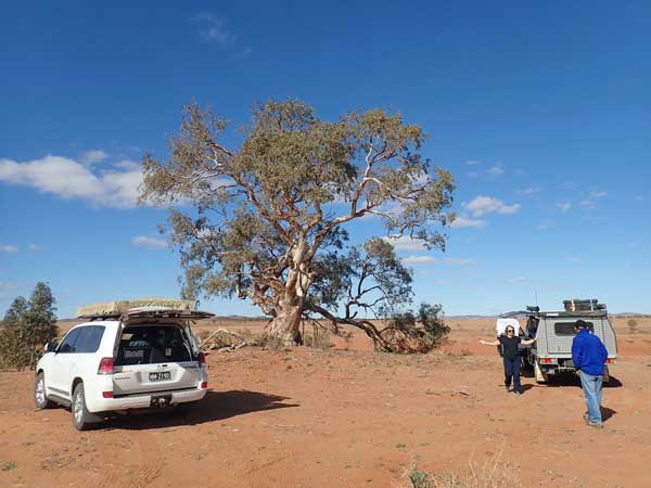 |  |
| Lunch at Smiths Creek | Ian cutting some timber for tonight's fire |
We leave after 10 minutes and a short distance on we stop again when Donna spots some Sturts Desert Peas on the side of a creek bed. We leave a short time later. The road here is quite good and we sit on 80 to 90 km/h. There is some bulldust in spots, especially on some corners. There are dozens of gates that have to be opened and closed today. Mostly it is Donna opening and Sharon closing, but occasionally I end up closing a gate.
 | 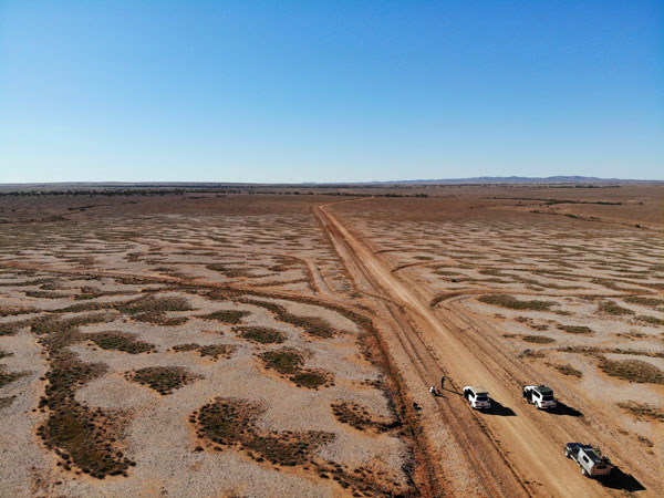 |
| Sturts Desert Pea | Looking north |
 |  |
| Looking south | Going through one of many gates |
It is a bit greener near Avenal Station. An interesting thing about today is that nearly every station has Telstra phone coverage (including internet). It extends out about three kilometres from the homestead. We end up passing most of the other vehicles (perhaps all, I cannot remember). We arrive at Packsaddle Creek at 3:50 pm. We camp about a kilometre to the west of where the road crosses the (dry) creek bed. It is 216 kilometres to here from Broken Hill, I have averaged about 13.2 litres/100 km today, pretty good.
We set up camp on a nice flat section, plenty of room and trees around us. We are perhaps 50 metres from the creek. There is now no wind, unlike most of the day. We start a fire straight away as we are cooking roast dinners in our camp ovens. We have the normal drinks and nibblies starting at 5:00 pm. At the same time, Ianâs large chicken goes on, 15 minutes later Ronâs smaller chicken and at 5:30 pm my marinated pork which is in two smaller pieces.
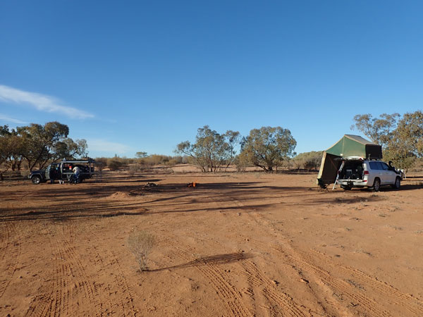 | 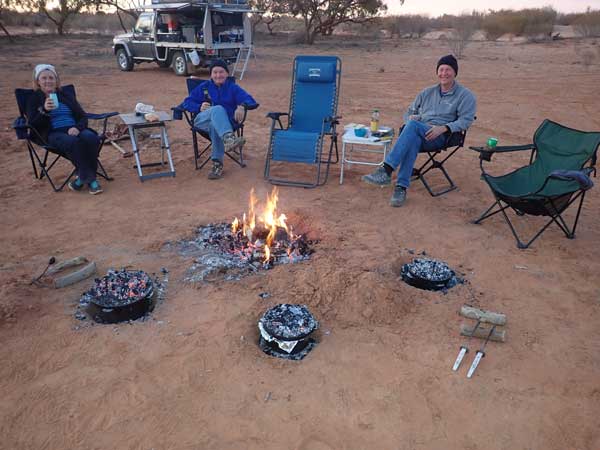 |
| Our Packsaddle Creek campsite | Three camp ovens on for dinner |
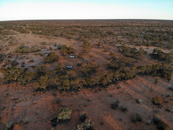 | 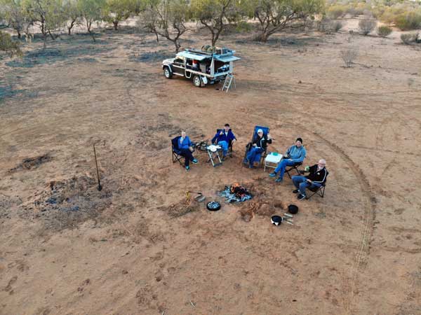 |
| Looking east at Packsaddle Creek | Packsaddle Creek |
At 6:00 pm I put my vegetables into the camp oven. At 6:45 pm all three dinners are cooked and we serve it up (we share meats). I purchased a nice bottle of Australian Chandon sparkling last night and Donna, Sharon and I have this with our dinner. I use my new crystal champagne glass for the first time. An excellent meal!
After dinner we sit watching the stars. We see at least 10 satellites and 4 shooting stars. This is despite an almost full moon. We go to bed at 10:05 pm, it is a cold 6.4â°C.
Today we travelled from Silverton via Eldee, Willangee, Mount Woowoolahra, Joulnie and Pine View.
Weather: Fine, maximum of 18ÂșC
Arrived: Packsaddle Creek Time: 3:50 pmDistance: 216 kilometres
Day 13 â Thursday 9 July 2020 â Packsaddle Creek to Depot Glen Milparinka
Weather: Minimum of 1.4ÂșC and fine
A second cold night, but no frost as it warms up later to 5.5â°C when the wind picks up from the west. It is a cool 6.2â°C when I get up at 7:40 am. I was able to listen to both ABC Melbourne and Adelaide 7 am news on my radio. It is calm with a high overcast. After breakfast and some other things, we leave at 8:55 am.
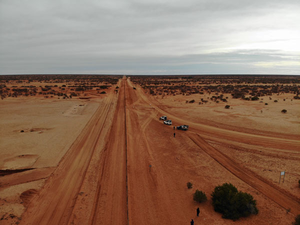 |  |
| The dog fence, this is the only section you are allowed to drive alongside | The dog fence, South Australia is over the fence |
The road this morning is a lot rougher than yesterday. Again today there is Telstra coverage at some of the stations. Border Downs and Moorabie have coverage. We arrive at the dog fence along the South Australian/New South Wales border at 10:00 am. This is 61 kilometres from our camp site and I have averaged 12.0 l/100 km. I take some drone photos here and the others photos of the fence. We leave about 10:20 am and at 10:40 am we stop 20 kilometres along for morning tea. We are still on the dog fence.
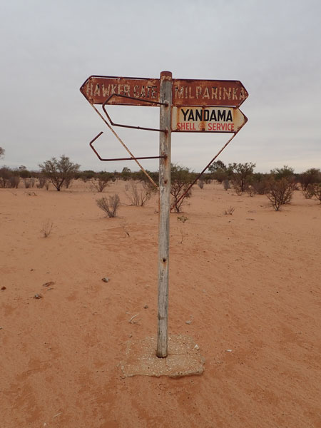 |  |
| A very old sign, from the 1950s or earlier | A whopping big bull ant! |
There has been phone coverage along most of the fence. We leave at 11:00 am and 20 minutes later stop to cut timber for our fire. We leave just over five minutes later. At 12:35 pm we arrive at Depot Glen, 181 kilometres from our camp. It is a warmer 17â°C but overcast. We have lunch here. This is where Sturt and his exploration party were stuck for six months over the summer of 1844/5 due to extreme heat.
 |  |
| Ian approaching one of the many gates | Sharon closing a gate |
After lunch we drive the short distance to Pooles Grave. This is where Sturtâs second in command, James Poole, was buried after he died of scurvy on 16 July 1845. There is a gravestone and also a tree which has carved in it, JP 1845. This is believed to have been done by Sturtâs party. From here we drive to Mount Poole which is on the nearby Mount Poole Station.
Mount Poole is not very high, it is an easy walk to the top, although there is not a real good track up. As well as the 360â° views, there is a cairn on the top. This was built by Sturtâs men to commemorate Poole. The cairn is correctly known as Pooleâs Cairn, although I have also seen it referred to as Sturtâs Cairn. I fly my drone and take some photos of the view and us at the top. We spend about 45 minutes walking up and back.
 |  |
| James Pooles Grave Site | The carved tree, JP 1845 is very clear |
After this we return to Depot Glen. I did not mention this before, but this is a permanent waterhole, which even when Sturt was stranded here did not dry up (Sturt says it was so hot the lead fell out of their pencils!). It is 2:40 pm when we set up camp here. There are a few spots where you can camp. We travelled 196 kilometres today and I have averaged 13.4 l/100 km since Broken Hill. After setting up camp we have showers using Ronâs car shower.
I make the dough for tonightâs dinner, pizza. I let it rise and later roll out six pizzas, one for each and a garlic and cheese one to share. We all put in bits for the pizzas, bacon, chicken, pineapple, salami, cabanossi, onion, capsicum, chilli sauce, mushrooms and of course, mozzarella cheese. Everyone selects their own toppings and makes their pizza.
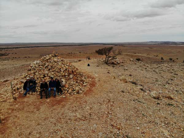 |  |
| Drone shot of us at Pooles Cairn | Another photo of Pooles Cairn |
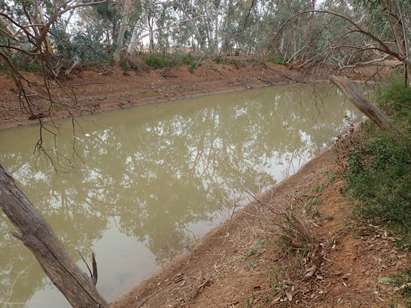 |  |
| Depot Glen | Our campsite at Depot Glen |
We have a fire and sit around it having drinks. I put on the first pizza at 6:00 pm. They are all cooked by 7:00 pm. Fantastic, better than any restaurant pizza I have ever had. After this we have the Aldi version of Baileys, not the same but nice. It is overcast and warm when we go to bed at 9:40 pm.
Weather: Overcast, maximum of 17ÂșC
Arrived: Depot Glen, Milparinka Time: 2:40 pm Distance: 196 kilometres
Day 14 â Friday 10 July 2020 â Milparinka to Tibooburra
Weather: Minimum of 9.2ÂșC and raining
It was a warm night and at 5:40 am it starts raining. This goes on for 75 minutes apart from 15 minutes in the middle when it stops. It is not heavy but it is consistent. I get up at 7:40 am and cook bacon and toast for breakfast. It starts to rain again. My shoes have about 15 mm of mud on the bottom and it is hard to walk around. During the slight gaps in the rain, we pack up.
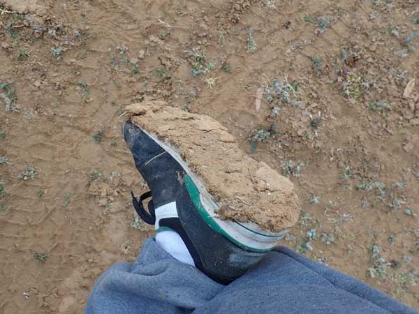 |  |
| Thick mud on my shoe! | Mud in my wheel arch after driving to Milparinka |
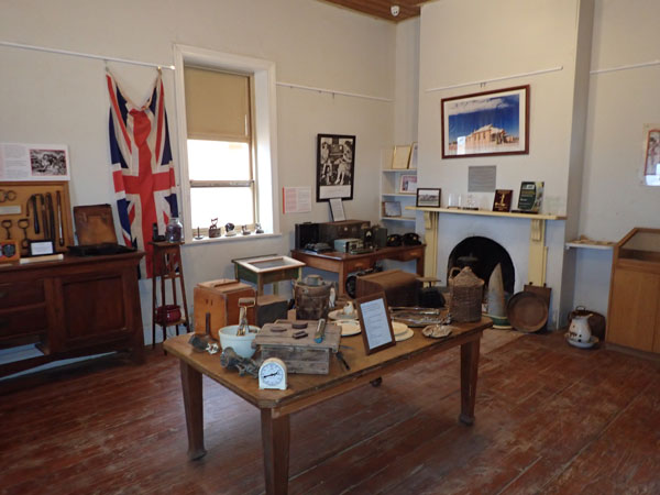
At 9:30 am we leave. It is still spitting but looks blue towards Tibooburra (to the north). We arrive at Milparinka at 9:45 am. It has stopped raining. We have a look around the town. Again, this is a ghost town, with some old buildings like the court house. There is a hotel which I assume is still open (in 2010 it was closed, but I was not sure if this was permanent or temporary).
 |  |
| Some of the buildings at Milparinka | Inside the Milparinka Museum |
There is now a camping area behind the court house, nice toilets and showers. However, the camping area has lots of sticky mud, although it looks like there was less rain here than at Depot Glen. My car has a lot of mud on it and under the wheel arches from the short drive. I knock as much mud off as I can and we leave at 10:30 am.
It is tar from here to Tibooburra, in fact, as of a few days ago, the road is officially sealed from Broken Hill to Tibooburra. We arrive at Tibooburra at 11:00 am. I go straight to the main fuel station (should have went to the smaller one, 7 cents a litre cheaper!). Here I fill up, 64.6 litres at $1.369 = $88.44. We have travelled 499 kilometres since Broken Hill at an average of 13.2 l/100 km.
 |  |
| Parked outside the Family Hotel | A couple of the murals inside the Family Hotel |
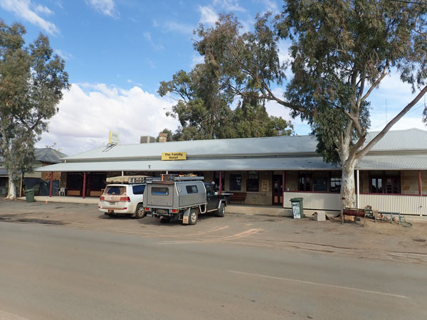
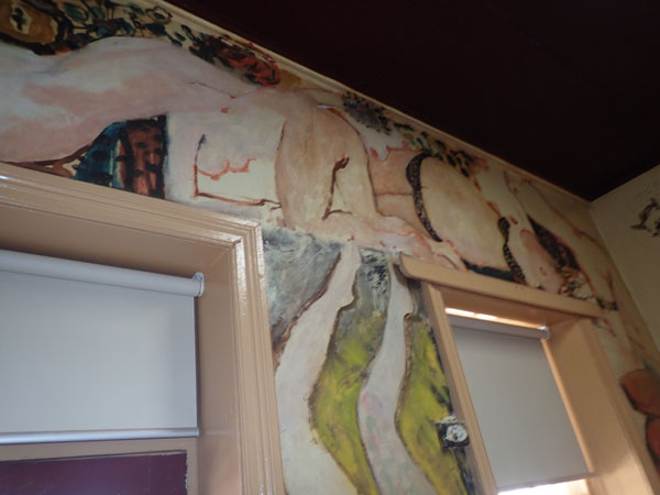
After this we go to the Family Hotel and park outside. We all have a look around (I have been here five times before, including two weeks in January 1980 for work). We meet up with John and Maureen who arrived yesterday as they decided to stay on the tar road. We have a beer in the hotel and look at the artwork on the walls of the hotel. These have been done by some very famous Australian artists including Clifton Pugh.
We also get water for our tanks from a tap outside the hotel. There is more rain around to the north. We leave at 12:20 pm and drive the short distance to Dead Horse Gully Camping Area in Sturt National Park. This is a 10 minute drive and it is on the north-western side of the town.
 | 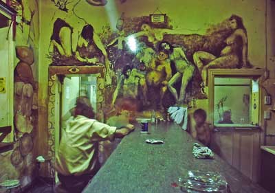 |
| The main wall of murals inside the Family Hotel. The publican from 70s and 80s is the devil top left. | A photo I took in 1980 of the murals. Note the difference, including one female nude now missing |
We pick a spot next to a large undercover area as it is certain that there will be rain shortly. It soon starts to rain and thunder. There is some lightning and it really pours. We sit under the shelter till it is over. We make lunch while this is all going on. The rain stops at 1:15 pm and there is a nice double rainbow.
 |  |
| The rain is pouring down | A rainbow after the rain has stopped |
 | 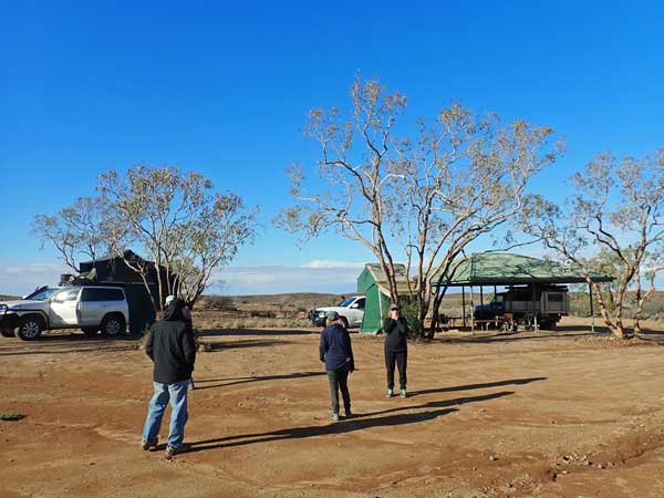 |
| The view from a section of the Dead Horse Gully walk | A view of our campsite at Dead horse Gully |
After the rain it clears and the sky is blue. I set up the Shippshape tent, including the two sides (in case it rains) and fly the drone to get some photographs. At 2:00 pm it looks like some more rain is coming and it later rains a little bit. After this it is fine again and most of us do the Granites Walk which is at the camping area. This is a nice walk. After we finish, at 4:30 pm Ian and I go in his car to town.
We go to the Tibooburra Hotel (the two storey hotel). There are quite a few vehicles coming into town. The ones coming from north and west particularly have large amounts of mud on them and under their wheel arches. At the pub we have a couple of beers and then get back to the camping area at 5:45 pm. Unfortunately a few months later the hotel catches fire and is badly damaged. I am not sure if it has yet been repaired but at least one bar is open as of April 2022.
 | 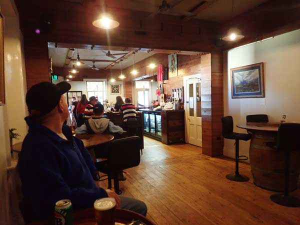 |
| The Tibooburra Hotel | Ian inside the Tibooburra Hotel |
 | 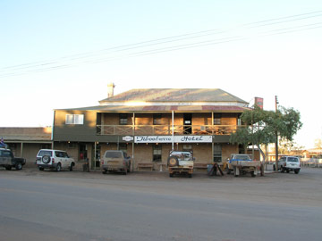 |
| The Tibooburra Hotel in 1978 | The Tibooburra Hotel in 2010 |
It is now a totally clear sky. I cook pork fillet and make Asian rice from a packet. We use the provided BBQs and burners. After this we sit and watch the stars, seeing 11 satellites and four shooting stars. I also watch South Sydney play West Tigers on my phone, pretty good reception. Souths win 18-10! I go to bed at 10:10 pm after the game. It is now 13â°C.
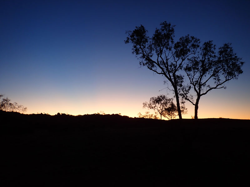 | 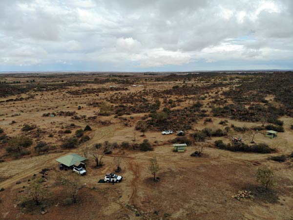 |
| Sunset at Dead Horse Gully | A drone shot of Dead Horse Gully looking towards the town |
Weather: Overcast and rain, maximum of 17ÂșC
Arrived: Dead Horse Gully, Tibooburra Time: 12:30 pm Distance: 60 kilometres
Day 15 â Saturday 11 July 2020 â Tibooburra to Cameron Corner and back to Fort Grey, Sturt NP
Weather: Minimum of 9.2ÂșC and fine
Last night was again fairly warm and when I get up at 8:00 am it is 10.5â°C. After breakfast I put some of my wet stuff out to dry and then later pack up. We leave at 9:50 am for town. John and Ian leave a bit earlier as they need to get fuel and water and some other things. We leave Tibooburra at 10:00 am. It looks like there is rain out to the west. We head west on the Cameron Corner Road.
We stop for morning tea at 10:55 am, having travelled 69 kilometres. The road has been good to here, although you can see where some cars yesterday have slipped all over the road in spots and there is some water on the creek crossings, giving lots of mud puddles. My car is now extremely dirty as at one âcreekâ crossing where there were two small mud puddles, it totally sprayed up over the car, even though I was only doing 50 km/h when I hit them. The rain holds off and the dark clouds go to the south and disappear.
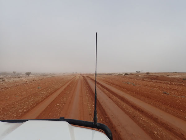 |  |
| A foggy morning on the road to Cameron Corner | After I went through the small patch of mud! |
We leave at 11:20 am and the road remains fairly good, although just before the turn off to the Fort Grey Camping Area and a bit past this there are two sections of road which are totally covered with water. We have to detour off the road around these sections. Nearing Cameron Corner we come across a new fenced off section of Sturt National Park. This appears to have been done to protect native species from dogs, foxes and cats. In September 2020 there is some publicity on this in the media. The road passes through the fence which has radar activated sounds to deter the predators from going though the gap in the fence.
We arrive at Cameron Corner at 12:30 pm. We go into South Australia and then over to the gate into Queensland. While technically South Australia is closed to us (due to COVID-19), there is nothing stopping us entering.
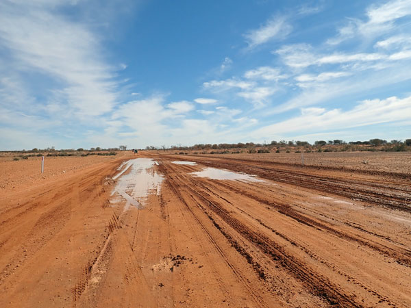 |  |
| One of the larger water patches on the road | Going through the dingo fence on the SA/NSW border |
Queensland reopened to New South Wales as from yesterday, but you need to complete a form and request approval to enter. There is a Police LandCruiser at the gate and we speak to the Police officer. He tells us we can apply to him for access, but we will need to complete a long form. We decide it is not worth it just to go to the Corner Store for a beer. Funny thing is we were actually in Queensland when we were speaking to the officer as the fence is not right on the border!
 |  |
| The road block on the SA/Queensland border | At Cameron Corner, NSW is behind us, SA is to between us and the camera and Qld bottom left |
I have been here many times before, at least five or six from memory. The others have never been here. We walk over to the actual corner, take some photos and I fly the drone too. We then have lunch at our cars. There is a cold wind so even though it is sunny, it is cool.
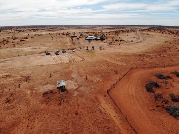 |  |
A drone shot of Cameron Corner, NSW bottom right inside fence,
SA left of fence and Queensland top right | The crossing into the new dog free reserve near Cameron Corner |
We head off at 1:25 pm. We backtrack towards Fort Grey and just after turning off the Dunes Scenic Road onto the Cameron Corner Road, we come to the second big âlakeâ across the road that I mentioned earlier. There is a bright red Ford Ranger bogged on the western side of the road. It is 1:50 pm.
We pull up and have a look. When we came past this water this morning, we went to the eastern side of it, but not off the road reserve. The Ranger has gone to the western side which is a bit higher off the road and also has a big drop to the west. The car has sunk down so far it is now laying on the ground and threatening to topple over off the road edge.
 | 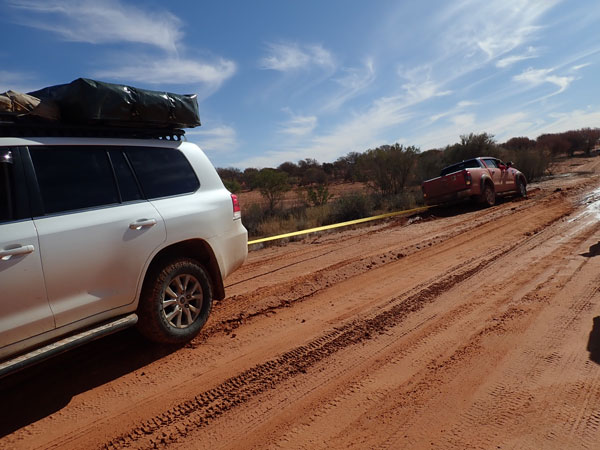 |
| The bogged Ford Ranger with two of the young blokes | Ron about to pull the Ranger out |
The vehicle contains four young sub-20 year old males. After looking at it, we decide to pull it out backwards, it would be very hard to pull it forward. Ron will pull it using his LandCruiser. John puts a towing hitch in their tow bar and we attach a snatch strap. Ron is going to slowly pull them out, not snatch them. He starts and we yell to stop. The driver has either his foot on the brake or it is in park! âWhat, you want me to put it in reverse?â says the driver!
Ron easily pulls the vehicle out. We leave at 2:00 pm. At 2:10 pm we arrive at the Fort Grey Camping Area. We set up camp in the same spot I camped in 2010. There are a number of free BBQs and sheds as well as a toilet. It is a bit warmer as more protected from the wind and temperature is now 17â°C.
 |  |
| A drone shot looking from the camping area towards Lake Pinaroo | Looking straight down at our vehicles |
 |
| Lake Pinaroo in 1978 |
After setting up, most of us go on the Lake Pinaroo (also called Fort Grey Lake) walk. This goes to the old Fort Grey Homestead ruins and then across the dry lake. In 1978, 1980 and 2010 I could not do this as the lake had a lot of water in it (full in January 1980, I swam in it). I decide to do the extra section to Sturts Tree. This is another carved tree from Charles Sturtâs 1845 expedition. This is almost on the other side of the lake. The whole walk takes me about 100 minutes, about 35 more than the others.
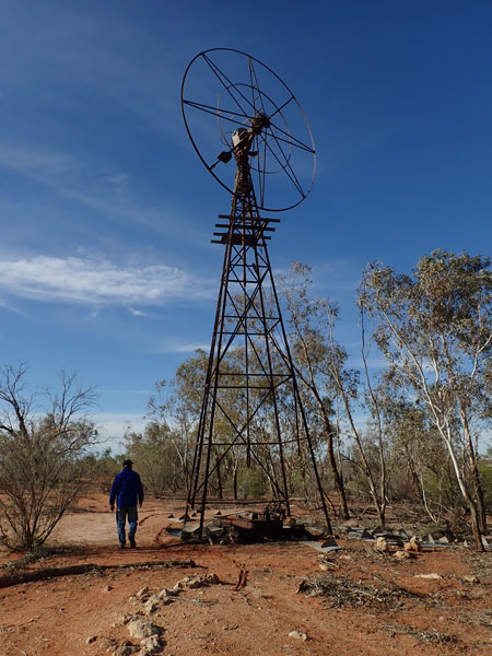 |  |
| The windmill at the old Fort Grey Homestead | An old dam on Lake Pinaroo bed, boiler for pump on right |
 | 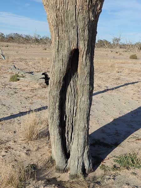 |
| Sturts Tree and the supporting structure | A close up of Sturts Tree, this was where it was blazed |
We have showers using Ianâs gas hot water system and then drinks. I cook another Mongolian lamb strips for Ian and myself. We have this with leftover rice from the other night. There are four other cars here, one of which is playing very loud music till another person goes over to them. Must have been extremely loud for that bloke, we were a long way from him and it was loud here.
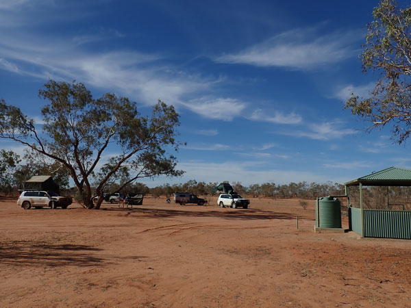 |  |
| Our camping spot | A gecko |
The wind finally totally drops at 9:00 pm. We go to bed about 9:35 pm, it is 13â°C.
Weather: Fine, maximum of 17ÂșC
Arrived: Fort Grey, Sturt National Park Time: 2:10 pm Distance: 173 kilometres
Day 16 â Sunday 12 July 2020 â Fort Grey to Mount Wood, Sturt National Park
Weather: Minimum of 7.1ÂșC and fine
After again listening to the ABC Melbourne news, I get up at 7:10 am. It is nice and sunny unlike the last two mornings. I have breakfast and then fly the drone to get some photos as it was too windy yesterday. We leave at 8:55 am. We backtrack about three kilometres to Middle Road. This is a much rougher road than the ones we have been on during this trip and last time I was here in 2010 it was closed due to water.
We are only a few kilometres down this road when Ron calls out over the radio someone is bogged. He then says it looks like they have camped here. We come to a very long stretch of road totally covered with water. Guess what, it is the red Ford Ranger again! This time they have gone across country to try to get around the water. We can see where they have gone and where in a couple of spots they must have got bogged but then got out.
 |  |
| The Ford Ranger bogged again! | The water across the road where they got bogged |
This time the car is bogged on what looks like hard ground but is, in fact, in spots very soft. We stop well back from them and walk over. There are two small tents set up and only two of the young blokes are here. They tell us that they got bogged yesterday evening and decided to camp here. The other two blokes left at 6:00 am to walk, believe it or not, to Cameron Corner. In a straight line, they are only 2.5 kilometres from where we camped last night at Fort Grey.
We tell them that they should never leave their car, but if they did walk, they should have only walked back to the Cameron Corner Road where if they had sat and waited, dozens of cars would have went past today. As we did not see them, they must have really turned towards Cameron Corner. This time I will pull them out, so we again set up the same as yesterday and I easily pull the Ranger onto harder ground.
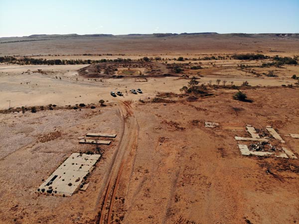 |  |
| Binerah Downs Homestead ruins and dam | Some of the artefacts from the homestead |
As we talk to them, it becomes obvious they have no idea about 4WDs or how they operate. They ask âwhat does the 4WD button doâ and âdoes 4WD Low give you more powerâ. I show the owner how to put it into 4WD and low range and explain what they do! He then asks me to drive the car back to the road so he does not get bogged again. I do this. We tell them that they should pack up straight away and head off to find their mates. We wonder if this is the last we see or hear from them!
We continue on our way. As I drive, I realise that I probably could have driven the Ranger out of where it was bogged just by putting it in 4WD (I did not realise when I pulled them out it was still in 2WD). The road has lots of water over parts of the road, especially near Lake Pinaroo, and we can see that only two vehicles have travelled on it since the rain almost 48 hours ago. At 10:10 am we arrive at the Binerah Downs Homestead ruins. We stop and have morning tea as we explore the area. There are lots of building remains and many bottles and small pieces of machinery.
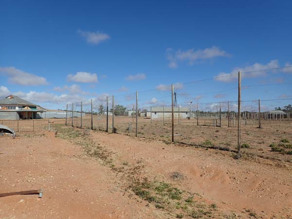 |  |
| Olive Downs Homestead and tennis court | The ruins of the Olive Downs Shearers Quarters |
We leave at 10:45 am and go down the Toona Gate Road back towards Tibooburra. We then go back on Middle Road again, this section is much better than the earlier part. It is also a lot greener here than out towards Cameron Corner. We see some small flocks of budgerigars. At 11:35 am we arrive at Olive Downs Homestead (which you cannot actually access) and then the nearby shearers quarters. These are now ruins after a storm ripped off the roof sometime before 2010. I stayed here for two weeks in January 1980 for work.
 |  |
| At the lookout on top of the Jump Ups | Looking back towards the Jump Ups |
We do not stop long and at 11:47 am we arrive at The Jump Ups Lookout. This has great views down over the lower land. We have travelled 92 kilometres this morning. We have phone reception for the first time in over 24 hours and check emails etc. It is sunny but a cool 14â°C. We leave after 10 minutes and see more flocks of budgies on the way. This is now the Jump Up Loop Road.
 |  |
| Horton Park Outstation | At the Gorge Lookout |
At 12:25 pm we arrive at Mount King Tank which is a nice spot to look for birdlife. We have lunch here, I make a Mongolian lamb wrap for Ian and myself. We leave at 12:55 pm and after a short stop at South Myers Tank (where there is a bird hide), we cross over the Silver City Highway to go on the Gorge Loop Road. At 1:35 pm we stop at Horton Park Outstation. This small building was an outstation of the much larger Mount Wood Station. There is an even older ruins near the road. The remaining building is an interesting example of a not as prosperous property building.
 |  |
| The whim at Mt Wood | Inside the Mt Wound Shearing Shed |
We leave at 1:47 pm and continue on, with a short stop at The Gorge Lookout. This has some views over the lower land, not really a gorge, but nice anyway. We pass by Mount Wood Homestead and Camping Area and go to the Mount Wood Pastoral Museum, arriving at 2:38 pm. This is great recreation of some of the various machinery items used on 1800s sheep stations. There are also some real items here too. Well worth a visit.
We backtrack to the camping area and at 3:00 pm we set up camp. This is a very small camping area and tonight all the usable spots will be taken. It really needs to be expanded as every time I have been here it has been crowded. After I have set up camp, I have a cuppa and then Ian, Sharon and I walk to the homestead (which you cannot really see much of unless you are paying to stay there). We then walk to the Mount Wood Shearing Shed which is a great example of 19th century shearing sheds. We go via the shearersâ quarters which are mostly much newer.
 |  |
| At Mt Wood Camping Area looking towards the homestead | A fantastic sunset tonight |
Back at camp it is time for drinks. I end up cooking pork ribs with periperi sauce. I cook in a small saucepan with some water on the bottom. I use the gas burner on the provided BBQ. I have some left over oriental rice from last night and I add this to the saucepan and soak up the juices. A very good meal.
Tonight we have a great sunset and later the wind drops. It is a cool 10.7â°C and we cannot have a fire, so we go to bed quite early at 8:40 pm.
Weather: Fine, maximum of 15ÂșC
Arrived: Mount Wood, Sturt NP Time: 3:00 pm Distance: 186 kilometres
Day 17 â Monday 13 July 2020 â Sturt NP to Mays Bend, Bourke
Weather: minimum of 3.8ÂșC and fine
A very cold night and at 7:10 am when I get up it is only 5.2â°C. We have breakfast and then pack up. We leave at 8:40 am. We are travelling via the Tibooburra Road which then becomes The Cut Line. This road used to be called the Wanaaring Road but for some reason changed about 20 years ago. At 10:15 am we stop on the side of the road for morning tea. We have travelled 130 kilometres averaging 12.3 l/100 kilometres. It is a cool 10â°C.
We have seen lots of budgies on the way here and at this spot we see a dozen pink cockatoos. We leave at 10:32 am, it is quite dark to the south-west, but this comes to nothing. We pass through Wanaaring at 11:25 am, we do not stop. Just past here there is a 12 kilometre long section of tar road and a few smaller sections. We stop for lunch at 12:40 pm at a spot where it looks like they are preparing to tar another long section. We have travelled 306 kilometres, again, 12.3 l/100 kilometres.
The road to here has been pretty good, with only a few bad sections. I travelled this road in 1978 in my Holden Gemini, it is much better than it was then! On the way I hear an awful noise from a wheel. I end up working out that it is a small rock stuck between the disc pad and brake pad, on the back right wheel I think. I have to stop a few times and reverse before it is dislodged. We leave at 1:12 pm, it is a cold 13â°C!
 | 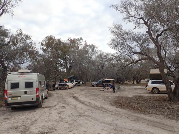 |
| Lunch along the Wanaaring Road | Mays Bend camp site |
It is tar from here to Bourke so we have to stop again while Ian and Ron pump their tyres back up to normal pressure. We also stop to cut timber. We meet Eda and Ray at the North Bourke intersection. While Ron goes into town to get fuel, we head out to Mays Bend where we spent our second night on this trip. We cannot go to the spot we camped at before as Ray and Eda have a motorhome, it will be too high to get past one spot and I doubt they will get up one of the dry creek crossings.
I scout ahead and find a good spot on the river but there is someone else there. I end up finding another spot which is on a dry billabong. This is to the far left as you come in. We set up camp here and Sharon soon has a nice fire going. It is 3:25 pm when I finish setting up. John ends up finding us after a few problems and then Ron arrives.
We have showers using Ronâs setup. I make up my Apple Crusty Pudding which I will cook in my camp oven after we have dinner. We have drinks and nibblies and then I cook chicken fillet with smoky BBQ sauce cooked on Rayâs new and never used biji BBQ. Later I put the dessert on and we have it with ice cream that Eda bought in Bourke (I phoned her from Wanaaring to get). An excellent finish to the meal. We sit around the fire and have a few small ports before going to bed at 10:00 pm.
Weather: Fine, maximum of 13ÂșC
Arrived: Mays Bend, Bourke Time: 3:15 pm Distance: 410 kilometres
Day 18 â Tuesday 14 July 2020 â Mays Bend, Bourke to Lightning Ridge
Weather: minimum of 3.2ÂșC and fine
Another cold night. I get up at 7:10 am and make breakfast. We leave in dribs and drabs as some have to get fuel and others water. I leave at 8:45 am and go to the Outback Centre where I top up with water (and use the toilet, sadly none at Mays Bend). I then fill up, 98.8 litres @ $1.259 total $124.39. I averaged 12.4 litres/100 km for the 797 kilometres since I last refueled in Tibooburra.
We leave Bourke at 9:30 am and head for Brewarrina. It is a reasonably good tar road. We arrive there at 10:35 am. I look for a bakery to buy something for everyone's morning tea, but there is none. Unfortunately it is a pretty sad old town, not many resources for residents or visitors.
 |  |
| Brewarrina Fish Trap | Opal Caravan Park |
We go to the Brewarrina Fish Trap and have a look around and then have morning tea. The fish trap was made from rocks in the Barwon River by Aboriginals eons ago. By opening and closing slots, water levels were raised and dropped, enabling fish to enter and then be caught as the water level dropped. Ingenious. There is another one at Arrawarra on the coast north of Coffs Harbour, this time in the ocean. We leave at 11:30 am, it is still a cool 12ÂșC.
We travel via Walgett and on the way we stop on a side road for lunch at 12:40 pm. We leave at 1:00 pm, it is only one degree warmer! We arrive at Lightning Ridge at 2:35 pm and check in to the Opal Caravan Park which is on the road out of town to the east and almost opposite the artesian bores. This is a very nice caravan park, but it has a crappy system for unpowered sites, nothing is marked out and you are not allocated a site. This means people are parked all over the place.
We finally find spots and set up. Unfortunately Eda and Ray have not booked a spot, so there is no place for them, although they are told to come back later and there may be room. The problem is part of the unpowered area is not usable at the moment due to the rain that fell while we were in Tibooburra. After a cuppa, a few of us walk over to the artesian bore and have a soak. Very warm, about 40ÂșC I reckon.
After this we walk back and Eda and Ray have now been able to come in and are camped next to us (we sort of saved them a spot). We have a beer and Eda brings out a cake for my birthday. It even has candles on it! After showers, at 5:30 pm we walk to the Lightning Ridge Bowling Club for dinner. There are restrictions on numbers, but we were told we did not need to book. We find a large table and order drinks and dinner. Ray and I share some Chinese dishes, very nice.
John and Maureen arrive late as they drove basically by themselves and they had a flat tyre out of Brewarrina. After a nice dinner, we walk back to the caravan park (2.3 km each way, 25 minutes). Ron, Ian and I have another drink. We go to bed about 10:30 pm. I read for 30 minutes before going to sleep.
Weather: Fine, maximum of 13ÂșC
Arrived: Lightning Ridge Time: 2:35 pm Distance: 327 kilometres
Day 20 â Wednesday 15 July 2020 â Lightning Ridge area
Weather: minimum of 5.7ÂșC and fine
Another cool night, only 7.5ÂșC at 8:00 am when I get up. Ron, Donna, Ian, Sharon and I walk over to the artesian baths, not many people here so it was great. We are back at the caravan park at 8:45 am and I then have breakfast. I put out the solar panel for the first time on the trip to keep my battery topped up.
 |  |
| Golf course at Club in the Scrub, this is a "green" | The Club in the Scrub |
At 10:10 am, I head off with Eda and Ray in their motorhome. Our plan is to do the Orange Car Door tour to the Grawin Opal Fields which are about 80 kilometres away. Most of it is tar road, but the last section is a very rough dirt road. We stop at the Club in the Scrub for a beer (they have a golf course!). We leave here at 11:30 am and head deeper into the opal fields. We pass a huge mound of mine refuse and stop to have a scavenge for opals (none of course).
We continue on to the Glengarry Hilton where we plan to have lunch. However, it is way too crowded for our liking, so we decide to go onto the Sheepyard Inn. However, when we get there it is empty. When we ask about food (which is advertised outside and in all information), we are told there is none and they have sold out of pies (I call bullshit on that one, no way they could have sold out already).
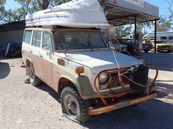 |  |
| Old 55 series Toyota LandCruiser, made from 1967 to 1980! I used to drive these at work. | The house with walls made from beer bottles |
We head back to the Club in the Scrub and arrive there at 1:30 pm. We have stopped at the war memorial on the way. We order hamburgers and another beer. The hamburger is $10 and chips $2. Both were very good. We leave at 2:15 pm and head back to Lightning Ridge. We do the Red Door Tour (guides are $1 from the visitor centre). Two castles, a house with walls made from bottles and more.
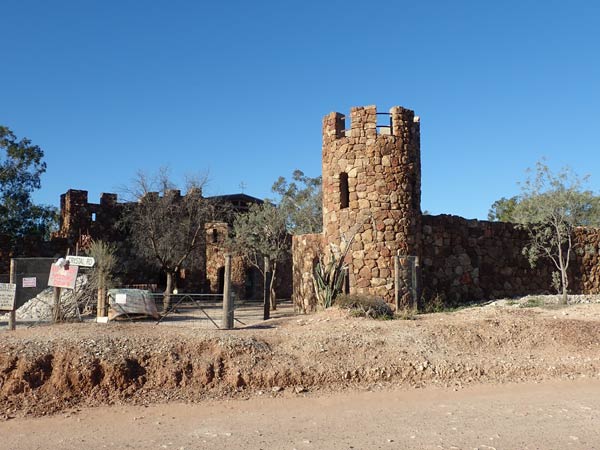 |  |
| The huge castle | The oldest house in Lightning Ridge - 1916 |
We arrive back at the caravan park at 3:50 pm. I have a cuppa and put the solar away, my battery is now 12.9 volts. I also put the small amount of washing I did yesterday away. A few of us walk over to the baths again but they are way too crowded.
After a nice shower, we have drinks at 5:15 pm and then I cook the rest of the Mongolian lamb from a few nights ago. We have more drinks after dinner and I go to bed at 10:00 pm. It is a cool 9ÂșC.
Weather: Fine, maximum of 17ÂșC
Arrived: Lightning Ridge Time: 3:50 pm Distance: 0 kilometres in my car, about 170 km
Click here to go to the next part of this trip.
| 
 v6.00.307 © 2003-2005